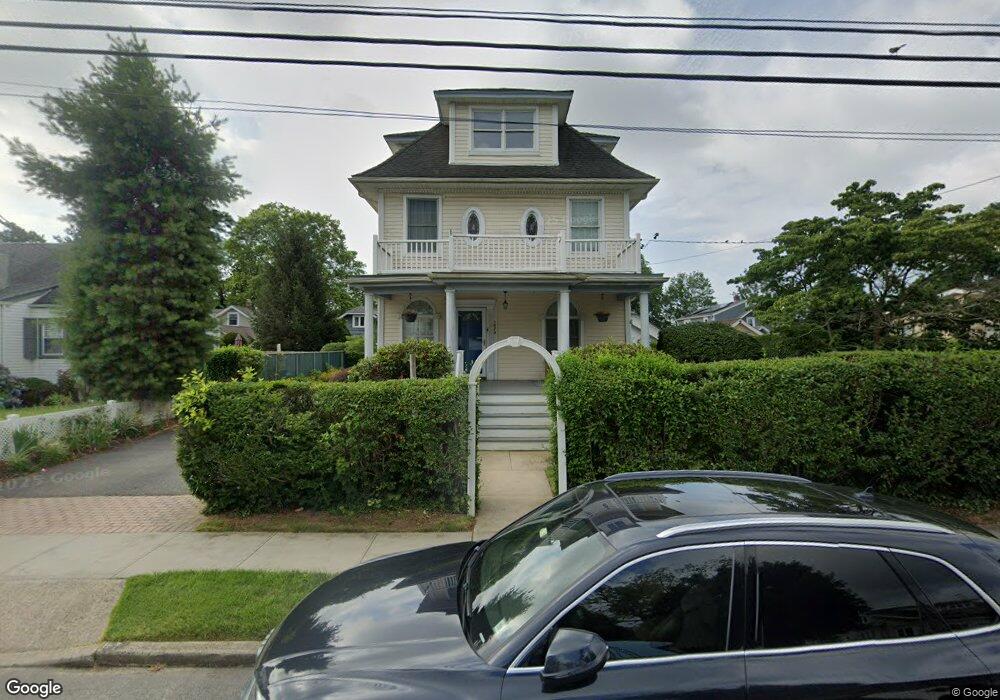
1074 Pacific St Baldwin, NY 11510
Estimated Value: $634,000 - $689,136
3
Beds
2
Baths
1,788
Sq Ft
$370/Sq Ft
Est. Value
About This Home
This home is located at 1074 Pacific St, Baldwin, NY 11510 and is currently estimated at $661,568, approximately $370 per square foot. 1074 Pacific St is a home located in Nassau County with nearby schools including Baldwin Senior High School.
Ownership History
Date
Name
Owned For
Owner Type
Purchase Details
Closed on
Apr 19, 2021
Sold by
Walsh Linda
Bought by
Bernardez Gabrielle and Bernardez Matthew
Current Estimated Value
Home Financials for this Owner
Home Financials are based on the most recent Mortgage that was taken out on this home.
Original Mortgage
$513,000
Outstanding Balance
$462,924
Interest Rate
3.1%
Mortgage Type
New Conventional
Estimated Equity
$198,644
Purchase Details
Closed on
Jul 25, 2014
Sold by
The Estate Of Mark Paul Walsh and Csaszar
Bought by
Walsh Linda
Create a Home Valuation Report for This Property
The Home Valuation Report is an in-depth analysis detailing your home's value as well as a comparison with similar homes in the area
Home Values in the Area
Average Home Value in this Area
Purchase History
| Date | Buyer | Sale Price | Title Company |
|---|---|---|---|
| Bernardez Gabrielle | $540,000 | Security Title | |
| Bernardez Gabrielle | $540,000 | Security Title | |
| Bernardez Gabrielle | $540,000 | Security Title | |
| Walsh Linda | -- | -- | |
| Walsh Linda | -- | -- | |
| Walsh Linda | -- | -- |
Source: Public Records
Mortgage History
| Date | Status | Borrower | Loan Amount |
|---|---|---|---|
| Open | Bernardez Gabrielle | $513,000 | |
| Closed | Bernardez Gabrielle | $513,000 |
Source: Public Records
Tax History
| Year | Tax Paid | Tax Assessment Tax Assessment Total Assessment is a certain percentage of the fair market value that is determined by local assessors to be the total taxable value of land and additions on the property. | Land | Improvement |
|---|---|---|---|---|
| 2025 | $12,460 | $424 | $158 | $266 |
| 2024 | $3,039 | $404 | $158 | $246 |
Source: Public Records
Map
Nearby Homes
- 2934 Dahlia Ave
- 1003 Steele Blvd
- 1050 Hastings St
- 47 Anchor St Unit Y
- 1031 Jefferson St
- 2842 Dahlia Ave
- 2864 Eastern Blvd
- 982 Adams St
- 116 Westend Ave Unit 8
- 1137 Washington Place
- 31 Anchor St Unit Y
- 1108 Washington Place
- 77 Hampton Place
- 525 Ray St
- 937 Hastings St
- 14 Florence Ave Unit 25B
- 12 Florence Ave Unit 29A
- 2989 Grand Blvd
- 8 Florence Ave Unit 16C
- 153 Westend Ave
- 1080 Pacific St
- 1066 Pacific St
- 1071 Steele Blvd
- 1067 Steele Blvd
- 1075 Steele Blvd
- 1084 Pacific St
- 1079 Steele Blvd
- 1063 Steele Blvd
- 1058 Pacific St
- 27 Pacific St
- 1083 Steele Blvd
- 1090 Pacific St
- 1051 Steele Blvd
- 1089 Steele Blvd
- 1089 Steele Blvd
- 2932 Tulip Ave
- 1052 Pacific St
- 1094 Pacific St
- 2945 Tulip Ave
- 1047 Steele Blvd
Your Personal Tour Guide
Ask me questions while you tour the home.