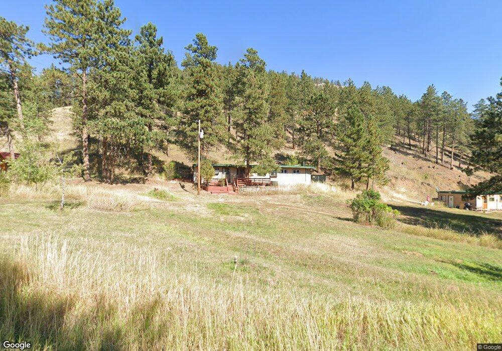
10742 Rist Canyon Rd Bellvue, CO 80512
Estimated Value: $490,000 - $619,604
2
Beds
2
Baths
866
Sq Ft
$646/Sq Ft
Est. Value
About This Home
This home is located at 10742 Rist Canyon Rd, Bellvue, CO 80512 and is currently estimated at $559,651, approximately $646 per square foot. 10742 Rist Canyon Rd is a home located in Larimer County with nearby schools including Stove Prairie Elementary School, Cache La Poudre Middle School, and Poudre High School.
Ownership History
Date
Name
Owned For
Owner Type
Purchase Details
Closed on
Aug 27, 2010
Sold by
Jibben Celeste M
Bought by
Schisler George J and Schisler Sharon M
Current Estimated Value
Home Financials for this Owner
Home Financials are based on the most recent Mortgage that was taken out on this home.
Original Mortgage
$146,368
Outstanding Balance
$97,336
Interest Rate
4.58%
Mortgage Type
New Conventional
Estimated Equity
$462,315
Purchase Details
Closed on
Jul 13, 2000
Sold by
Christiansen George C
Bought by
Jibben Celeste M
Purchase Details
Closed on
Jun 12, 2000
Sold by
Christiansen George G
Bought by
Jibbon Celeste N
Purchase Details
Closed on
Apr 28, 2000
Sold by
Jimenez Roger Emanuel and Waters Patricia Louise
Bought by
Christiansen George C
Purchase Details
Closed on
Oct 22, 1998
Sold by
Waters Patricia Louise
Bought by
Jimenez Roger Emanuel
Create a Home Valuation Report for This Property
The Home Valuation Report is an in-depth analysis detailing your home's value as well as a comparison with similar homes in the area
Home Values in the Area
Average Home Value in this Area
Purchase History
| Date | Buyer | Sale Price | Title Company |
|---|---|---|---|
| Schisler George J | $182,960 | Land Title Guarantee Company | |
| Jibben Celeste M | -- | -- | |
| Jibbon Celeste N | -- | -- | |
| Christiansen George C | -- | -- | |
| Jimenez Roger Emanuel | -- | -- |
Source: Public Records
Mortgage History
| Date | Status | Borrower | Loan Amount |
|---|---|---|---|
| Open | Schisler George J | $146,368 |
Source: Public Records
Tax History Compared to Growth
Tax History
| Year | Tax Paid | Tax Assessment Tax Assessment Total Assessment is a certain percentage of the fair market value that is determined by local assessors to be the total taxable value of land and additions on the property. | Land | Improvement |
|---|---|---|---|---|
| 2025 | $2,972 | $38,639 | $11,725 | $26,914 |
| 2024 | $2,809 | $38,639 | $11,725 | $26,914 |
| 2022 | $2,164 | $25,924 | $8,340 | $17,584 |
| 2021 | $2,182 | $26,670 | $8,580 | $18,090 |
| 2020 | $1,671 | $20,227 | $10,725 | $9,502 |
| 2019 | $1,679 | $20,227 | $10,725 | $9,502 |
| 2018 | $1,427 | $17,798 | $7,848 | $9,950 |
| 2017 | $1,422 | $17,798 | $7,848 | $9,950 |
| 2016 | $1,294 | $16,103 | $3,821 | $12,282 |
| 2015 | $1,283 | $16,100 | $3,820 | $12,280 |
| 2014 | $890 | $11,090 | $3,980 | $7,110 |
Source: Public Records
Map
Nearby Homes
- 620 Davis Ranch Rd
- 0 Pine Acres Rd Unit 1041697
- 0 Rist Creek Rd Unit 4284551
- 0 Rist Creek Rd Unit REC4803675
- 427 Wilderness Ridge Way
- 2518 Whale Rock Rd
- 3805 Davis Ranch Rd
- 269 Cox Ct
- 0 Pine Acres Way Unit 1045910
- 3235 Davis Ranch Rd
- 3434 Davis Ranch Rd
- 865 Redstone Dr
- 1600 Whale Rock Rd
- 4119 Davis Ranch Rd
- 0 Davis Ranch Rd Unit 1048176
- 898 Hernia Hill Trail
- 100 Canyon Gulch Rd
- 14884 Rist Canyon Rd
- 0 Tip Top Rd
- 0 Tbd Stratton Park Rd Lot 3
- 10738 Rist Canyon Rd Unit B
- 10738 Rist Canyon Rd Unit A
- 10738 Rist Canyon Rd
- 10731 Rist Canyon Rd
- 10940 Rist Canyon Rd
- 10829 Rist Canyon Rd
- 83 Davis Ranch Rd
- 181 Davis Ranch Rd
- 50 Davis Ranch Rd
- 11060 Rist Canyon Rd
- 191 Davis Ranch Rd
- 201 Davis Ranch Rd
- 167 Davis Ranch Rd
- 10470 Rist Canyon Rd
- 10425 Rist Canyon Rd
- 375 Davis Ranch Rd
- 117 Lichen Ct
- 10420 Rist Canyon Rd
- 411 Davis Ranch Rd
- 11220 Rist Canyon Rd