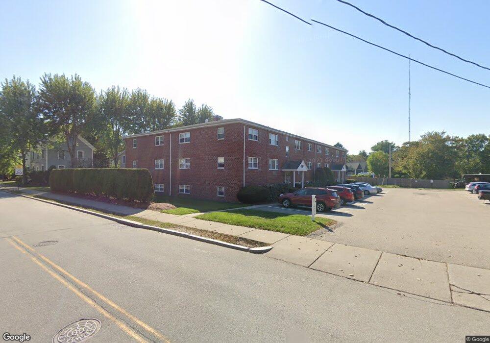
1075 Chestnut St Unit 11 Newton Upper Falls, MA 02464
Newton Upper Falls NeighborhoodEstimated Value: $451,000 - $514,000
1
Bed
1
Bath
715
Sq Ft
$670/Sq Ft
Est. Value
About This Home
This home is located at 1075 Chestnut St Unit 11, Newton Upper Falls, MA 02464 and is currently estimated at $479,178, approximately $670 per square foot. 1075 Chestnut St Unit 11 is a home located in Middlesex County with nearby schools including Countryside Elementary School, Charles E Brown Middle School, and Newton South High School.
Ownership History
Date
Name
Owned For
Owner Type
Purchase Details
Closed on
Aug 31, 2011
Sold by
Mccourt Paul and Mccourt Peter
Bought by
Cascap-Metstate Housin
Current Estimated Value
Home Financials for this Owner
Home Financials are based on the most recent Mortgage that was taken out on this home.
Original Mortgage
$282,082
Outstanding Balance
$195,550
Interest Rate
4.52%
Mortgage Type
Purchase Money Mortgage
Estimated Equity
$283,628
Purchase Details
Closed on
Dec 21, 2005
Sold by
Shriber Richard J
Bought by
Mccourt Brian and Mccourt Paul
Create a Home Valuation Report for This Property
The Home Valuation Report is an in-depth analysis detailing your home's value as well as a comparison with similar homes in the area
Home Values in the Area
Average Home Value in this Area
Purchase History
| Date | Buyer | Sale Price | Title Company |
|---|---|---|---|
| Cascap-Metstate Housin | $217,500 | -- | |
| Mccourt Brian | $169,900 | -- |
Source: Public Records
Mortgage History
| Date | Status | Borrower | Loan Amount |
|---|---|---|---|
| Open | Cascap-Metstate Housin | $282,082 |
Source: Public Records
Tax History
| Year | Tax Paid | Tax Assessment Tax Assessment Total Assessment is a certain percentage of the fair market value that is determined by local assessors to be the total taxable value of land and additions on the property. | Land | Improvement |
|---|---|---|---|---|
| 2025 | $3,733 | $380,900 | $0 | $380,900 |
| 2024 | $3,609 | $369,800 | $0 | $369,800 |
| 2023 | $3,532 | $347,000 | $0 | $347,000 |
| 2022 | $3,477 | $330,500 | $0 | $330,500 |
| 2021 | $3,355 | $311,800 | $0 | $311,800 |
| 2020 | $3,255 | $311,800 | $0 | $311,800 |
| 2019 | $3,163 | $302,700 | $0 | $302,700 |
| 2018 | $2,959 | $273,500 | $0 | $273,500 |
| 2017 | $2,869 | $258,000 | $0 | $258,000 |
| 2016 | $2,936 | $258,000 | $0 | $258,000 |
| 2015 | $2,853 | $245,700 | $0 | $245,700 |
Source: Public Records
Map
Nearby Homes
- 304 Elliot St Carriage House S Unit 4
- 1003 Chestnut St
- 302 Elliot St Carriage House N Unit 3
- 27 Hamilton Place
- 300 Elliot St Unit 2
- 51 Pettee St Unit 31
- 54 Indiana Terrace
- 10 Pennsylvania Ave Unit 1
- 5 Summer St
- 17 Daley St
- 8 Arnold St
- 29 Cottage St Unit 29
- 32 Hickory Cliff Rd
- 18 Evergreen Rd
- 873 Chestnut St
- 170 Central Ave
- 30 Circuit Ave Unit 30
- 212 Central Ave
- 829 Chestnut St
- 1077 Boylston St Unit 1
- 1075 Chestnut St Unit 12
- 1075 Chestnut St Unit 10
- 1075 Chestnut St Unit 9
- 1075 Chestnut St Unit 8
- 1075 Chestnut St Unit 7
- 1075 Chestnut St Unit 6
- 1075 Chestnut St Unit 5
- 1075 Chestnut St Unit 4
- 1075 Chestnut St Unit 3
- 1075 Chestnut St Unit 2
- 1075 Chestnut St Unit 1
- 1075 Chestnut St Unit d
- 1089 Chestnut St
- 1077 Chestnut St Unit 10
- 1077 Chestnut St Unit 9
- 1077 Chestnut St Unit 8
- 1077 Chestnut St Unit 7
- 1077 Chestnut St Unit 6
- 1077 Chestnut St Unit 5
- 1077 Chestnut St Unit 4
Your Personal Tour Guide
Ask me questions while you tour the home.