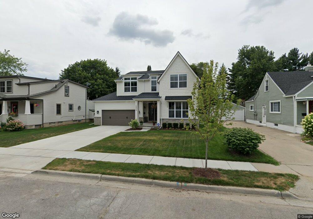
1075 Hartsough St Unit Bldg-Unit Plymouth, MI 48170
Estimated Value: $873,000 - $1,032,000
2
Beds
5
Baths
2,673
Sq Ft
$364/Sq Ft
Est. Value
About This Home
This home is located at 1075 Hartsough St Unit Bldg-Unit, Plymouth, MI 48170 and is currently estimated at $973,979, approximately $364 per square foot. 1075 Hartsough St Unit Bldg-Unit is a home located in Wayne County with nearby schools including Canton High School, Smith Elementary School, and West Middle School.
Ownership History
Date
Name
Owned For
Owner Type
Purchase Details
Closed on
Aug 2, 2024
Sold by
Pruente Matthew and Pruente Jessica
Bought by
Blanchette Gregory and Blanchette Amanda
Current Estimated Value
Home Financials for this Owner
Home Financials are based on the most recent Mortgage that was taken out on this home.
Original Mortgage
$400,000
Outstanding Balance
$381,558
Interest Rate
5.99%
Mortgage Type
New Conventional
Estimated Equity
$592,421
Purchase Details
Closed on
Feb 28, 2018
Sold by
Dw Development Llc
Bought by
Pruente Mathew and Pruente Jessica
Purchase Details
Closed on
Nov 22, 2016
Sold by
Valenti Dennis R
Bought by
Brand Jason and Brand Sarah
Create a Home Valuation Report for This Property
The Home Valuation Report is an in-depth analysis detailing your home's value as well as a comparison with similar homes in the area
Home Values in the Area
Average Home Value in this Area
Purchase History
| Date | Buyer | Sale Price | Title Company |
|---|---|---|---|
| Blanchette Gregory | $890,000 | None Listed On Document | |
| Pruente Mathew | $697,450 | Reputaion First Title Agency | |
| Brand Jason | $265,000 | None Available |
Source: Public Records
Mortgage History
| Date | Status | Borrower | Loan Amount |
|---|---|---|---|
| Open | Blanchette Gregory | $400,000 |
Source: Public Records
Tax History Compared to Growth
Tax History
| Year | Tax Paid | Tax Assessment Tax Assessment Total Assessment is a certain percentage of the fair market value that is determined by local assessors to be the total taxable value of land and additions on the property. | Land | Improvement |
|---|---|---|---|---|
| 2025 | $15,231 | $455,000 | $0 | $0 |
| 2024 | $15,231 | $440,400 | $0 | $0 |
| 2023 | $14,835 | $390,500 | $0 | $0 |
| 2022 | $15,725 | $368,500 | $0 | $0 |
| 2021 | $15,237 | $362,500 | $0 | $0 |
| 2020 | $15,061 | $347,400 | $0 | $0 |
| 2019 | $13,260 | $340,000 | $0 | $0 |
| 2018 | $1,445 | $39,300 | $0 | $0 |
| 2017 | $1,336 | $159,200 | $0 | $0 |
| 2016 | $4,029 | $151,700 | $0 | $0 |
| 2015 | $9,228 | $133,310 | $0 | $0 |
| 2013 | $8,940 | $114,820 | $0 | $0 |
| 2011 | -- | $103,330 | $0 | $0 |
Source: Public Records
Map
Nearby Homes
- 1078 Simpson St
- 1338 S Harvey St
- 844 Ross St
- 1125 Sutherland St
- 1199 S Sheldon Rd
- 775 Deer Ct Unit 104
- 9405 Northern Ave
- 770 Deer St Unit 204
- 638 S Harvey St
- 9453 Brookline Ave
- 9264 Brookline Ave
- 44571 Clare Blvd
- 543 Deer St
- 9205 Rocker Ave
- 44736 Lynn Dr
- 660 Maple St
- 44703 Erin Dr
- 636 Maple St
- 644 Maple St
- 668 Maple St
- 1075 Hartsough St
- 1051 Hartsough St
- 1097 Hartsough St Unit Bldg-Unit
- 1097 Hartsough St
- 1121 Hartsough St
- 1102 S Harvey St
- 1076 Ross St
- 1134 S Harvey St
- 1076 Hartsough St Unit Bldg-Unit
- 1076 Hartsough St
- 1052 Ross St
- 1062 Hartsough St
- 1096 Hartsough St
- 1150 S Harvey St
- 1122 Ross St
- 1044 Hartsough St
- 1112 Hartsough St
- 1145 Hartsough St
- 1132 Ross St
- 1174 S Harvey St