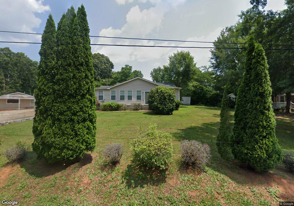
1075 Morningside Dr Covington, GA 30016
Estimated Value: $173,704 - $235,000
Studio
1
Bath
1,543
Sq Ft
$134/Sq Ft
Est. Value
About This Home
This home is located at 1075 Morningside Dr, Covington, GA 30016 and is currently estimated at $206,176, approximately $133 per square foot. 1075 Morningside Dr is a home located in Newton County with nearby schools including South Salem Elementary School, Liberty Middle School, and Alcovy High School.
Ownership History
Date
Name
Owned For
Owner Type
Purchase Details
Closed on
Feb 18, 2020
Sold by
Floyd Wendell L
Bought by
Floyd Sedrick L
Current Estimated Value
Home Financials for this Owner
Home Financials are based on the most recent Mortgage that was taken out on this home.
Original Mortgage
$62,300
Outstanding Balance
$54,926
Interest Rate
3.6%
Mortgage Type
New Conventional
Estimated Equity
$151,250
Purchase Details
Closed on
Mar 15, 2019
Sold by
Floyd Wendell L
Bought by
Floyd Wendell L and Floyd Sedrick L
Purchase Details
Closed on
Aug 20, 2003
Sold by
Floyd Helen W
Bought by
Floyd Wendell L
Home Financials for this Owner
Home Financials are based on the most recent Mortgage that was taken out on this home.
Original Mortgage
$67,500
Interest Rate
5.52%
Mortgage Type
New Conventional
Create a Home Valuation Report for This Property
The Home Valuation Report is an in-depth analysis detailing your home's value as well as a comparison with similar homes in the area
Home Values in the Area
Average Home Value in this Area
Purchase History
| Date | Buyer | Sale Price | Title Company |
|---|---|---|---|
| Floyd Sedrick L | -- | -- | |
| Floyd Wendell L | -- | -- | |
| Floyd Wendell L | -- | -- |
Source: Public Records
Mortgage History
| Date | Status | Borrower | Loan Amount |
|---|---|---|---|
| Open | Floyd Sedrick L | $62,300 | |
| Previous Owner | Floyd Wendell L | $67,500 |
Source: Public Records
Tax History
| Year | Tax Paid | Tax Assessment Tax Assessment Total Assessment is a certain percentage of the fair market value that is determined by local assessors to be the total taxable value of land and additions on the property. | Land | Improvement |
|---|---|---|---|---|
| 2025 | $1,526 | $61,320 | $6,480 | $54,840 |
| 2024 | $1,519 | $59,960 | $3,680 | $56,280 |
| 2023 | $1,506 | $55,520 | $3,680 | $51,840 |
| 2022 | $1,267 | $46,680 | $3,680 | $43,000 |
| 2021 | $864 | $28,480 | $3,080 | $25,400 |
| 2020 | $941 | $28,000 | $6,000 | $22,000 |
| 2019 | $917 | $26,880 | $6,000 | $20,880 |
| 2018 | $444 | $25,840 | $6,000 | $19,840 |
| 2017 | $816 | $23,760 | $4,000 | $19,760 |
| 2016 | $737 | $21,480 | $4,000 | $17,480 |
| 2015 | $733 | $21,360 | $4,000 | $17,360 |
| 2014 | $219 | $6,400 | $0 | $0 |
Source: Public Records
Map
Nearby Homes
- 215 Morningside Dr
- 14 Highway 162
- 15 Jackson Rd
- 711 Highway 162
- 195 Twin Lakes Dr
- 10 Elm St
- 55 Twin Lakes Dr
- 85 Austin Terrace Unit LOT 45
- 25 Kevin Ct
- 0 Eleanor Dr Unit 10443925
- 10 Heaton Dr
- 0 Roseberry Rd
- 4 Ivy St
- 8 Hemlock St
- 7 Cotton Ave
- 0 Tempie Ln
- 2 N Broad St
- 14 Hazel St
- 15 Lisa Ct
- 6 N Broad St
- 100 Old River Rd
- 1155 Morningside Dr
- 120 Usher Dr
- 120 Ridge Ave
- 1180 Morningside Dr
- 1275 Morningside Dr
- 73 Old River Rd
- 1000 Morningside Dr
- 1200 Morningside Dr
- 160 Old River Rd
- 1300 Morningside Dr
- 0 White Trail Unit 8396940
- 0 White Trail Unit 8395388
- 0 White Trail Unit 8297002
- 0 White Trail Unit 8296232
- 0 White Trail Unit 7513567
- 0 White Trail Unit 8137604
- 0 White Trail Unit 5588277
- 0 White Trail Unit 5807192
- 0 White Trail Unit 6834506
Your Personal Tour Guide
Ask me questions while you tour the home.