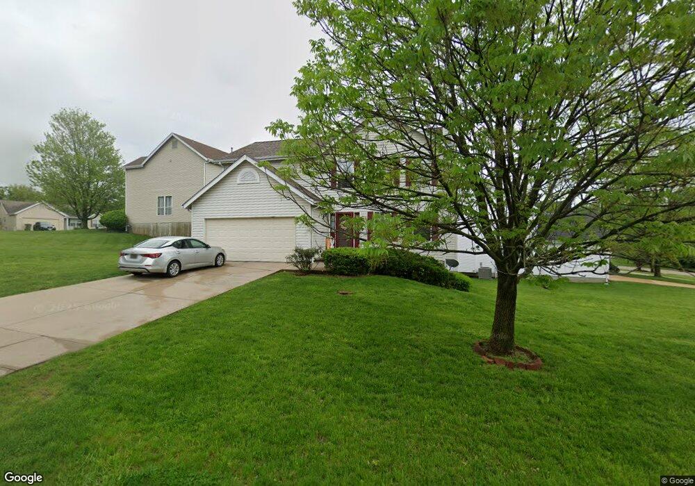
10753 Oak Pointe Dr Saint Ann, MO 63074
Estimated Value: $289,000 - $330,857
4
Beds
3
Baths
1,849
Sq Ft
$166/Sq Ft
Est. Value
About This Home
This home is located at 10753 Oak Pointe Dr, Saint Ann, MO 63074 and is currently estimated at $306,464, approximately $165 per square foot. 10753 Oak Pointe Dr is a home located in St. Louis County with nearby schools including Robert Drummond Elementary School, Holman Middle School, and Pattonville High School.
Ownership History
Date
Name
Owned For
Owner Type
Purchase Details
Closed on
Dec 28, 2001
Sold by
Mcbride & Son Homes Inc
Bought by
Hairston Oliver and Hairston Judy M
Current Estimated Value
Home Financials for this Owner
Home Financials are based on the most recent Mortgage that was taken out on this home.
Original Mortgage
$163,900
Outstanding Balance
$64,805
Interest Rate
6.73%
Mortgage Type
FHA
Estimated Equity
$241,659
Create a Home Valuation Report for This Property
The Home Valuation Report is an in-depth analysis detailing your home's value as well as a comparison with similar homes in the area
Home Values in the Area
Average Home Value in this Area
Purchase History
| Date | Buyer | Sale Price | Title Company |
|---|---|---|---|
| Hairston Oliver | $169,808 | -- |
Source: Public Records
Mortgage History
| Date | Status | Borrower | Loan Amount |
|---|---|---|---|
| Open | Hairston Oliver | $163,900 |
Source: Public Records
Tax History Compared to Growth
Tax History
| Year | Tax Paid | Tax Assessment Tax Assessment Total Assessment is a certain percentage of the fair market value that is determined by local assessors to be the total taxable value of land and additions on the property. | Land | Improvement |
|---|---|---|---|---|
| 2025 | $4,507 | $52,840 | $7,010 | $45,830 |
| 2024 | $4,453 | $49,490 | $7,010 | $42,480 |
| 2023 | $4,453 | $49,490 | $7,010 | $42,480 |
| 2022 | $3,547 | $36,970 | $7,010 | $29,960 |
| 2021 | $3,538 | $36,970 | $7,010 | $29,960 |
| 2020 | $3,925 | $38,930 | $8,570 | $30,360 |
| 2019 | $3,905 | $38,930 | $8,570 | $30,360 |
| 2018 | $3,371 | $30,360 | $4,670 | $25,690 |
| 2017 | $3,353 | $30,360 | $4,670 | $25,690 |
| 2016 | $3,182 | $31,250 | $5,090 | $26,160 |
| 2015 | $3,148 | $31,250 | $5,090 | $26,160 |
| 2014 | $3,048 | $30,170 | $5,870 | $24,300 |
Source: Public Records
Map
Nearby Homes
- 10810 Hobday Ave
- 10730 Wurdack Ave
- 10583 Mert Ave
- 10719 Thorpe Ave
- 10651 Thorpe Ave
- 10525 Hobday Ave
- 10515 Clarendon Ave
- 3005 Ashby Rd
- 3001 Ashby Rd
- 3000 Ashby Rd
- 3134 O Hare Dr
- 2729 Link Rd
- 3113 Pearl Harbor Dr
- 10325 Breckenridge Rd
- 2703 Ashby Rd
- 10762 Saint Dismas Ct
- 10300 Breckenridge Rd
- 2454 Prouhet Ave
- 10228 Saint Arsene Ln
- 3217 Krem Ave
- 10737 Oak Pointe Dr
- 10773 Oak Pointe Dr
- 10789 Oak Pointe Dr
- 10733 Oak Pointe Dr
- 10760 Oak Pointe Dr
- 10764 Oak Pointe Dr
- 10793 Oak Pointe Dr
- 10756 Oak Pointe Dr
- 10744 Oak Pointe Dr
- 10740 Oak Pointe Dr
- 10768 Oak Pointe Dr
- 10736 Oak Pointe Dr
- 10748 Oak Pointe Dr
- 10721 Oak Pointe Dr
- 10752 Oak Pointe Dr
- 10713 Farview (Re-Listing) Ave
- 10797 Oak Pointe Dr
- 10732 Oak Pointe Dr
- 10784 Oak Pointe Dr
- 10780 Oak Pointe Dr