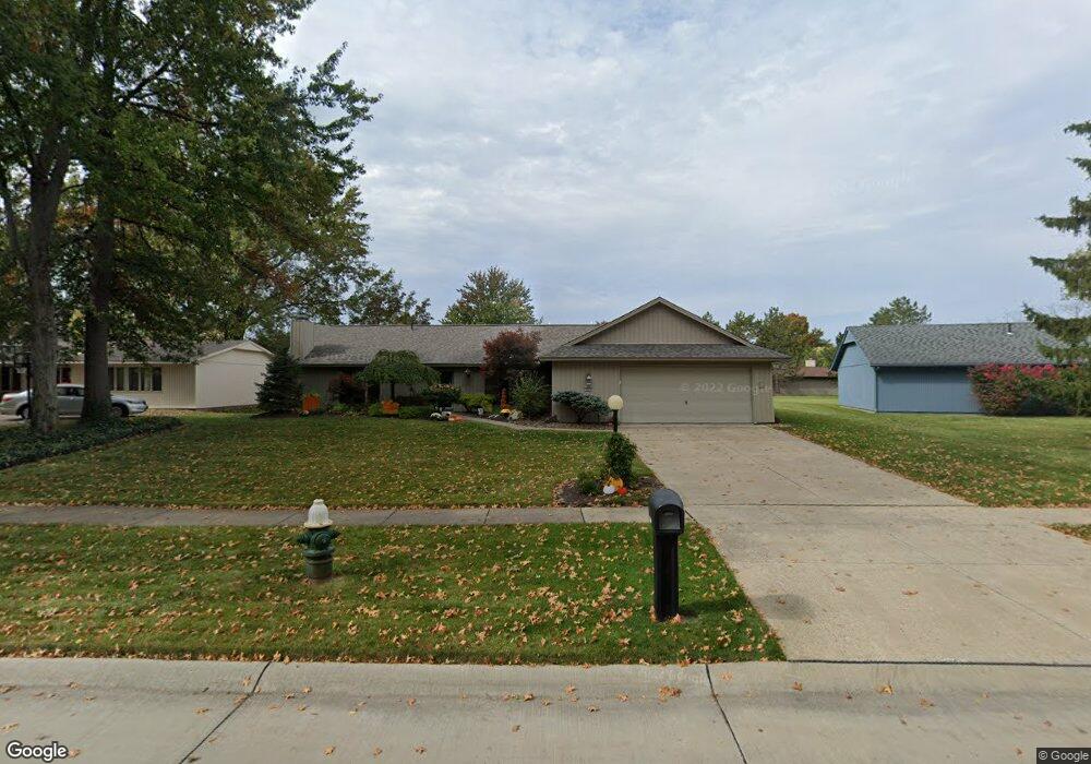
10754 Gate Post Rd Strongsville, OH 44149
Estimated Value: $396,000 - $436,000
4
Beds
3
Baths
2,660
Sq Ft
$155/Sq Ft
Est. Value
About This Home
This home is located at 10754 Gate Post Rd, Strongsville, OH 44149 and is currently estimated at $411,567, approximately $154 per square foot. 10754 Gate Post Rd is a home located in Cuyahoga County with nearby schools including Strongsville High School, Sts Joseph & John Interparochial School, and St Mary School.
Ownership History
Date
Name
Owned For
Owner Type
Purchase Details
Closed on
Aug 8, 1996
Sold by
Schmitt Homes Inc
Bought by
Schmitt Corbin E and Schmitt Amy M
Current Estimated Value
Home Financials for this Owner
Home Financials are based on the most recent Mortgage that was taken out on this home.
Original Mortgage
$60,000
Interest Rate
7.87%
Mortgage Type
New Conventional
Purchase Details
Closed on
Jan 1, 1977
Bought by
Bob Schmitt Homes Inc
Create a Home Valuation Report for This Property
The Home Valuation Report is an in-depth analysis detailing your home's value as well as a comparison with similar homes in the area
Home Values in the Area
Average Home Value in this Area
Purchase History
| Date | Buyer | Sale Price | Title Company |
|---|---|---|---|
| Schmitt Corbin E | $181,440 | -- | |
| Bob Schmitt Homes Inc | -- | -- |
Source: Public Records
Mortgage History
| Date | Status | Borrower | Loan Amount |
|---|---|---|---|
| Closed | Schmitt Corbin E | $60,000 |
Source: Public Records
Tax History Compared to Growth
Tax History
| Year | Tax Paid | Tax Assessment Tax Assessment Total Assessment is a certain percentage of the fair market value that is determined by local assessors to be the total taxable value of land and additions on the property. | Land | Improvement |
|---|---|---|---|---|
| 2024 | $5,659 | $120,540 | $20,020 | $100,520 |
| 2023 | $6,196 | $98,950 | $17,430 | $81,520 |
| 2022 | $6,151 | $98,950 | $17,430 | $81,520 |
| 2021 | $6,102 | $98,950 | $17,430 | $81,520 |
| 2020 | $6,052 | $86,800 | $15,300 | $71,510 |
| 2019 | $5,874 | $248,000 | $43,700 | $204,300 |
| 2018 | $5,115 | $86,800 | $15,300 | $71,510 |
| 2017 | $4,990 | $75,220 | $13,620 | $61,600 |
| 2016 | $4,949 | $75,220 | $13,620 | $61,600 |
| 2015 | $4,872 | $75,220 | $13,620 | $61,600 |
| 2014 | $4,872 | $73,010 | $13,230 | $59,780 |
Source: Public Records
Map
Nearby Homes
- 10001 N Marks Rd
- 10800 Meadow Trail
- 10824 Watercress Rd
- 9598 Pebble Brook Ln
- 22300 Rock Creek Cir
- 10842 Fence Row Dr
- 8746 Barton Dr
- 9829 Plum Brook Ln
- 0 Priem Rd
- 9384 N Marks Rd
- 11030 Southwind Ct
- 8902 Lincolnshire Blvd
- 10353 Oak Branch Trail
- 8981 Leatherleaf Dr
- 8896 Firethorne Dr
- 8960 Leatherleaf Dr
- 8924 Leatherleaf Dr
- 21292 Creekside Dr
- 8839 Leatherleaf Dr
- 10700 Whitewing Way
- 10758 Gate Post Rd
- 10750 Gate Post Rd
- 10753 Meadow Trail
- 10762 Gate Post Rd
- 10747 Meadow Trail
- 10757 Meadow Trail
- 10755 Gate Post Rd
- 10746 Gate Post Rd
- 10761 Meadow Trail
- 10763 Gate Post Rd
- 10766 Gate Post Rd
- 10743 Meadow Trail
- 10751 Gate Post Rd
- 10767 Gate Post Rd
- 10742 Gate Post Rd
- 10767 Meadow Trail
- 10740 Meadow Trail
- 10770 Gate Post Rd
- 10771 Gate Post Rd
- 10769 Meadow Trail