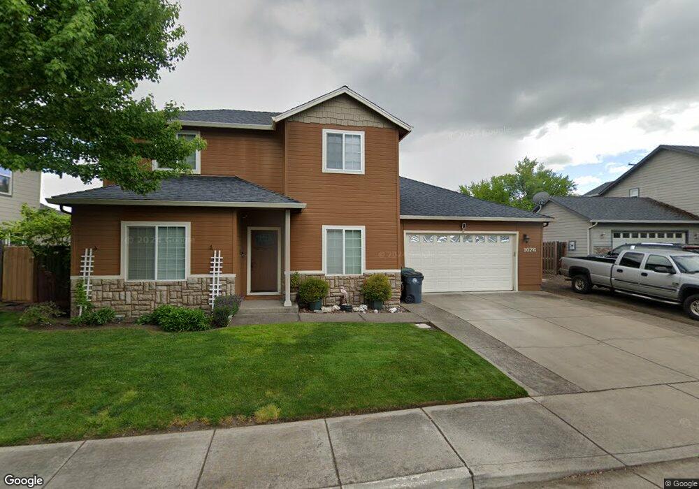
1076 Kensington Ct Central Point, OR 97502
Estimated Value: $491,523 - $534,000
3
Beds
3
Baths
2,345
Sq Ft
$221/Sq Ft
Est. Value
About This Home
This home is located at 1076 Kensington Ct, Central Point, OR 97502 and is currently estimated at $518,881, approximately $221 per square foot. 1076 Kensington Ct is a home located in Jackson County with nearby schools including Central Point Elementary School, Scenic Middle School, and Crater High School.
Ownership History
Date
Name
Owned For
Owner Type
Purchase Details
Closed on
Jul 15, 2004
Sold by
Anderson Marsha
Bought by
Moffitt Levi E and Moffitt Shelby L
Current Estimated Value
Home Financials for this Owner
Home Financials are based on the most recent Mortgage that was taken out on this home.
Original Mortgage
$275,000
Outstanding Balance
$134,890
Interest Rate
6.27%
Mortgage Type
Purchase Money Mortgage
Estimated Equity
$383,991
Create a Home Valuation Report for This Property
The Home Valuation Report is an in-depth analysis detailing your home's value as well as a comparison with similar homes in the area
Purchase History
| Date | Buyer | Sale Price | Title Company |
|---|---|---|---|
| Moffitt Levi E | $289,900 | Lawyers Title Ins |
Source: Public Records
Mortgage History
| Date | Status | Borrower | Loan Amount |
|---|---|---|---|
| Open | Moffitt Levi E | $275,000 |
Source: Public Records
Tax History
| Year | Tax Paid | Tax Assessment Tax Assessment Total Assessment is a certain percentage of the fair market value that is determined by local assessors to be the total taxable value of land and additions on the property. | Land | Improvement |
|---|---|---|---|---|
| 2026 | $4,694 | $283,680 | -- | -- |
| 2025 | $4,579 | $275,420 | $120,410 | $155,010 |
| 2024 | $4,579 | $267,400 | $116,900 | $150,500 |
| 2023 | $4,432 | $259,620 | $113,500 | $146,120 |
| 2022 | $4,328 | $259,620 | $113,500 | $146,120 |
| 2021 | $4,205 | $252,060 | $110,190 | $141,870 |
| 2020 | $4,082 | $244,720 | $106,980 | $137,740 |
| 2019 | $3,981 | $230,680 | $100,840 | $129,840 |
| 2018 | $3,860 | $223,970 | $97,910 | $126,060 |
| 2017 | $3,763 | $223,970 | $97,910 | $126,060 |
| 2016 | $3,653 | $211,120 | $92,290 | $118,830 |
| 2015 | $3,500 | $211,120 | $92,290 | $118,830 |
| 2014 | $3,411 | $199,010 | $86,990 | $112,020 |
Source: Public Records
Map
Nearby Homes
- 736 Hemlock Ave
- 3364 Bursell Rd
- 3358 Bursell Rd
- 1204 Heather Ln
- 918 Brandi Way
- 533 Brittni Ln
- 959 Westrop Dr
- 755 S 4th St
- 1258 Joshua Ct
- 555 Freeman Rd Unit 73
- 555 Freeman Rd Unit 254
- 555 Freeman Rd Unit 105
- 555 Freeman Rd Unit 209
- 992 Glengrove Ave
- 1025 Fairfield Ave
- 887 Silver Fox Dr
- 301 Freeman Rd Unit 30
- 301 Freeman Rd Unit 92
- 301 Freeman Rd Unit 91
- 14 Scholarship Way
- 1076 Kensington Ct Unit 4
- 1088 Kensington Ct Unit 2
- 1088 Kensington Ct
- 1064 Kensington Ct
- 778 Sydney Ct
- 1073 Kensington Ct
- 766 Sydney Ct
- 790 Sydney Ct
- 1061 Kensington Ct Unit 5
- 1061 Kensington Ct
- 1085 Kensington Ct Unit 1
- 1085 Kensington Ct
- 1052 Kensington Ct Unit 8
- 1052 Kensington Ct
- 1052 Kensington Ct
- 754 Sydney Ct
- 742 Sydney Ct
- 1049 Kensington Ct Unit 7
- 1049 Kensington Ct
- 3558 Bursell Rd
Your Personal Tour Guide
Ask me questions while you tour the home.