Estimated Value: $443,000 - $489,000
4
Beds
3
Baths
2,200
Sq Ft
$210/Sq Ft
Est. Value
About This Home
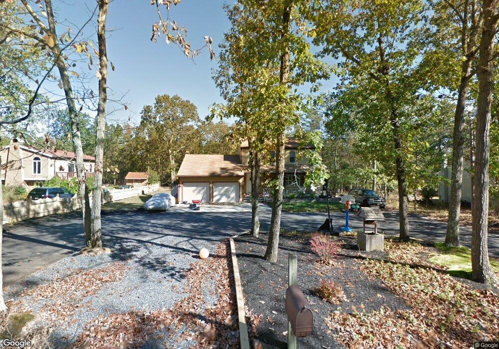
This home is located at 1076 Pederson Blvd, Atco, NJ 08004 and is currently estimated at $461,216, approximately $209 per square foot. 1076 Pederson Blvd is a home located in Camden County with nearby schools including Thomas Richards Elementary School, Waterford Elementary School, and Atco Elementary School.
Ownership History
Date
Name
Owned For
Owner Type
Purchase Details
Closed on
Feb 26, 2010
Sold by
Marshall Robert A and Marshall Constance T
Bought by
Cronce Harry M and Cronce Leah M
Current Estimated Value
Home Financials for this Owner
Home Financials are based on the most recent Mortgage that was taken out on this home.
Original Mortgage
$224,257
Outstanding Balance
$151,868
Interest Rate
5.5%
Mortgage Type
FHA
Estimated Equity
$309,348
Create a Home Valuation Report for This Property
The Home Valuation Report is an in-depth analysis detailing your home's value as well as a comparison with similar homes in the area
Home Values in the Area
Average Home Value in this Area
Purchase History
| Date | Buyer | Sale Price | Title Company |
|---|---|---|---|
| Cronce Harry M | $232,000 | -- |
Source: Public Records
Mortgage History
| Date | Status | Borrower | Loan Amount |
|---|---|---|---|
| Open | Cronce Harry M | $224,257 |
Source: Public Records
Tax History
| Year | Tax Paid | Tax Assessment Tax Assessment Total Assessment is a certain percentage of the fair market value that is determined by local assessors to be the total taxable value of land and additions on the property. | Land | Improvement |
|---|---|---|---|---|
| 2025 | $10,201 | $223,700 | $52,100 | $171,600 |
| 2024 | $9,612 | $223,700 | $52,100 | $171,600 |
| 2023 | $9,612 | $223,700 | $52,100 | $171,600 |
| 2022 | $9,185 | $223,700 | $52,100 | $171,600 |
| 2021 | $9,140 | $223,700 | $52,100 | $171,600 |
| 2020 | $9,096 | $223,700 | $52,100 | $171,600 |
| 2019 | $8,957 | $223,700 | $52,100 | $171,600 |
| 2018 | $8,948 | $223,700 | $52,100 | $171,600 |
| 2017 | $8,809 | $223,700 | $52,100 | $171,600 |
| 2016 | $8,682 | $223,700 | $52,100 | $171,600 |
| 2015 | $8,454 | $223,700 | $52,100 | $171,600 |
| 2014 | $8,445 | $152,900 | $32,700 | $120,200 |
Source: Public Records
Map
Nearby Homes
- 1080 Pederson Blvd
- 2127 Dorothy Ave
- 2212 Oakwood Ln
- 622 Jackson Rd
- 687 Jackson Rd
- 1691 Conrad Ave
- 2076 Hendricks Ave
- 2422 Louden Ln
- 2212 Kingsford Ln
- 221 White Horse Pike
- 320 White Horse Pike
- 205 Hendricks Ave
- 0 Maple Ave
- 0 Thompson Ave
- 2006 A Ave
- 117 Maple Ave
- 2336 Auburn Ave
- 327 Vineyard Rd
- 321 Thompson Ave
- 2246 Auburn Ave
- 1072 Pederson Blvd
- 1068 Pederson Blvd
- 1091 Pederson Blvd
- 2139 Columbia Ave
- 1064 Pederson Blvd
- 2149 Columbia Ave
- 2153 Columbia Ave
- 1165 Maple Ave
- 1010 Martha Blvd
- 1060 Pederson Blvd
- 1016 Martha Blvd
- 1004 Martha Blvd
- 1159 Maple Ave
- 1095 Pederson Blvd
- 1022 Martha Blvd
- 996 Martha Blvd
- 2144 Columbia Ave
- 2148 Columbia Ave
- 2156 Columbia Ave
- 1099 Pederson Blvd
Your Personal Tour Guide
Ask me questions while you tour the home.