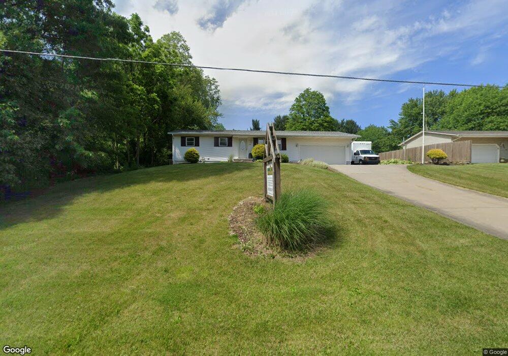
10761 Corundite Rd NW Massillon, OH 44647
Amherst Heights-Clearview NeighborhoodEstimated Value: $222,128 - $289,000
3
Beds
1
Bath
1,040
Sq Ft
$245/Sq Ft
Est. Value
About This Home
This home is located at 10761 Corundite Rd NW, Massillon, OH 44647 and is currently estimated at $254,782, approximately $244 per square foot. 10761 Corundite Rd NW is a home located in Stark County with nearby schools including Tuslaw Elementary School, Tuslaw Middle School, and Tuslaw High School.
Ownership History
Date
Name
Owned For
Owner Type
Purchase Details
Closed on
Sep 22, 2012
Sold by
Wellman Jeanne R
Bought by
Tobin Gregory S
Current Estimated Value
Purchase Details
Closed on
Mar 27, 2006
Sold by
Osborn Robert W and Wellman Jeanne R
Bought by
Wellman Jeanne R
Purchase Details
Closed on
Dec 11, 2003
Sold by
Clay Herman R and Clay Maxine F
Bought by
Wellman Jeanne R
Home Financials for this Owner
Home Financials are based on the most recent Mortgage that was taken out on this home.
Original Mortgage
$81,000
Interest Rate
6.01%
Mortgage Type
Purchase Money Mortgage
Purchase Details
Closed on
May 25, 1999
Sold by
Clay Herman R and Clay Maxine F
Bought by
Clay Herman R and Clay Maxine F
Create a Home Valuation Report for This Property
The Home Valuation Report is an in-depth analysis detailing your home's value as well as a comparison with similar homes in the area
Home Values in the Area
Average Home Value in this Area
Purchase History
| Date | Buyer | Sale Price | Title Company |
|---|---|---|---|
| Tobin Gregory S | -- | None Available | |
| Wellman Jeanne R | -- | None Available | |
| Wellman Jeanne R | $111,000 | Colonial Title Agency Inc | |
| Clay Herman R | -- | -- |
Source: Public Records
Mortgage History
| Date | Status | Borrower | Loan Amount |
|---|---|---|---|
| Previous Owner | Wellman Jeanne R | $81,000 |
Source: Public Records
Tax History Compared to Growth
Tax History
| Year | Tax Paid | Tax Assessment Tax Assessment Total Assessment is a certain percentage of the fair market value that is determined by local assessors to be the total taxable value of land and additions on the property. | Land | Improvement |
|---|---|---|---|---|
| 2025 | -- | $71,580 | $13,790 | $57,790 |
| 2024 | -- | $71,580 | $13,790 | $57,790 |
| 2023 | $2,179 | $55,200 | $10,780 | $44,420 |
| 2022 | $2,175 | $55,160 | $10,780 | $44,380 |
| 2021 | $2,207 | $55,160 | $10,780 | $44,380 |
| 2020 | $2,053 | $48,270 | $8,860 | $39,410 |
| 2019 | $1,984 | $48,270 | $8,860 | $39,410 |
| 2018 | $1,954 | $48,270 | $8,860 | $39,410 |
| 2017 | $1,906 | $44,280 | $8,330 | $35,950 |
| 2016 | $1,942 | $44,630 | $8,330 | $36,300 |
| 2015 | $1,966 | $44,630 | $8,330 | $36,300 |
| 2014 | $993 | $43,120 | $8,050 | $35,070 |
| 2013 | $1,001 | $43,120 | $8,050 | $35,070 |
Source: Public Records
Map
Nearby Homes
- 2170 Carmont Ave NW
- 10225 Wooster St NW
- 860 17th St NW
- 852 15th St NW
- 1783 Heron Creek St NW
- 830 Standish Cir NW
- 3564 Kenyon Creek Ave NW
- Grand Cayman w/ Basement Plan at Sippo Reserves
- Eden Cay w/ Basement Plan at Sippo Reserves
- Aruba Bay w/ Basement Plan at Sippo Reserves
- Grand Bahama w/ Basement Plan at Sippo Reserves
- 3575 Kenyon Creek Ave NW
- 3610 Kenyon Creek Ave NW
- 2636 Kenyon Ave NW
- 2855 Poplar St NW
- 0 1st St NE
- 3069 Castle West Cir NW
- 485 Grosvenor Ave NW
- 3060 Erie Ave NW
- 948 Queen Anne Dr NW
- 10771 Corundite Rd NW
- 10743 Corundite Rd NW
- 10775 Corundite Rd NW
- 10699 Corundite Rd NW
- 10750 Corundite Rd NW
- 10691 Corundite Rd NW
- 10843 Corundite Rd NW
- 2535 Beaumont Ave NW
- 2571 Beaumont Ave NW
- 10850 Corundite Rd NW
- 10702 Corundite Rd NW
- 2454 Beaumont Ave NW
- 2556 Beaumont Ave NW
- 2426 Beaumont Ave NW
- 2347 Beaumont Ave NW
- 10804 Corundite Rd NW
- 10955 Corundite Rd NW
- 2412 Beaumont Ave NW
- 2661 Beaumont Ave NW
- 10930 Corundite Rd NW