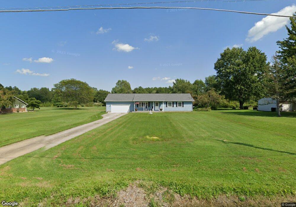
10761 Mitchell Rd Columbia Station, OH 44028
Estimated Value: $265,000 - $310,000
3
Beds
2
Baths
1,352
Sq Ft
$206/Sq Ft
Est. Value
About This Home
This home is located at 10761 Mitchell Rd, Columbia Station, OH 44028 and is currently estimated at $278,350, approximately $205 per square foot. 10761 Mitchell Rd is a home located in Lorain County with nearby schools including Olmsted Falls Intermediate Building, Falls-Lenox Primary Elementary School, and Olmsted Falls Middle School.
Ownership History
Date
Name
Owned For
Owner Type
Purchase Details
Closed on
Feb 11, 2020
Sold by
Porinchok Diane J
Bought by
Hildebrandt Dennis R
Current Estimated Value
Home Financials for this Owner
Home Financials are based on the most recent Mortgage that was taken out on this home.
Original Mortgage
$80,000
Outstanding Balance
$70,834
Interest Rate
3.6%
Mortgage Type
New Conventional
Estimated Equity
$207,516
Create a Home Valuation Report for This Property
The Home Valuation Report is an in-depth analysis detailing your home's value as well as a comparison with similar homes in the area
Home Values in the Area
Average Home Value in this Area
Purchase History
| Date | Buyer | Sale Price | Title Company |
|---|---|---|---|
| Hildebrandt Dennis R | $100,000 | Fidelity National Ttl Co Llc |
Source: Public Records
Mortgage History
| Date | Status | Borrower | Loan Amount |
|---|---|---|---|
| Open | Hildebrandt Dennis R | $80,000 |
Source: Public Records
Tax History Compared to Growth
Tax History
| Year | Tax Paid | Tax Assessment Tax Assessment Total Assessment is a certain percentage of the fair market value that is determined by local assessors to be the total taxable value of land and additions on the property. | Land | Improvement |
|---|---|---|---|---|
| 2024 | $3,004 | $68,446 | $29,918 | $38,528 |
| 2023 | $3,026 | $60,151 | $37,513 | $22,638 |
| 2022 | $2,952 | $60,151 | $37,513 | $22,638 |
| 2021 | $2,981 | $60,151 | $37,513 | $22,638 |
| 2020 | $2,408 | $52,180 | $32,540 | $19,640 |
| 2019 | $2,394 | $52,180 | $32,540 | $19,640 |
| 2018 | $2,413 | $52,180 | $32,540 | $19,640 |
| 2017 | $2,441 | $49,690 | $24,250 | $25,440 |
| 2016 | $2,458 | $49,690 | $24,250 | $25,440 |
| 2015 | $2,458 | $49,690 | $24,250 | $25,440 |
| 2014 | $2,289 | $49,690 | $24,250 | $25,440 |
| 2013 | $2,289 | $49,690 | $24,250 | $25,440 |
Source: Public Records
Map
Nearby Homes
- 26571 Sprague Rd
- 33621 Henwell Rd
- 33700 Henwell Rd
- 33743 Henwell Rd
- 9628 Kingston Trail
- 27167 Watkin Rd
- 9954 Ethan Dr
- 8860 Sharp Rd
- 23663 Victory Ln
- 27056 Sprague Rd
- 0 V L Schady Rd Unit 5163658
- 8706 Stearns Rd
- 9129 Riverwood Dr
- 33932 Abercorn Place
- 33964 Abercorn Place
- 9113 Riverwood Dr
- 9032 Riverwood Dr
- 33110 Wren Haven Cir
- 9130 Devonshire Dr
- 9112 Devonshire Dr
- 10795 Mitchell Rd
- 10713 Mitchell Rd
- 10823 Mitchell Rd
- 10692 Mitchell Rd
- 10685 Mitchell Rd
- 10760 Mitchell Rd
- 10853 Mitchell Rd
- 0 Mitchell Rd
- 10844 Mitchell Rd
- 10893 Mitchell Rd
- 10615 Mitchell Rd
- 10630 Mitchell Rd
- 10818 Mitchell Rd
- 10720 Mitchell Rd
- 10890 Mitchell Rd
- 10955 Mitchell Rd
- 10531 Mitchell Rd
- 10934 Mitchell Rd
- 10532 Mitchell Rd
- 10969 Mitchell Rd