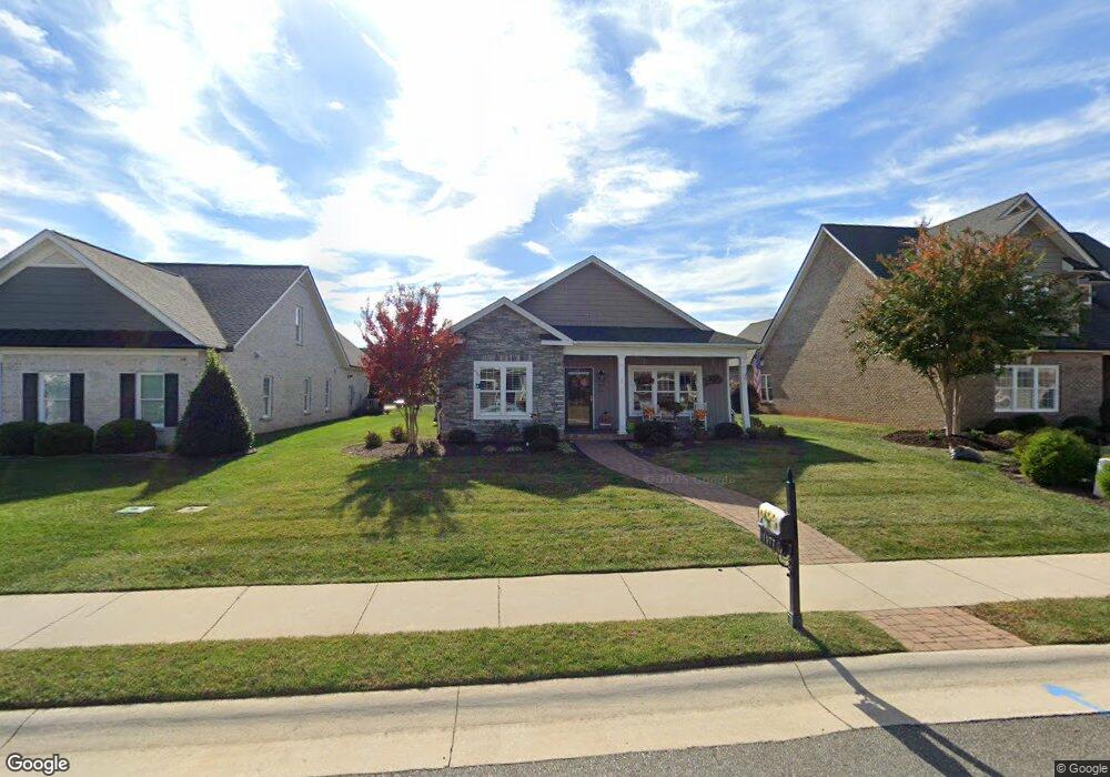
1077 Lindenshire Dr Forest, VA 24551
Estimated Value: $285,000 - $588,000
--
Bed
--
Bath
--
Sq Ft
9,148
Sq Ft Lot
About This Home
This home is located at 1077 Lindenshire Dr, Forest, VA 24551 and is currently estimated at $440,658. 1077 Lindenshire Dr is a home located in Bedford County with nearby schools including Forest Elementary School, Forest Middle School, and Jefferson Forest High School.
Ownership History
Date
Name
Owned For
Owner Type
Purchase Details
Closed on
Sep 6, 2019
Sold by
Allen W Harvey Limited Partnership Llp
Bought by
Duncan Carlos Michael and Duncan Joyce L
Current Estimated Value
Purchase Details
Closed on
Mar 3, 2017
Sold by
Chase Property Development Llc A Virgini
Bought by
Allen W Harvey Family Partnership Llc
Purchase Details
Closed on
Dec 12, 2016
Sold by
Vc Enterprises Llc A Virginia Limited Li
Bought by
Chase Property Development Llc A Virgini
Purchase Details
Closed on
Aug 15, 2012
Sold by
Farmington Views Inc
Bought by
Vc Enterprises Llc
Create a Home Valuation Report for This Property
The Home Valuation Report is an in-depth analysis detailing your home's value as well as a comparison with similar homes in the area
Home Values in the Area
Average Home Value in this Area
Purchase History
| Date | Buyer | Sale Price | Title Company |
|---|---|---|---|
| Duncan Carlos Michael | $339,000 | Attorney | |
| Allen W Harvey Family Partnership Llc | $325,000 | Mountain View Stlmnt Svcs | |
| Chase Property Development Llc A Virgini | $55,000 | Attorney | |
| Vc Enterprises Llc | $252,000 | Advantage Title & Closing Ll |
Source: Public Records
Tax History Compared to Growth
Tax History
| Year | Tax Paid | Tax Assessment Tax Assessment Total Assessment is a certain percentage of the fair market value that is determined by local assessors to be the total taxable value of land and additions on the property. | Land | Improvement |
|---|---|---|---|---|
| 2025 | $1,361 | $332,000 | $55,000 | $277,000 |
| 2024 | $1,361 | $332,000 | $55,000 | $277,000 |
| 2023 | $1,361 | $166,000 | $0 | $0 |
| 2022 | $1,311 | $131,050 | $0 | $0 |
| 2021 | $1,311 | $262,100 | $55,000 | $207,100 |
| 2020 | $1,311 | $262,100 | $55,000 | $207,100 |
| 2019 | $1,311 | $262,100 | $55,000 | $207,100 |
| 2018 | $1,234 | $237,400 | $60,000 | $177,400 |
| 2017 | $1,234 | $237,400 | $60,000 | $177,400 |
| 2016 | $286 | $55,000 | $55,000 | $0 |
| 2015 | $286 | $55,000 | $55,000 | $0 |
| 2014 | $208 | $40,000 | $40,000 | $0 |
Source: Public Records
Map
Nearby Homes
- 0 Brewington Dr
- 0 Brewington Dr
- 1267 Harborough Dr
- 1543 Farmington Dr
- 1058 Brownstone Ln
- 1013 Cobblestone Ln
- 1099 Harborough Dr
- 1261 Stoney Ridge Blvd
- 1175 Helmsdale Dr
- 0 Farmington Dr
- 1300 Stoney Ridge Blvd Unit 206
- 1300 Stoney Ridge Blvd Unit 208
- 0 Dayna Ct
- 1229 Commonwealth Cir
- 1163 Commonwealth Cir
- 1069 Commonwealth Cir
- 942 Leander Dr
- 0 Lejack Cir Unit 333233
- 0 Lejack Cir
- 1061 Casley Way
- 1069 Lindenshire Dr
- 1093 Lindenshire Dr
- 1055 Lindenshire Dr
- 1083 Brewington Dr
- 1043 Lindenshire Dr
- 1093 Brewington Dr
- 1071 Brewington Dr
- 1072 Lindenshire Dr
- 1111 Lindenshire Dr
- 1058 Lindenshire Dr
- 1059 Brewington Dr
- 1078 Lindenshire Dr
- 1105 Brewington Dr
- 1094 Lindenshire Dr
- 1133 Lindenshire Dr
- 1121 Lindenshire Dr
- 1114 Lindenshire Dr
- 1049 Brewington Dr
- 1121 Brewington Dr
- 1037 Brewington Dr