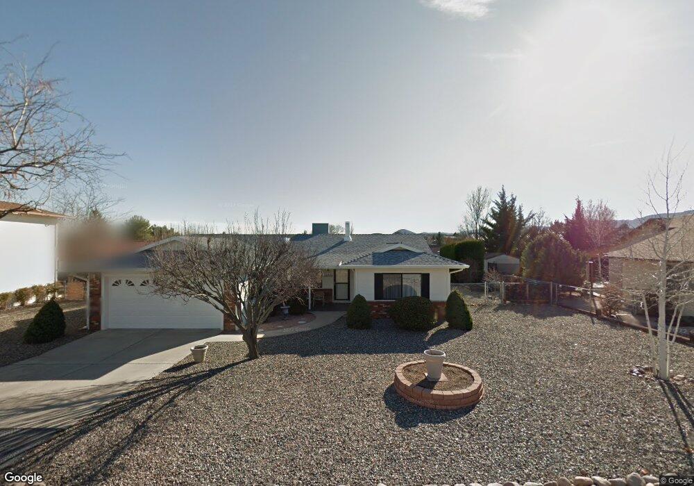
10775 E Stirrup High Dr W Dewey, AZ 86327
Prescott Golf & Country Club NeighborhoodEstimated Value: $381,968 - $441,000
3
Beds
2
Baths
1,496
Sq Ft
$269/Sq Ft
Est. Value
About This Home
This home is located at 10775 E Stirrup High Dr W, Dewey, AZ 86327 and is currently estimated at $402,492, approximately $269 per square foot. 10775 E Stirrup High Dr W is a home located in Yavapai County with nearby schools including Lake Valley Elementary School, Glassford Hill Middle School, and Bradshaw Mountain High School.
Ownership History
Date
Name
Owned For
Owner Type
Purchase Details
Closed on
Jul 16, 2024
Sold by
Strader Candace and Strader Scott Allan
Bought by
Candace Kay Strader Living Trust and Strader
Current Estimated Value
Purchase Details
Closed on
Nov 3, 2022
Sold by
Marcella A Zinzilieta Trust
Bought by
Strader Candace and Strader Scott Allan
Purchase Details
Closed on
Jun 30, 1995
Sold by
Zinzilieta Marcella A
Bought by
Marcella A Zinzilieta Trust
Purchase Details
Closed on
Feb 28, 1995
Sold by
Butler Henry E and Butler Irene S
Bought by
Zinzilieta Marcella A
Home Financials for this Owner
Home Financials are based on the most recent Mortgage that was taken out on this home.
Original Mortgage
$73,800
Interest Rate
8.77%
Mortgage Type
New Conventional
Create a Home Valuation Report for This Property
The Home Valuation Report is an in-depth analysis detailing your home's value as well as a comparison with similar homes in the area
Home Values in the Area
Average Home Value in this Area
Purchase History
| Date | Buyer | Sale Price | Title Company |
|---|---|---|---|
| Candace Kay Strader Living Trust | -- | None Listed On Document | |
| Strader Candace | $339,500 | Pioneer Title | |
| Marcella A Zinzilieta Trust | -- | -- | |
| Zinzilieta Marcella A | $123,000 | First American Title Ins |
Source: Public Records
Mortgage History
| Date | Status | Borrower | Loan Amount |
|---|---|---|---|
| Previous Owner | Zinzilieta Marcella A | $73,800 |
Source: Public Records
Tax History Compared to Growth
Tax History
| Year | Tax Paid | Tax Assessment Tax Assessment Total Assessment is a certain percentage of the fair market value that is determined by local assessors to be the total taxable value of land and additions on the property. | Land | Improvement |
|---|---|---|---|---|
| 2026 | $1,636 | $29,320 | -- | -- |
| 2024 | $1,500 | $30,735 | -- | -- |
| 2023 | $1,500 | $25,581 | $4,642 | $20,939 |
| 2022 | $1,475 | $20,912 | $4,061 | $16,851 |
| 2021 | $1,541 | $19,001 | $4,074 | $14,927 |
| 2020 | $1,481 | $0 | $0 | $0 |
| 2019 | $1,463 | $0 | $0 | $0 |
| 2018 | $1,391 | $0 | $0 | $0 |
| 2017 | $1,364 | $0 | $0 | $0 |
| 2016 | $1,318 | $0 | $0 | $0 |
| 2015 | $1,299 | $0 | $0 | $0 |
| 2014 | $1,299 | $0 | $0 | $0 |
Source: Public Records
Map
Nearby Homes
- 819 N Winchester Way
- 11820 E Stirrup High Dr E
- 11847 E Stirrup High Dr E
- 776 N Maverick Trail
- 942 Latigo Ln
- 11992 E Rawhide Ridge
- 11873 E Turquoise Cir Unit 2
- 11493 E Turquoise Cir
- 11613 E Silver Spur
- 707 N Apache Dr
- 11452 E Turquoise Cir Unit 4
- 11516 E Wingfoot Ct
- 1140 N Latigo Ln
- 1017 N Fairway Dr
- 864 N Mountain Brush Dr
- 1131 N Tapadero Dr Unit 4
- 12026 E Turquoise Cir
- 12070 E Pepper Tree Way
- 11448 E Concho Canyon
- 914 N Ponderosa Pine Dr
- 10775 E Stirrup High Dr W Unit W
- 10755 Stirrup High Dr E
- 10755 E Stirrup High Dr W
- 11784 E Longhorn Dr
- 11796 E Longhorn Dr
- 11766 E Longhorn Dr
- 11766 E Longhorn Dr Unit 1
- 10776 E Stirrup High Dr W
- 10756 Stirrup High Dr E
- 10756 E Stirrup High Dr W
- 10739 E Stirrup High Dr W
- 11800 E Stirrup High Dr W
- 219 Longhorn Dr
- 11740 E Longhorn Dr
- 865 N Cowboy Cir
- 864 N Cowboy Cir
- 760 N Winchester Way
- 799 N Winchester Way
- 799 N Winchester Way Unit 1
- 11808 E Stirrup High Dr W