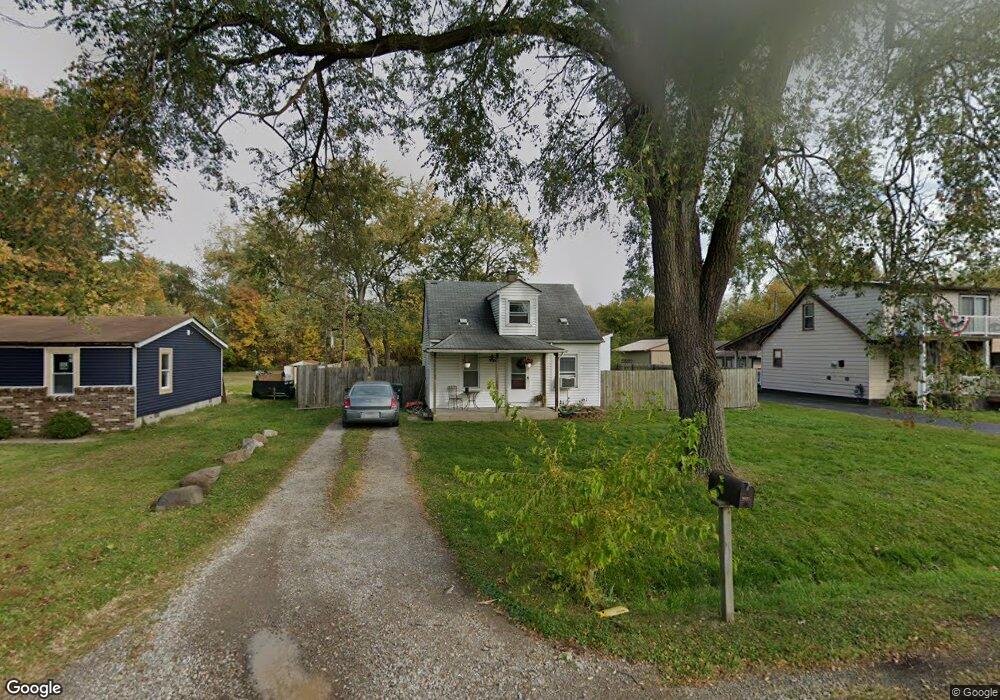
10775 Oak St Unit Bldg-Unit Taylor, MI 48180
Estimated Value: $125,000 - $132,000
Studio
1
Bath
840
Sq Ft
$153/Sq Ft
Est. Value
About This Home
This home is located at 10775 Oak St Unit Bldg-Unit, Taylor, MI 48180 and is currently estimated at $128,922, approximately $153 per square foot. 10775 Oak St Unit Bldg-Unit is a home located in Wayne County with nearby schools including Kinyon Elementary School, Robert J. West Middle School, and Taylor High School.
Ownership History
Date
Name
Owned For
Owner Type
Purchase Details
Closed on
Jun 27, 2018
Sold by
Fifth Third Mortgage Company
Bought by
Omler Nicole
Current Estimated Value
Purchase Details
Closed on
Apr 24, 2018
Sold by
Molnar Daniel
Bought by
Fifth Third Mortgage Company
Purchase Details
Closed on
Mar 15, 2018
Sold by
Molnar Daniel
Bought by
Fifth Third Mortgage Company
Purchase Details
Closed on
Jul 11, 2003
Sold by
Biroscak Troy J and Biroscak Karen
Bought by
Molnar Daniel
Create a Home Valuation Report for This Property
The Home Valuation Report is an in-depth analysis detailing your home's value as well as a comparison with similar homes in the area
Home Values in the Area
Average Home Value in this Area
Purchase History
| Date | Buyer | Sale Price | Title Company |
|---|---|---|---|
| Omler Nicole | $53,500 | Servicelink Llc | |
| Fifth Third Mortgage Company | $2,500 | None Available | |
| Fifth Third Mortgage Company | $54,400 | None Available | |
| Molnar Daniel | $112,000 | Multiple |
Source: Public Records
Tax History
| Year | Tax Paid | Tax Assessment Tax Assessment Total Assessment is a certain percentage of the fair market value that is determined by local assessors to be the total taxable value of land and additions on the property. | Land | Improvement |
|---|---|---|---|---|
| 2025 | $1,694 | $53,500 | $0 | $0 |
| 2024 | $1,640 | $49,800 | $0 | $0 |
| 2023 | $2,597 | $44,700 | $0 | $0 |
| 2022 | $2,181 | $37,500 | $0 | $0 |
| 2021 | $2,501 | $33,200 | $0 | $0 |
| 2020 | $2,338 | $33,100 | $0 | $0 |
| 2019 | $275,260 | $34,300 | $0 | $0 |
| 2018 | $1,036 | $28,500 | $0 | $0 |
| 2017 | $597 | $23,700 | $0 | $0 |
| 2016 | $1,336 | $23,800 | $0 | $0 |
| 2015 | $2,560 | $26,900 | $0 | $0 |
| 2013 | $2,540 | $26,200 | $0 | $0 |
| 2012 | $1,084 | $25,500 | $11,000 | $14,500 |
Source: Public Records
Map
Nearby Homes
- 10769 Birch St
- 11078 Pine St
- 22675 Goddard Rd
- 000 Pine Lot A St
- 000 Beechdaly
- 000 Pine Lot B St
- 6445 Pardee Rd
- Telegraph Telegraph Rd
- 011 Pine St
- 01 Pine St
- 11187 Pardee Rd
- 9788 Pine St
- 9731 Cornell St
- 11724 Syracuse St
- 11725 Cornell St
- 9814 Cass Ave
- 9690 Cornell St
- 11788 Syracuse St
- 22243 Kinyon St Unit 3
- 22243 Kinyon St Unit 1
Your Personal Tour Guide
Ask me questions while you tour the home.