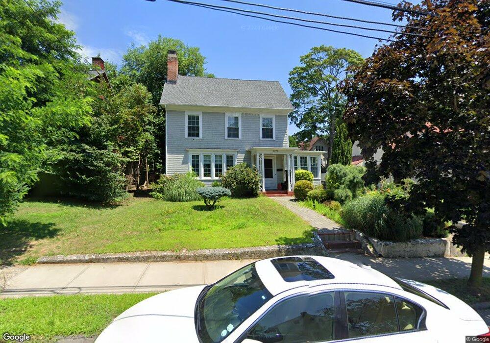
1078 Laurel Ave Bridgeport, CT 06604
Brooklawn-Saint Vincent NeighborhoodEstimated Value: $415,000 - $507,000
3
Beds
2
Baths
2,020
Sq Ft
$228/Sq Ft
Est. Value
About This Home
This home is located at 1078 Laurel Ave, Bridgeport, CT 06604 and is currently estimated at $460,224, approximately $227 per square foot. 1078 Laurel Ave is a home located in Fairfield County with nearby schools including Geraldine Johnson School, Bassick High School, and Merkaz Community High School for Judaic Studies.
Ownership History
Date
Name
Owned For
Owner Type
Purchase Details
Closed on
Jan 18, 1995
Sold by
Berger Mildred C
Bought by
Mckenzie Roger and Mckenzie Vivian J
Current Estimated Value
Home Financials for this Owner
Home Financials are based on the most recent Mortgage that was taken out on this home.
Original Mortgage
$83,600
Interest Rate
7.82%
Mortgage Type
Unknown
Create a Home Valuation Report for This Property
The Home Valuation Report is an in-depth analysis detailing your home's value as well as a comparison with similar homes in the area
Home Values in the Area
Average Home Value in this Area
Purchase History
| Date | Buyer | Sale Price | Title Company |
|---|---|---|---|
| Mckenzie Roger | $44,000 | -- | |
| Mckenzie Roger | $44,000 | -- | |
| Mckenzie Roger V | $44,000 | -- |
Source: Public Records
Mortgage History
| Date | Status | Borrower | Loan Amount |
|---|---|---|---|
| Open | Mckenzie Roger V | $107,250 | |
| Closed | Mckenzie Roger V | $75,000 | |
| Closed | Mckenzie Roger V | $84,800 | |
| Closed | Mckenzie Roger V | $83,600 |
Source: Public Records
Tax History Compared to Growth
Tax History
| Year | Tax Paid | Tax Assessment Tax Assessment Total Assessment is a certain percentage of the fair market value that is determined by local assessors to be the total taxable value of land and additions on the property. | Land | Improvement |
|---|---|---|---|---|
| 2025 | $7,479 | $172,130 | $80,160 | $91,970 |
| 2024 | $7,479 | $172,130 | $80,160 | $91,970 |
| 2023 | $7,479 | $172,130 | $80,160 | $91,970 |
| 2022 | $7,479 | $172,130 | $80,160 | $91,970 |
| 2021 | $7,479 | $172,130 | $80,160 | $91,970 |
| 2020 | $6,234 | $115,460 | $48,570 | $66,890 |
| 2019 | $6,234 | $115,460 | $48,570 | $66,890 |
| 2018 | $6,278 | $115,460 | $48,570 | $66,890 |
| 2017 | $6,278 | $115,460 | $48,570 | $66,890 |
| 2016 | $6,278 | $115,460 | $48,570 | $66,890 |
| 2015 | $7,081 | $167,800 | $58,790 | $109,010 |
| 2014 | $7,081 | $167,800 | $58,790 | $109,010 |
Source: Public Records
Map
Nearby Homes
- 184 Pacific St
- 687 Wood Ave
- 366 Brooklawn Ave
- 2370 North Ave Unit 4C
- 2370 North Ave Unit 12G
- 2370 North Ave Unit 3F
- 860 Briarwood Ave
- 566 Wood Ave
- 665 W Taft Ave
- 74 Carleton Ave
- 700 Laurel Ave
- 697 Laurel Ave
- 80 Cartright St Unit 5D
- 80 Cartright St Unit 8J
- 80 Cartright St Unit 2F
- 80 Cartright St Unit GC
- 80 Cartright St Unit 8B
- 25 Cartright St Unit 5D
- 1213 Wood Ave
- 414 Wood Ave
- 1086 Laurel Ave
- 1060 Laurel Ave
- 1094 Laurel Ave
- 1052 Laurel Ave
- 281 Pacific St
- 271 Pacific St Unit 273
- 291 Pacific St
- 273 Pacific St
- 259 Pacific St Unit 261
- 261 Pacific St
- 299 Pacific St
- 8 Brooklawn Place
- 251 Pacific St
- 1110 Laurel Ave
- 1036 Laurel Ave
- 305 Pacific St
- 253 Pacific St Unit 2
- 241 Pacific St Unit 2 flr
- 241 Pacific St Unit 243
- 241 Pacific St Unit 1 flr