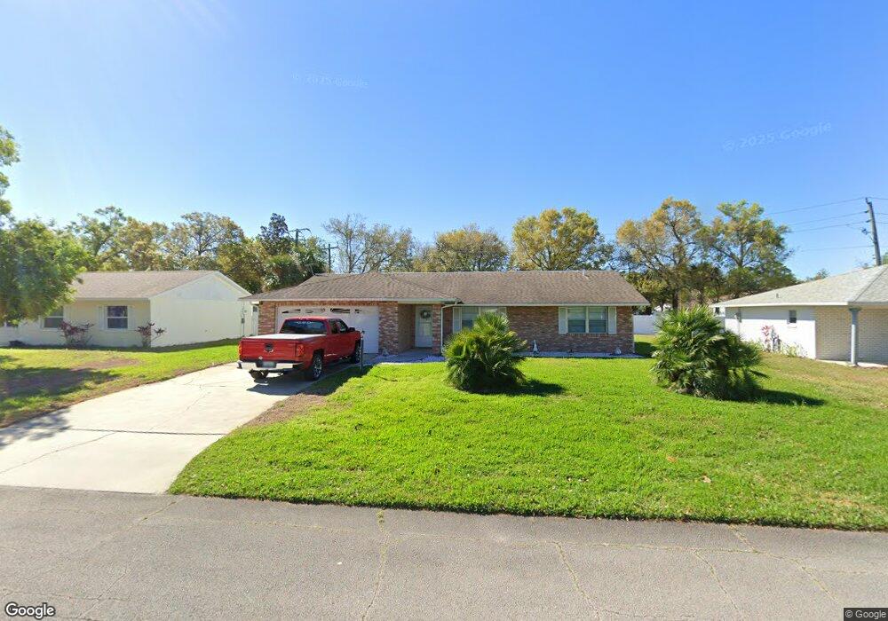
1078 Wexford Way Port Orange, FL 32129
Port Orange West NeighborhoodEstimated Value: $266,573 - $294,000
3
Beds
2
Baths
1,247
Sq Ft
$229/Sq Ft
Est. Value
About This Home
This home is located at 1078 Wexford Way, Port Orange, FL 32129 and is currently estimated at $285,643, approximately $229 per square foot. 1078 Wexford Way is a home located in Volusia County with nearby schools including Atlantic High School, Sugar Mill Elementary School, and Silver Sands Middle School.
Ownership History
Date
Name
Owned For
Owner Type
Purchase Details
Closed on
Feb 26, 2021
Sold by
Watt Maxine M and Watt James P
Bought by
Watt James P and Watt Amy L
Current Estimated Value
Purchase Details
Closed on
Jul 8, 2010
Sold by
Watt Maxine M
Bought by
Watt Maxine M and Watt James P
Purchase Details
Closed on
Feb 15, 1980
Bought by
Watt Maxine M and Watt James P
Create a Home Valuation Report for This Property
The Home Valuation Report is an in-depth analysis detailing your home's value as well as a comparison with similar homes in the area
Home Values in the Area
Average Home Value in this Area
Purchase History
| Date | Buyer | Sale Price | Title Company |
|---|---|---|---|
| Watt James P | -- | Accommodation | |
| Watt Maxine M | -- | Attorney | |
| Watt Maxine M | $46,500 | -- |
Source: Public Records
Tax History Compared to Growth
Tax History
| Year | Tax Paid | Tax Assessment Tax Assessment Total Assessment is a certain percentage of the fair market value that is determined by local assessors to be the total taxable value of land and additions on the property. | Land | Improvement |
|---|---|---|---|---|
| 2025 | $3,585 | $213,825 | $75,200 | $138,625 |
| 2024 | $3,585 | $217,096 | $75,200 | $141,896 |
| 2023 | $3,585 | $197,296 | $70,000 | $127,296 |
| 2022 | $3,275 | $179,412 | $38,800 | $140,612 |
| 2021 | $2,860 | $146,782 | $26,800 | $119,982 |
| 2020 | $2,807 | $147,016 | $26,000 | $121,016 |
| 2019 | $2,530 | $131,764 | $20,800 | $110,964 |
| 2018 | $2,537 | $129,000 | $17,600 | $111,400 |
| 2017 | $2,457 | $121,552 | $17,600 | $103,952 |
| 2016 | $2,313 | $111,287 | $0 | $0 |
| 2015 | $2,183 | $99,879 | $0 | $0 |
| 2014 | $2,218 | $101,441 | $0 | $0 |
Source: Public Records
Map
Nearby Homes
- 1077 Willow Wood Dr
- 1086 Donnell Dr
- 1118 Kane Dr
- 1075 Horizon View Blvd
- 1300 Harms Way
- 1132 Loblolly Ln
- 1106 Blueberry Dr
- 4041 S Waterbridge Cir
- 4039 N Waterbridge Cir
- 4029 N Waterbridge Cir
- 1213 Jeffery Dr
- 1245 Thomas Dr
- 993 Appleview Way
- 4015 N Waterbridge Cir
- 3830 Bourbon St
- 3841 Bourbon St
- 3929 Oak Crest Cir
- 14 Woodlake Dr
- 5912 Plainview Dr
- 3916 Oak Crest Cir
- 1080 Wexford Way
- 1076 Wexford Way
- 1074 Wexford Way
- 1081 Wexford Way
- 1083 Wexford Way
- 1079 Wexford Way
- 1069 Azalea Pointe Dr
- 1089 Wexford Way
- 1070 Azalea Pointe Dr
- 1077 Wexford Way
- 1072 Wexford Way
- 1090 York Way
- 1084 Wexford Way
- 1067 Azalea Pointe Dr
- 1088 York Way
- 1091 Wexford Way
- 1075 Wexford Way
- 1092 York Way
- 1070 Wexford Way
- 1068 Azalea Pointe Dr