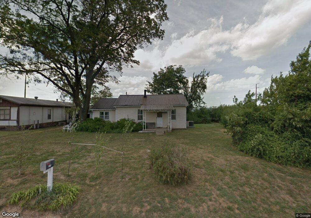
10785 John Zodrow Rd Gentry, AR 72734
Estimated Value: $165,829 - $578,000
--
Bed
1
Bath
808
Sq Ft
$371/Sq Ft
Est. Value
About This Home
This home is located at 10785 John Zodrow Rd, Gentry, AR 72734 and is currently estimated at $299,957, approximately $371 per square foot. 10785 John Zodrow Rd is a home located in Benton County with nearby schools including Gentry Intermediate School, Gentry Primary School, and Gentry Middle School.
Ownership History
Date
Name
Owned For
Owner Type
Purchase Details
Closed on
Jul 14, 2020
Sold by
Tenbrook Johnny L
Bought by
Tenbrook John Clifton and Tenbrook Peggy
Current Estimated Value
Purchase Details
Closed on
May 26, 2015
Sold by
Tenbrook Johnny L and Tenbrook Patricia A
Bought by
Erb Poultry Farms Llc
Purchase Details
Closed on
Oct 21, 1999
Bought by
Tenbrook
Purchase Details
Closed on
Oct 7, 1999
Bought by
Tenbrook
Purchase Details
Closed on
Aug 18, 1997
Bought by
Tenbrook J
Purchase Details
Closed on
Oct 12, 1973
Bought by
Tenbrook
Create a Home Valuation Report for This Property
The Home Valuation Report is an in-depth analysis detailing your home's value as well as a comparison with similar homes in the area
Home Values in the Area
Average Home Value in this Area
Purchase History
| Date | Buyer | Sale Price | Title Company |
|---|---|---|---|
| Tenbrook John Clifton | -- | None Available | |
| Erb Poultry Farms Llc | $8,500 | Etc | |
| Tenbrook | -- | -- | |
| Tenbrook | -- | -- | |
| Tenbrook J | -- | -- | |
| Tenbrook | $20,000 | -- |
Source: Public Records
Tax History Compared to Growth
Tax History
| Year | Tax Paid | Tax Assessment Tax Assessment Total Assessment is a certain percentage of the fair market value that is determined by local assessors to be the total taxable value of land and additions on the property. | Land | Improvement |
|---|---|---|---|---|
| 2025 | $502 | $17,763 | $6,387 | $11,376 |
| 2024 | $468 | $17,763 | $6,387 | $11,376 |
| 2023 | $444 | $10,720 | $2,140 | $8,580 |
| 2022 | $75 | $10,720 | $2,140 | $8,580 |
| 2021 | $52 | $10,720 | $2,140 | $8,580 |
| 2020 | $37 | $7,640 | $1,560 | $6,080 |
| 2019 | $109 | $9,120 | $2,300 | $6,820 |
| 2018 | $134 | $9,120 | $2,300 | $6,820 |
| 2017 | $127 | $9,120 | $2,300 | $6,820 |
| 2016 | $127 | $9,120 | $2,300 | $6,820 |
| 2015 | $450 | $9,000 | $2,410 | $6,590 |
| 2014 | $100 | $9,000 | $2,410 | $6,590 |
Source: Public Records
Map
Nearby Homes
- 19241 Floyd Moore Rd
- 22.56 Acres Floyd Moore Rd
- TBD Floyd Moore Rd
- 11230 John Zodrow Rd
- 21854 Floyd Moore Rd
- 22338 Floyd Moore Rd
- 21944 Arkansas 12
- 22443 Floyd Moore Rd
- TBD N Bloomfield Rd
- 21743 Bozarth Cemetery Rd
- 21214 Floyd Moore Rd
- 0 Bozarth Cemetery Rd
- 11419 Cripps Rd
- 22006 Bozarth Cemetery Rd
- Rc Morgan Plan at Crowder
- RC Kinsley II Plan at Crowder
- RC Baltimore Plan at Crowder
- RC Coleman Plan at Crowder
- RC Carnegie II Plan at Crowder
- RC Glenwood Plan at Crowder
- 10803 John Zodrow Rd
- 10769 John Zodrow Rd
- 10852 John Zodrow Rd
- 10858 John Zodrow Rd
- 10980 John Zodrow Rd
- 21980 Gann Rd
- 10581 John Zodrow Rd
- 10811 John Zodrow Rd
- 21754 Gann Rd
- 21758 Gann Rd
- 21801 Gann Rd
- 22228 W Highway 12
- 0 Zodrow Rd
- 0 John Zodrow Rd Unit 534153
- 0 John Zodrow Rd Unit 573823
- 0 John Zodrow Rd Unit 575267
- 0 John Zodrow Rd Unit 575348
- 0 John Zodrow Rd Unit 576835
- 0 N John Zodrow Rd Unit 629613
- 0 John Zodrow Rd Unit 690855