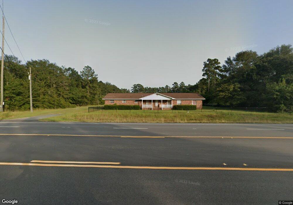
10785 Waycross Hwy Screven, GA 31560
Estimated Value: $234,000 - $329,000
4
Beds
2
Baths
2,852
Sq Ft
$106/Sq Ft
Est. Value
About This Home
This home is located at 10785 Waycross Hwy, Screven, GA 31560 and is currently estimated at $300,896, approximately $105 per square foot. 10785 Waycross Hwy is a home located in Wayne County with nearby schools including Screven Elementary School, Arthur Williams Middle School, and Wayne County High School.
Ownership History
Date
Name
Owned For
Owner Type
Purchase Details
Closed on
Aug 13, 2018
Sold by
Phillips Glen W
Bought by
Stewart Joseph and Stewart Carrie
Current Estimated Value
Purchase Details
Closed on
Mar 1, 2002
Sold by
Deloach Cheryl L
Bought by
Phillips Glen W
Purchase Details
Closed on
Jan 1, 1993
Purchase Details
Closed on
Sep 1, 1961
Create a Home Valuation Report for This Property
The Home Valuation Report is an in-depth analysis detailing your home's value as well as a comparison with similar homes in the area
Home Values in the Area
Average Home Value in this Area
Purchase History
| Date | Buyer | Sale Price | Title Company |
|---|---|---|---|
| Stewart Joseph | $110,000 | -- | |
| Phillips Glen W | -- | -- | |
| Deloach Cheryl L | -- | -- | |
| -- | -- | -- | |
| -- | -- | -- |
Source: Public Records
Tax History Compared to Growth
Tax History
| Year | Tax Paid | Tax Assessment Tax Assessment Total Assessment is a certain percentage of the fair market value that is determined by local assessors to be the total taxable value of land and additions on the property. | Land | Improvement |
|---|---|---|---|---|
| 2024 | $2,770 | $109,568 | $2,826 | $106,742 |
| 2023 | $2,888 | $96,250 | $2,826 | $93,424 |
| 2022 | $2,286 | $77,603 | $2,826 | $74,777 |
| 2021 | $1,730 | $56,294 | $2,826 | $53,468 |
| 2020 | $1,886 | $59,055 | $5,587 | $53,468 |
| 2019 | $1,401 | $59,055 | $5,587 | $53,468 |
| 2018 | $2,121 | $59,055 | $5,587 | $53,468 |
| 2017 | $1,826 | $59,055 | $5,587 | $53,468 |
| 2016 | $644 | $59,054 | $5,587 | $53,468 |
| 2014 | $643 | $59,054 | $5,587 | $53,468 |
| 2013 | -- | $59,053 | $5,586 | $53,467 |
Source: Public Records
Map
Nearby Homes
- 0 Dale Mill Rd
- 102 Highsmith Ave
- 107 Gaffney St
- 868 Broadhurst Rd W
- 301 Whitaker Dr
- 109 Joyner St
- 406 Cw Collins St
- 9009 Waycross Hwy
- 391 S Forks Rd
- 0 S Forks Rd
- 7132 Waycross Hwy
- 7114 Waycross Hwy
- 7014 Waycross Hwy
- 59 Enoch Moody Rd
- 675 Foxwood Cir
- 362 Crosby Ln
- 301 Broadhurst Rd
- 188 Bennetts Cir
- 0 Us Highway 301
- 1351 Old Screven Rd
- 10825 Waycross Hwy
- 10800 Waycross Hwy
- 10850 Waycross Hwy
- 10934 Waycross Hwy
- 0 Waycross Hwy Unit 18541
- 0 Waycross Hwy Unit 130886
- 10880 Waycross Hwy
- 10805 Waycross Hwy
- 11122 Waycross Hwy
- 389 Jl Harris Rd
- 174 Jl Harris Rd
- 5150 Bennett Rd
- 5143 Bennett Rd
- 271 Dale Mill Rd
- 233 Easy St
- 237 Dale Mill Rd
- 145 Dale Mill Rd
- 11276 Waycross Hwy
- 46 Dale Mill Rd
- 10252 Waycross Hwy