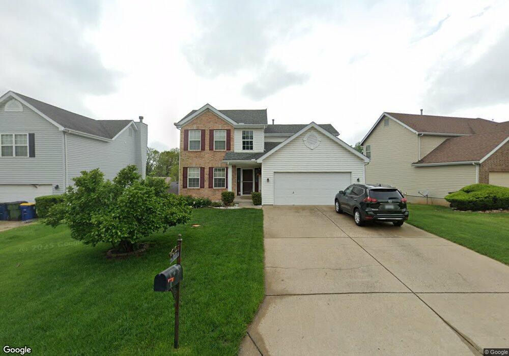
10789 Oak Pointe Dr Saint Ann, MO 63074
Estimated Value: $259,000 - $288,000
4
Beds
3
Baths
1,630
Sq Ft
$170/Sq Ft
Est. Value
About This Home
This home is located at 10789 Oak Pointe Dr, Saint Ann, MO 63074 and is currently estimated at $277,277, approximately $170 per square foot. 10789 Oak Pointe Dr is a home located in St. Louis County with nearby schools including Robert Drummond Elementary School, Holman Middle School, and Pattonville High School.
Ownership History
Date
Name
Owned For
Owner Type
Purchase Details
Closed on
Aug 16, 2010
Sold by
Quach Huy and Quach Mandy Tao
Bought by
Quach Huy and Quach Mandy Tao
Current Estimated Value
Home Financials for this Owner
Home Financials are based on the most recent Mortgage that was taken out on this home.
Original Mortgage
$100,000
Interest Rate
4.06%
Mortgage Type
New Conventional
Create a Home Valuation Report for This Property
The Home Valuation Report is an in-depth analysis detailing your home's value as well as a comparison with similar homes in the area
Home Values in the Area
Average Home Value in this Area
Purchase History
| Date | Buyer | Sale Price | Title Company |
|---|---|---|---|
| Quach Huy | -- | Integrity Land Title Co Inc |
Source: Public Records
Mortgage History
| Date | Status | Borrower | Loan Amount |
|---|---|---|---|
| Closed | Quach Huy | $100,000 |
Source: Public Records
Tax History
| Year | Tax Paid | Tax Assessment Tax Assessment Total Assessment is a certain percentage of the fair market value that is determined by local assessors to be the total taxable value of land and additions on the property. | Land | Improvement |
|---|---|---|---|---|
| 2025 | $4,075 | $49,780 | $6,610 | $43,170 |
| 2024 | $4,075 | $44,710 | $6,610 | $38,100 |
| 2023 | $4,025 | $44,710 | $6,610 | $38,100 |
| 2022 | $3,437 | $35,810 | $6,610 | $29,200 |
| 2021 | $3,427 | $35,810 | $6,610 | $29,200 |
| 2020 | $3,705 | $36,730 | $8,080 | $28,650 |
| 2019 | $3,686 | $36,730 | $8,080 | $28,650 |
| 2018 | $3,108 | $27,970 | $4,410 | $23,560 |
| 2017 | $3,090 | $27,970 | $4,410 | $23,560 |
| 2016 | $2,996 | $29,420 | $5,040 | $24,380 |
Source: Public Records
Map
Nearby Homes
- 10558 Hobday Ave
- 10592 Clarendon Ave
- 10563 Decker Ave
- 10651 Thorpe Ave
- 10643 Thorpe Ave
- 10515 Clarendon Ave
- 10525 Hobday Ave
- 3005 Ashby Rd
- 3001 Ashby Rd
- 3000 Ashby Rd
- 2820 Ashby Rd
- 2719 Francis Ave
- 2668 Midland Ridge Dr
- 10820 Saint Francis Ln
- 10704 Saint Matthew Ln
- 2454 Prouhet Ave
- 10397 Midland Blvd
- 2893 Lesmer Ct
- 10500 Silkwood Ct
- 10627 Canter Way
- 10793 Oak Pointe Dr
- 10773 Oak Pointe Dr
- 10737 Oak Pointe Dr
- 10733 Oak Pointe Dr
- 10753 Oak Pointe Dr
- 10797 Oak Pointe Dr
- 10721 Oak Pointe Dr
- 10788 Oak Pointe Dr
- 10784 Oak Pointe Dr
- 10792 Oak Pointe Dr
- 10780 Oak Pointe Dr
- 10796 Oak Pointe Dr
- 10764 Oak Pointe Dr
- 10768 Oak Pointe Dr
- 10760 Oak Pointe Dr
- 10736 Oak Pointe Dr
- 10776 Oak Pointe Dr
- 10740 Oak Pointe Dr
- 10732 Oak Pointe Dr
- 10744 Oak Pointe Dr