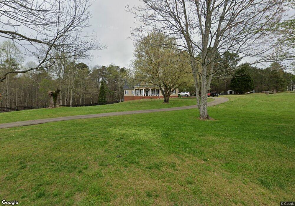
1079 Barron Rd Waleska, GA 30183
Estimated Value: $739,569 - $941,000
4
Beds
5
Baths
3,894
Sq Ft
$209/Sq Ft
Est. Value
About This Home
This home is located at 1079 Barron Rd, Waleska, GA 30183 and is currently estimated at $812,190, approximately $208 per square foot. 1079 Barron Rd is a home located in Cherokee County with nearby schools including R. M. Moore Elementary School, Teasley Middle School, and Cherokee High School.
Ownership History
Date
Name
Owned For
Owner Type
Purchase Details
Closed on
Sep 2, 2009
Sold by
Bourn William M
Bought by
Bourn William M and Bourn Lori L
Current Estimated Value
Home Financials for this Owner
Home Financials are based on the most recent Mortgage that was taken out on this home.
Original Mortgage
$250,100
Interest Rate
5.19%
Mortgage Type
New Conventional
Purchase Details
Closed on
Aug 27, 2009
Sold by
Bourn Lori L
Bought by
Bourn William M
Home Financials for this Owner
Home Financials are based on the most recent Mortgage that was taken out on this home.
Original Mortgage
$250,100
Interest Rate
5.19%
Mortgage Type
New Conventional
Purchase Details
Closed on
Aug 2, 2000
Sold by
Bourn William M
Bought by
Bourn William M and Bourn Lori L
Home Financials for this Owner
Home Financials are based on the most recent Mortgage that was taken out on this home.
Original Mortgage
$165,000
Interest Rate
8.23%
Mortgage Type
New Conventional
Create a Home Valuation Report for This Property
The Home Valuation Report is an in-depth analysis detailing your home's value as well as a comparison with similar homes in the area
Home Values in the Area
Average Home Value in this Area
Purchase History
| Date | Buyer | Sale Price | Title Company |
|---|---|---|---|
| Bourn William M | -- | -- | |
| Bourn William M | -- | -- | |
| Bourn William M | -- | -- |
Source: Public Records
Mortgage History
| Date | Status | Borrower | Loan Amount |
|---|---|---|---|
| Closed | Bourn William M | $250,100 | |
| Previous Owner | Bourn William M | $165,000 |
Source: Public Records
Tax History Compared to Growth
Tax History
| Year | Tax Paid | Tax Assessment Tax Assessment Total Assessment is a certain percentage of the fair market value that is determined by local assessors to be the total taxable value of land and additions on the property. | Land | Improvement |
|---|---|---|---|---|
| 2024 | $1,933 | $234,320 | $17,080 | $217,240 |
| 2023 | $1,570 | $232,440 | $12,040 | $220,400 |
| 2022 | $4,235 | $171,960 | $11,560 | $160,400 |
| 2021 | $3,896 | $142,360 | $10,040 | $132,320 |
| 2020 | $3,521 | $126,120 | $10,040 | $116,080 |
| 2019 | $3,464 | $124,120 | $10,040 | $114,080 |
| 2018 | $3,321 | $118,440 | $10,040 | $108,400 |
| 2017 | $3,526 | $311,600 | $14,720 | $109,920 |
| 2016 | $2,868 | $252,100 | $13,400 | $87,440 |
| 2015 | $2,934 | $255,200 | $13,400 | $88,680 |
| 2014 | $2,872 | $249,500 | $13,400 | $86,400 |
Source: Public Records
Map
Nearby Homes
- 3826 Salacoa Rd Unit TRACT C
- 3834 Salacoa Rd Unit TRACT B
- 3842 Salacoa Rd Unit TRACT A
- 3834 Salacoa-Tract B
- 3842 Salacoa-Tract A
- 905 Hancock Mountain Trail
- 7.65 Trail
- 0 Moores Gin Rd Unit 9693 10325272
- 2-Acre Garland Mountain Trail
- 4-Acre Garland Mountain Trail
- 744 Moores Gin Rd
- 487 Angel Rd
- 395 Able Rd
- 9351 Henderson Mountain Rd
- 126 Bagwell Trail
- 11953 Henderson Mountain Rd
- 0 Young Loop Unit 7206
- 1141 Addington Ln
- 386 Barron Rd
- 130 Cowart Mountain Trail
- 328 Barron Rd
- 5 Cowart Mountain Trail
- 0 Cowart Mountain Trail Unit 8240193
- 0- Cowart Mountain Trail
- 0 Cowart Mountain Trail Unit TRCT 1 7210109
- 0 Cowart Mountain Trail Unit TRCT 1 7350558
- 0 Cowart Mountain Trail
- 0 Cowart Mountain Trail Unit 7552043
- 0 Cowart Mountain Trail Unit 7440420
- 0 Cowart Mountain Trail Unit 7478855
- 0 Cowart Mountain Trail Unit 7124742
- 0 Cowart Mountain Trail Unit 7032919
- 0 Cowart Mountain Trail Unit 3076260
- 0 Cowart Mountain Trail Unit 7207956
- 0 Cowart Mountain Trail Unit 7162297
- 0 Cowart Mountain Trail Unit 9068412
- 0 Cowart Mountain Trail Unit 8180292
- 0 Cowart Mountain Trail Unit 8371312