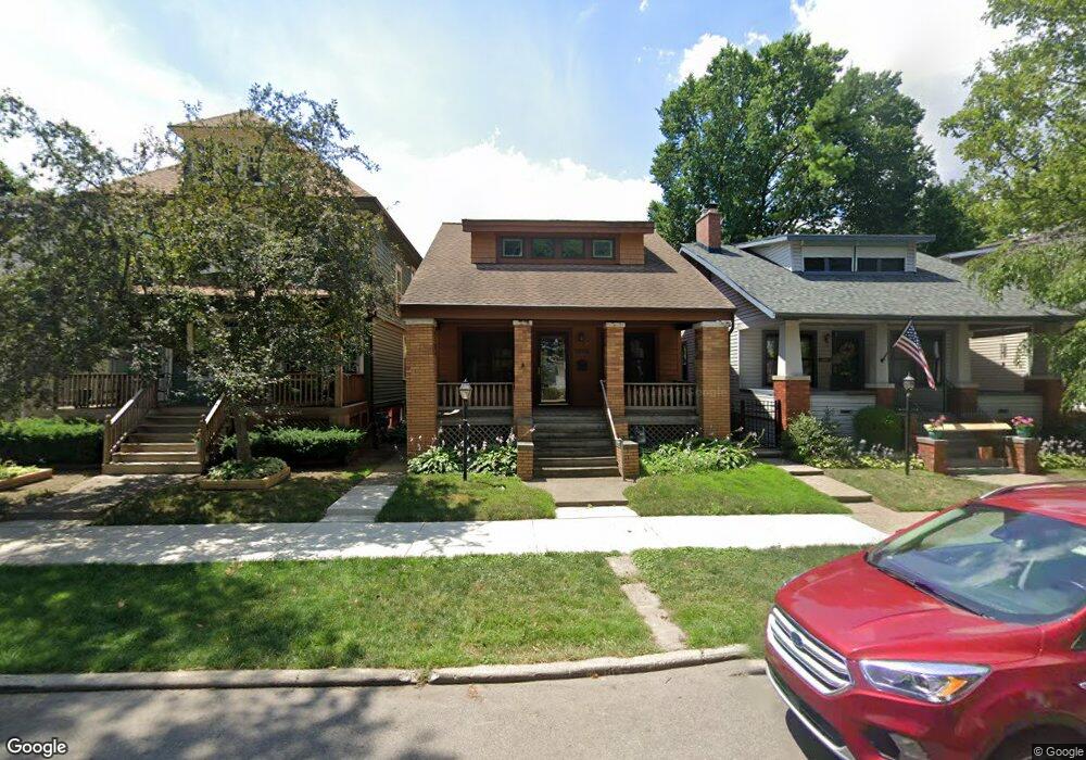
1079 Lakepointe St Grosse Pointe Park, MI 48230
Estimated Value: $267,000 - $368,000
--
Bed
--
Bath
1,632
Sq Ft
$203/Sq Ft
Est. Value
About This Home
This home is located at 1079 Lakepointe St, Grosse Pointe Park, MI 48230 and is currently estimated at $332,033, approximately $203 per square foot. 1079 Lakepointe St is a home located in Wayne County with nearby schools including George Defer Elementary School, Pierce Middle School, and Grosse Pointe South High School.
Ownership History
Date
Name
Owned For
Owner Type
Purchase Details
Closed on
Jul 23, 2004
Sold by
Federal Home Loan Mortgage Corporation
Bought by
Abn Amro Mortgage Group Inc
Current Estimated Value
Purchase Details
Closed on
Sep 22, 2003
Sold by
Abn Amro Mortgage Group Inc
Bought by
Federal Home Loan Mortgage Corporation
Purchase Details
Closed on
May 7, 2003
Sold by
Ditta Gary and Ditta Jean
Bought by
Abn Amro Mortgage Group Inc
Create a Home Valuation Report for This Property
The Home Valuation Report is an in-depth analysis detailing your home's value as well as a comparison with similar homes in the area
Home Values in the Area
Average Home Value in this Area
Purchase History
| Date | Buyer | Sale Price | Title Company |
|---|---|---|---|
| Abn Amro Mortgage Group Inc | -- | Metropolitan | |
| Federal Home Loan Mortgage Corporation | -- | -- | |
| Abn Amro Mortgage Group Inc | $137,433 | -- |
Source: Public Records
Tax History Compared to Growth
Tax History
| Year | Tax Paid | Tax Assessment Tax Assessment Total Assessment is a certain percentage of the fair market value that is determined by local assessors to be the total taxable value of land and additions on the property. | Land | Improvement |
|---|---|---|---|---|
| 2025 | $1,818 | $151,400 | $0 | $0 |
| 2024 | $1,818 | $137,600 | $0 | $0 |
| 2023 | $1,736 | $125,400 | $0 | $0 |
| 2022 | $1,649 | $117,700 | $0 | $0 |
| 2021 | $4,231 | $104,100 | $0 | $0 |
| 2019 | $4,133 | $81,300 | $0 | $0 |
| 2018 | $1,572 | $68,600 | $0 | $0 |
| 2017 | $5,170 | $47,800 | $0 | $0 |
| 2016 | $4,084 | $60,000 | $0 | $0 |
| 2015 | $5,884 | $59,100 | $0 | $0 |
| 2013 | $5,700 | $59,500 | $0 | $0 |
| 2012 | $1,631 | $61,500 | $12,200 | $49,300 |
Source: Public Records
Map
Nearby Homes
- 1083 Lakepointe St
- 1048 Lakepointe St Unit A
- 1058 Lakepointe St
- 1032 Beaconsfield Ave
- 54 Pointe Park Place Unit 208
- 74 Pointe Park Place Unit 311
- 1308 Ashland St
- 976 Lakepointe St
- 2568 Alter Rd
- 2140 Alter Rd
- 1254 Beaconsfield Ave
- 908 Manistique St
- 1306 Beaconsfield Ave Unit 1308
- 2190 Philip St
- 1328 Lakepointe St
- 14536 E Jefferson Ave
- 877 Manistique St
- 1332 Wayburn St
- 1336 Wayburn St
- 1337 Wayburn St
- 1075 Lakepointe St Unit 1075
- 1077 Lakepointe St
- 1083 Lakepointe St Unit 2
- 1083 Lakepointe St Unit 1
- 1083 Lakepointe St Unit 1 (Lower)
- 1083 Lakepointe St Unit Upper Apartment 2
- 1073 Lakepointe St
- 1087 Lakepointe St Unit 89
- 1085 Lakepointe St
- 1069 Lakepointe St
- 1091 Lakepointe St
- 1067 Lakepointe St
- 1065 Lakepointe St
- 1058 Maryland St
- 1096 Lakepointe St
- 1018 Lakepointe St
- 1006 Lakepointe St
- 1006 Lakepointe St Unit Lower
- 1054 Maryland St Unit 1056
- 1040 Maryland St