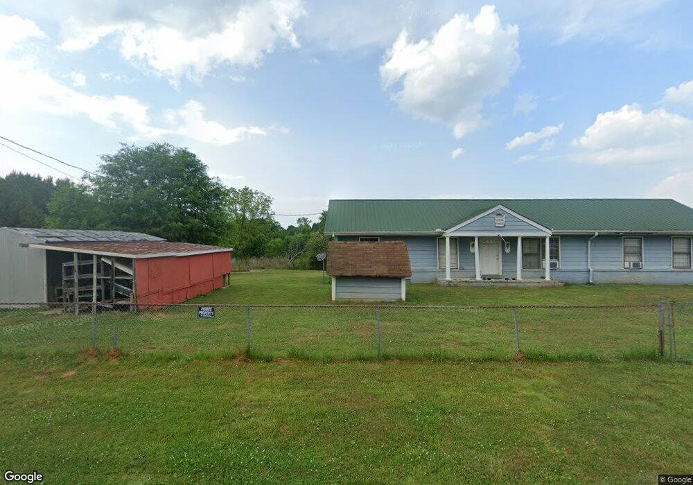
1079 Snip Dillard Rd Monroe, GA 30656
Estimated Value: $303,000 - $490,000
--
Bed
--
Bath
1,632
Sq Ft
$236/Sq Ft
Est. Value
About This Home
This home is located at 1079 Snip Dillard Rd, Monroe, GA 30656 and is currently estimated at $384,352, approximately $235 per square foot. 1079 Snip Dillard Rd is a home located in Walton County with nearby schools including Monroe Elementary School, Carver Middle School, and Monroe Area High School.
Ownership History
Date
Name
Owned For
Owner Type
Purchase Details
Closed on
Apr 24, 2006
Sold by
Deutsche Bk Natl Trust Co
Bought by
Brown Daniel C
Current Estimated Value
Purchase Details
Closed on
Jan 3, 2006
Sold by
Nasworthy Leroy
Bought by
Deutsche Bk Natl Co
Purchase Details
Closed on
Mar 13, 1990
Bought by
Nasworthy Leroy
Create a Home Valuation Report for This Property
The Home Valuation Report is an in-depth analysis detailing your home's value as well as a comparison with similar homes in the area
Home Values in the Area
Average Home Value in this Area
Purchase History
| Date | Buyer | Sale Price | Title Company |
|---|---|---|---|
| Brown Daniel C | $125,000 | -- | |
| Deutsche Bk Natl Co | $141,300 | -- | |
| Nasworthy Leroy | $60,000 | -- |
Source: Public Records
Tax History Compared to Growth
Tax History
| Year | Tax Paid | Tax Assessment Tax Assessment Total Assessment is a certain percentage of the fair market value that is determined by local assessors to be the total taxable value of land and additions on the property. | Land | Improvement |
|---|---|---|---|---|
| 2024 | $2,692 | $91,308 | $54,160 | $37,148 |
| 2023 | $2,645 | $87,188 | $51,360 | $35,828 |
| 2022 | $2,490 | $78,748 | $46,400 | $32,348 |
| 2021 | $2,040 | $62,628 | $36,120 | $26,508 |
| 2020 | $1,908 | $57,108 | $31,280 | $25,828 |
| 2019 | $1,783 | $53,028 | $27,800 | $25,228 |
| 2018 | $1,773 | $53,028 | $27,800 | $25,228 |
| 2017 | $1,804 | $52,348 | $27,800 | $24,548 |
| 2016 | $1,457 | $42,908 | $20,880 | $22,028 |
| 2015 | $1,434 | $41,548 | $20,520 | $21,028 |
| 2014 | $1,323 | $37,392 | $18,640 | $18,752 |
Source: Public Records
Map
Nearby Homes
- 1580 Lakeland Dr
- 935 Snip Dillard Rd
- 2028 Seclusion Trail
- 2033 Seclusion Trail
- 782 Michael Rd
- 1370 Michael Rd
- 3279 Tommy Dillard Rd
- 0 Treadwell Bridge Rd Unit 1025276
- 0 Treadwell Bridge Rd Unit 1025846
- 0 Treadwell Bridge Rd Unit 10525898
- 1299 McLeod Estates Dr
- 1412 Palmer Dr
- 0 Cooper Gin Rd Unit 1025274
- 0 Cooper Gin Rd Unit 10505587
- 1650 Locklin Cemetery Rd
- 1650 & 1620 Locklin Cemetery Rd
- 1186 Emmas Path
- 1811 Michael Rd
- 0 Monroe Hwy Unit 1025333
- 0 Hebron Church Rd Unit 25176734
- 1165 Bradley Gin Rd NW
- 1185 Bradley Gin Rd
- 1058 Snip Dillard Rd NW
- 1160 Bradley Gin Rd
- 1049 Snip Dillard Rd
- 1195 Bradley Gin Rd
- 1029 Snip Dillard Rd
- 1009 Snip Dillard Rd
- 1180 Bradley Gin Rd
- 1205 Bradley Gin Rd NW
- 1205 Bradley Gin Rd NW
- 1205 Bradley Gin Rd NW Unit 17
- 1069 Snip Dillard Rd
- 0 Snip Dillard Rd NW Unit 7289632
- 0 Snip Dillard Rd NW Unit 7155535
- 0 Snip Dillard Rd NW Unit 7354382
- 0 Snip Dillard Rd NW Unit 8337130
- 0 Snip Dillard Rd NW Unit 8894854
- 0 Snip Dillard Rd NW Unit 7457863
- 0 Snip Dillard Rd NW Unit 7516284