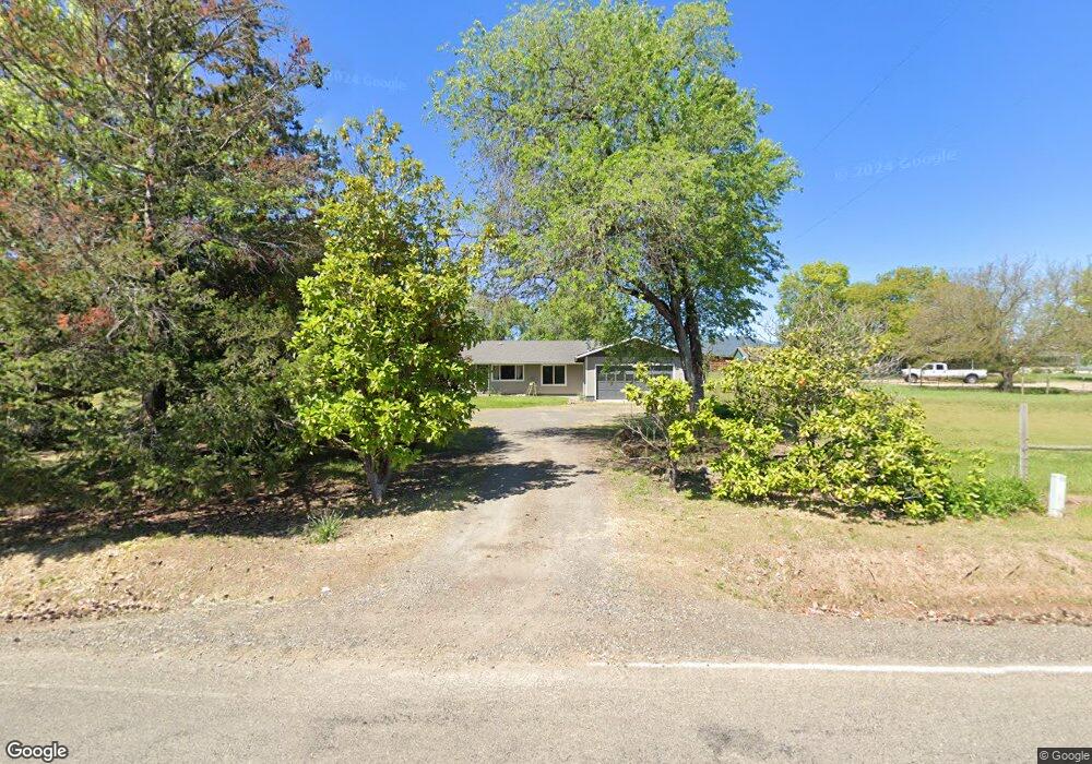
10795 Wheeler Rd Central Point, OR 97502
Estimated Value: $513,622 - $678,000
3
Beds
2
Baths
2,472
Sq Ft
$238/Sq Ft
Est. Value
About This Home
This home is located at 10795 Wheeler Rd, Central Point, OR 97502 and is currently estimated at $588,541, approximately $238 per square foot. 10795 Wheeler Rd is a home located in Jackson County with nearby schools including Sams Valley Elementary School, Hanby Middle School, and Crater High School.
Ownership History
Date
Name
Owned For
Owner Type
Purchase Details
Closed on
May 6, 2021
Sold by
Quilliams James C and Quilliams Ruth J
Bought by
Terpening Clayton and Terpening Mollie
Current Estimated Value
Home Financials for this Owner
Home Financials are based on the most recent Mortgage that was taken out on this home.
Original Mortgage
$382,800
Outstanding Balance
$343,947
Interest Rate
3.1%
Mortgage Type
New Conventional
Estimated Equity
$244,594
Create a Home Valuation Report for This Property
The Home Valuation Report is an in-depth analysis detailing your home's value as well as a comparison with similar homes in the area
Purchase History
| Date | Buyer | Sale Price | Title Company |
|---|---|---|---|
| Terpening Clayton | $478,500 | First American |
Source: Public Records
Mortgage History
| Date | Status | Borrower | Loan Amount |
|---|---|---|---|
| Open | Terpening Clayton | $382,800 |
Source: Public Records
Tax History
| Year | Tax Paid | Tax Assessment Tax Assessment Total Assessment is a certain percentage of the fair market value that is determined by local assessors to be the total taxable value of land and additions on the property. | Land | Improvement |
|---|---|---|---|---|
| 2026 | $3,619 | $266,170 | $153,340 | $112,830 |
| 2025 | $3,527 | $288,660 | $90,430 | $198,230 |
| 2024 | $3,527 | $280,260 | $87,790 | $192,470 |
| 2023 | $3,411 | $272,100 | $85,240 | $186,860 |
| 2022 | $3,274 | $272,100 | $85,240 | $186,860 |
| 2021 | $3,182 | $264,180 | $82,760 | $181,420 |
| 2020 | $3,089 | $256,490 | $80,350 | $176,140 |
| 2019 | $3,018 | $241,770 | $75,730 | $166,040 |
| 2018 | $2,924 | $234,730 | $73,520 | $161,210 |
| 2017 | $2,855 | $234,730 | $73,520 | $161,210 |
| 2016 | $2,772 | $221,270 | $69,300 | $151,970 |
| 2015 | $2,670 | $221,270 | $69,300 | $151,970 |
| 2014 | $2,575 | $208,580 | $65,320 | $143,260 |
Source: Public Records
Map
Nearby Homes
- 10695 Kildee Ave
- 10695 Killdee Ave
- 11220 Duggan Rd
- 11615 Michael Rd
- 13290 Table Rock Rd
- 395 Robleda Dr
- 0 Duggan Rd Unit 220198974
- 13007 Perry Rd
- 377 Pelton Ln
- 180 Glass Ln
- 4223 Merita Terrace
- 12214 Modoc Rd
- 4413 Merita Terrace
- 12240 Modoc Rd Unit A
- 12240 Modoc Rd Unit B
- 12240 Modoc Rd Unit C
- 700 Rogue Wood Dr
- 7505 Blackwell Rd
- 12940 Highway 234
- 10950 Ramsey Rd
- 10853 Wheeler Rd
- 10824 Kildee Ave
- 10739 Wheeler Rd
- 10796 Kildee Ave
- 10909 Wheeler Rd
- 0 Kildee Ave
- 10838 Kildee Ave
- 10683 Wheeler Rd
- 10931 Wheeler Rd
- 10684 Kildee Ave
- 10852 Kildee Ave
- 3000 Tresham Ln
- 10707 Kildee Ave
- 10626 Wheeler Rd
- 10625 Wheeler Rd
- 3251 Tresham Ln
- 10575 Wheeler Rd
- 2801 Tresham Ln
- 3040 Tresham Ln
- 3301 Tresham Ln
Your Personal Tour Guide
Ask me questions while you tour the home.