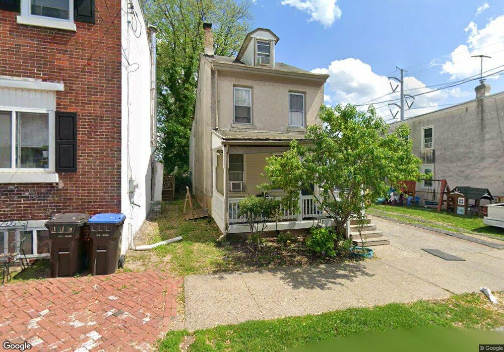
108 Chain St Norristown, PA 19401
Estimated Value: $144,000 - $228,000
4
Beds
1
Bath
1,664
Sq Ft
$120/Sq Ft
Est. Value
About This Home
This home is located at 108 Chain St, Norristown, PA 19401 and is currently estimated at $200,430, approximately $120 per square foot. 108 Chain St is a home located in Montgomery County with nearby schools including Davenport Elementary School, Charles Blockson Middle School, and East Norriton Middle School.
Ownership History
Date
Name
Owned For
Owner Type
Purchase Details
Closed on
Apr 20, 2007
Sold by
Maresca Michael J and Joseph Galanti A
Bought by
Hampshire Blue Llc
Current Estimated Value
Home Financials for this Owner
Home Financials are based on the most recent Mortgage that was taken out on this home.
Original Mortgage
$100,100
Outstanding Balance
$60,789
Interest Rate
6.23%
Estimated Equity
$139,641
Purchase Details
Closed on
Jun 28, 2005
Sold by
Powers Michael A
Bought by
Maresca Michael J and Joseph Galanti A
Purchase Details
Closed on
Mar 9, 1995
Sold by
Grauten Rita N and Powers Rita N
Bought by
Powers Michael A
Create a Home Valuation Report for This Property
The Home Valuation Report is an in-depth analysis detailing your home's value as well as a comparison with similar homes in the area
Home Values in the Area
Average Home Value in this Area
Purchase History
| Date | Buyer | Sale Price | Title Company |
|---|---|---|---|
| Hampshire Blue Llc | $92,500 | None Available | |
| Maresca Michael J | $50,000 | -- | |
| Powers Michael A | -- | Stewart Title Quantity Co |
Source: Public Records
Mortgage History
| Date | Status | Borrower | Loan Amount |
|---|---|---|---|
| Open | Hampshire Blue Llc | $100,100 |
Source: Public Records
Tax History Compared to Growth
Tax History
| Year | Tax Paid | Tax Assessment Tax Assessment Total Assessment is a certain percentage of the fair market value that is determined by local assessors to be the total taxable value of land and additions on the property. | Land | Improvement |
|---|---|---|---|---|
| 2025 | $3,423 | $55,770 | -- | -- |
| 2024 | $3,423 | $55,770 | -- | -- |
| 2023 | $3,392 | $55,770 | $0 | $0 |
| 2022 | $3,319 | $55,770 | $0 | $0 |
| 2021 | $3,303 | $55,770 | $0 | $0 |
| 2020 | $3,151 | $55,770 | $0 | $0 |
| 2019 | $3,093 | $55,770 | $0 | $0 |
| 2018 | $2,059 | $55,770 | $0 | $0 |
| 2017 | $2,841 | $55,770 | $0 | $0 |
| 2016 | $2,819 | $55,770 | $0 | $0 |
| 2015 | $2,701 | $55,770 | $0 | $0 |
| 2014 | $2,701 | $55,770 | $0 | $0 |
Source: Public Records
Map
Nearby Homes
- 201 Chain St Unit 28
- 208 Stanbridge St Unit 35
- 0 Astor St
- 557 Haws Ave
- 521 Norris St
- 544 Stanbridge St
- 13 Stanbridge St
- 324 Cherry St
- 907 W Airy St
- 558 Stanbridge St
- 530 Norris St
- 534 Norris St
- 637 Kohn St
- 501 Swede St
- 1009 W Main St
- 548 Cherry St
- 905 W Marshall St
- 718 Astor St
- 243 Buttonwood St
- 654 Stanbridge St