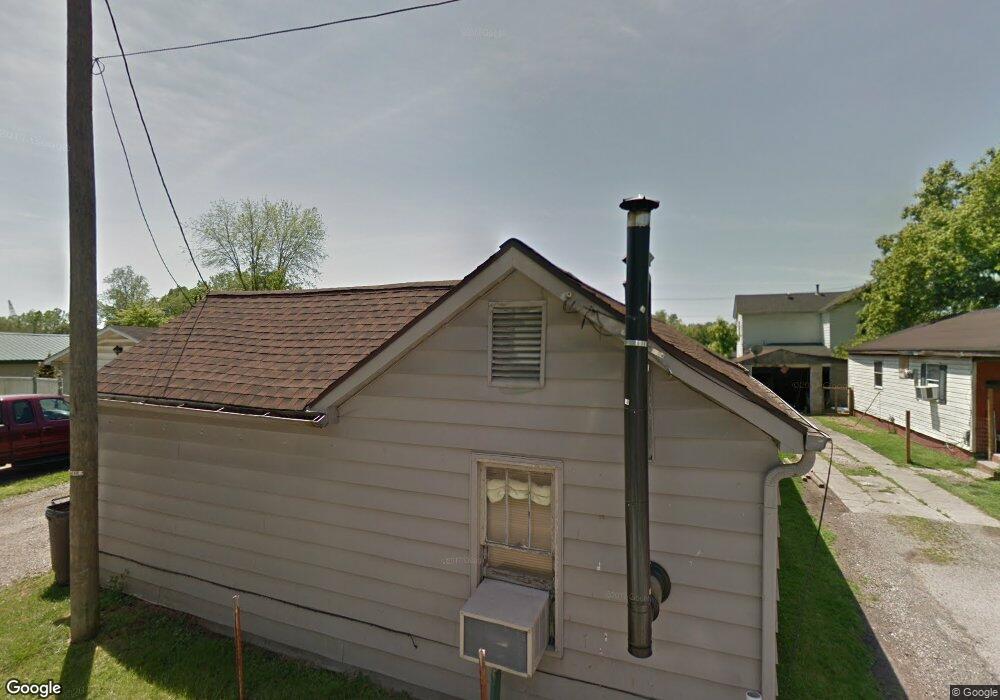
108 Higgins St Coal Grove, OH 45638
Estimated Value: $61,000 - $122,000
2
Beds
1
Bath
931
Sq Ft
$101/Sq Ft
Est. Value
About This Home
This home is located at 108 Higgins St, Coal Grove, OH 45638 and is currently estimated at $93,843, approximately $100 per square foot. 108 Higgins St is a home located in Lawrence County with nearby schools including Dawson-Bryant Elementary School, Dawson-Bryant Middle School, and Dawson-Bryant High School.
Ownership History
Date
Name
Owned For
Owner Type
Purchase Details
Closed on
May 19, 2008
Sold by
Pommell Bart M and Pommell Sherria L
Bought by
Lambert Scott and Lambert Flossie
Current Estimated Value
Purchase Details
Closed on
Sep 18, 1990
Bought by
Pommell Bart M and Pommell Sherri
Purchase Details
Closed on
Aug 9, 1988
Sold by
Vallance Floyd and Vallance Kathryn
Bought by
First Federal Savings And
Create a Home Valuation Report for This Property
The Home Valuation Report is an in-depth analysis detailing your home's value as well as a comparison with similar homes in the area
Home Values in the Area
Average Home Value in this Area
Purchase History
| Date | Buyer | Sale Price | Title Company |
|---|---|---|---|
| Lambert Scott | $30,000 | Attorney | |
| Pommell Bart M | $6,000 | -- | |
| First Federal Savings And | $6,000 | -- |
Source: Public Records
Tax History Compared to Growth
Tax History
| Year | Tax Paid | Tax Assessment Tax Assessment Total Assessment is a certain percentage of the fair market value that is determined by local assessors to be the total taxable value of land and additions on the property. | Land | Improvement |
|---|---|---|---|---|
| 2024 | -- | $11,740 | $2,880 | $8,860 |
| 2023 | $177 | $11,740 | $2,880 | $8,860 |
| 2022 | $459 | $11,740 | $2,880 | $8,860 |
| 2021 | $351 | $11,520 | $2,670 | $8,850 |
| 2020 | $452 | $11,520 | $2,670 | $8,850 |
| 2019 | $450 | $11,520 | $2,670 | $8,850 |
| 2018 | $455 | $11,520 | $2,670 | $8,850 |
| 2017 | $454 | $11,520 | $2,670 | $8,850 |
| 2016 | $426 | $11,520 | $2,670 | $8,850 |
| 2015 | $375 | $9,030 | $2,670 | $6,360 |
| 2014 | $353 | $9,030 | $2,670 | $6,360 |
| 2013 | $353 | $9,030 | $2,670 | $6,360 |
Source: Public Records
Map
Nearby Homes
- 805 1/2 High St
- 514 Lane St
- 519 Lane St
- 125 Center St
- 204 Dutey Dr
- 135 Lane St
- 119 Remy St
- 309 High St
- 309 High St Unit LAO-5
- 0 Central & Mlk
- 103 Carrico Dr
- 3107 S 4th St
- 0 Kentucky 5
- 430 Pierce St
- 342 Township Road 296
- 1824 Carter Ave
- 0 18th Street & Central Ave
- 317 Ashtabula St
- 601 Pollard Rd
- 0 Pollard Rd