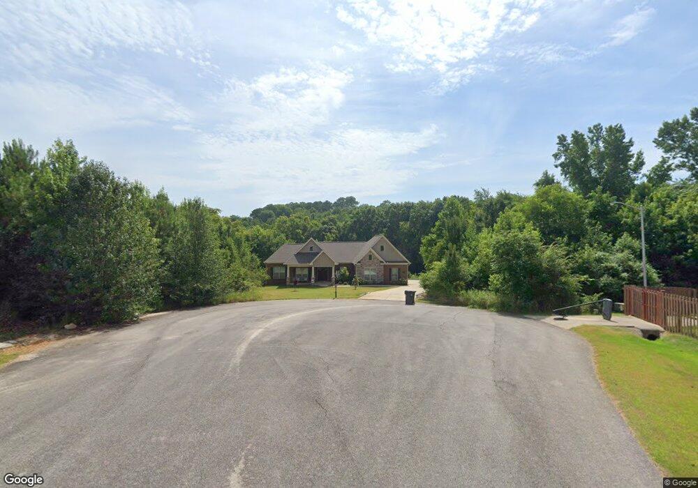
108 Hill Grass Cir Huntsville, AL 35811
Ryland NeighborhoodEstimated Value: $442,000 - $537,000
--
Bed
1
Bath
2,860
Sq Ft
$169/Sq Ft
Est. Value
About This Home
This home is located at 108 Hill Grass Cir, Huntsville, AL 35811 and is currently estimated at $484,674, approximately $169 per square foot. 108 Hill Grass Cir is a home located in Madison County with nearby schools including Central School, Madison County High School, and Union Chapel Christian Academy.
Ownership History
Date
Name
Owned For
Owner Type
Purchase Details
Closed on
Nov 7, 2019
Sold by
Wilbourn Ashley Rebecca and Bowers Ashley Wilbourn
Bought by
Bowers Ashley Wilbourn and Bowers Brian
Current Estimated Value
Home Financials for this Owner
Home Financials are based on the most recent Mortgage that was taken out on this home.
Original Mortgage
$372,807
Outstanding Balance
$331,295
Interest Rate
3.75%
Mortgage Type
Construction
Estimated Equity
$153,379
Purchase Details
Closed on
Sep 25, 2015
Sold by
Darwin Michael and Pope Paula
Bought by
Tipton Valerie and Tipton Michael
Purchase Details
Closed on
Feb 1, 2013
Sold by
Sunrise Valley Development Inc
Bought by
Darwin Evelyn
Create a Home Valuation Report for This Property
The Home Valuation Report is an in-depth analysis detailing your home's value as well as a comparison with similar homes in the area
Home Values in the Area
Average Home Value in this Area
Purchase History
| Date | Buyer | Sale Price | Title Company |
|---|---|---|---|
| Bowers Ashley Wilbourn | -- | None Available | |
| Tipton Valerie | $70,000 | None Available | |
| Darwin Evelyn | -- | None Available |
Source: Public Records
Mortgage History
| Date | Status | Borrower | Loan Amount |
|---|---|---|---|
| Open | Bowers Ashley Wilbourn | $372,807 |
Source: Public Records
Tax History Compared to Growth
Tax History
| Year | Tax Paid | Tax Assessment Tax Assessment Total Assessment is a certain percentage of the fair market value that is determined by local assessors to be the total taxable value of land and additions on the property. | Land | Improvement |
|---|---|---|---|---|
| 2024 | $1,610 | $44,420 | $2,000 | $42,420 |
| 2023 | $1,567 | $43,280 | $2,000 | $41,280 |
| 2022 | $1,420 | $39,080 | $2,000 | $37,080 |
| 2021 | $2,550 | $70,180 | $4,000 | $66,180 |
| 2020 | $140 | $4,000 | $4,000 | $0 |
| 2019 | $134 | $4,000 | $4,000 | $0 |
| 2018 | $134 | $4,000 | $0 | $0 |
| 2017 | $134 | $4,000 | $0 | $0 |
| 2016 | $161 | $4,800 | $0 | $0 |
| 2015 | $161 | $4,800 | $0 | $0 |
| 2014 | -- | $4,800 | $0 | $0 |
Source: Public Records
Map
Nearby Homes
- 208 Townsend Dr SE
- 3.8 Acres Townsend Dr SE
- 0 Old Gurley Rd NE Unit 24957018
- 109 Bridgestone Dr NE
- 1612 Calistoga Cir NE
- 1610 Calistoga Cir NE
- 1608 Calistoga Cir NE
- 1604 Calistoga Cir NE
- 1602 Calistoga Cir NE
- 1617 Calistoga Cir NE
- 1613 Calistoga Cir NE
- .73 Acres Highway 72 E
- 137 Bridgestone Dr NE
- 143 Bridgestone Dr NE
- 510 Old Gurley Rd NE
- 2100 Kanteen St NE
- 2102 Kanteen St NE
- 2106 Kanteen St NE
- 2104 Kanteen St NE
- The Rainier Plan at Trailhead - Park Series
- 101 Hill Grass Cir
- 100 Hill Grass Cir
- 106 Brookshire Cir
- 113 Sanders Dr
- 104 Brookshire Cir
- 108 Brookshire Cir
- 111 Sanders Dr
- 121 Sanders Dr
- 0 Sanders Dr Unit 1030604
- 0 Sanders Dr Unit 1032307
- 215 Black Oak Dr NE
- 213 Blackoak Dr NE
- 100 Brookshire Cir
- 123 Sanders Dr
- 116 Sanders Dr
- 196 Townsend Dr SE
- 112 Sanders Dr
- 202 Townsend Dr SE
- 118 Sanders Dr
- 216 Blackoak Dr NE