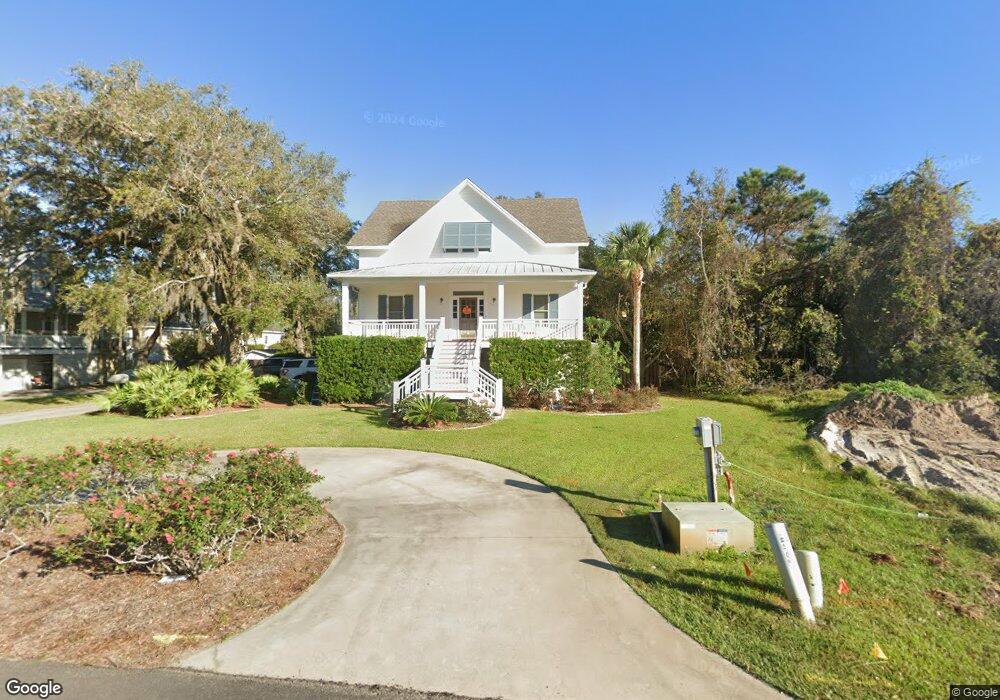
108 Killgriffe Saint Simons Island, GA 31522
Estimated Value: $833,000 - $1,099,000
4
Beds
3
Baths
2,083
Sq Ft
$463/Sq Ft
Est. Value
About This Home
This home is located at 108 Killgriffe, Saint Simons Island, GA 31522 and is currently estimated at $964,709, approximately $463 per square foot. 108 Killgriffe is a home located in Glynn County with nearby schools including St. Simons Elementary School, Glynn Middle School, and Glynn Academy.
Ownership History
Date
Name
Owned For
Owner Type
Purchase Details
Closed on
Mar 6, 2008
Sold by
Butler Margaret M
Bought by
Butler Bradford Mciniis
Current Estimated Value
Purchase Details
Closed on
Mar 21, 2005
Sold by
Daniel Roland L
Bought by
Butler Margaret M
Create a Home Valuation Report for This Property
The Home Valuation Report is an in-depth analysis detailing your home's value as well as a comparison with similar homes in the area
Home Values in the Area
Average Home Value in this Area
Purchase History
| Date | Buyer | Sale Price | Title Company |
|---|---|---|---|
| Butler Bradford Mciniis | $154,000 | -- | |
| Butler Margaret M | $154,000 | -- |
Source: Public Records
Tax History Compared to Growth
Tax History
| Year | Tax Paid | Tax Assessment Tax Assessment Total Assessment is a certain percentage of the fair market value that is determined by local assessors to be the total taxable value of land and additions on the property. | Land | Improvement |
|---|---|---|---|---|
| 2025 | $6,294 | $250,960 | $80,320 | $170,640 |
| 2024 | $6,466 | $257,840 | $80,320 | $177,520 |
| 2023 | $3,509 | $257,840 | $80,320 | $177,520 |
| 2022 | $3,969 | $178,960 | $80,320 | $98,640 |
| 2021 | $4,005 | $155,040 | $59,360 | $95,680 |
| 2020 | $4,126 | $164,600 | $59,360 | $105,240 |
| 2019 | $3,916 | $150,240 | $59,360 | $90,880 |
| 2018 | $3,142 | $150,240 | $59,360 | $90,880 |
| 2017 | $3,142 | $145,480 | $59,360 | $86,120 |
| 2016 | $2,909 | $124,400 | $59,360 | $65,040 |
| 2015 | $2,921 | $124,400 | $59,360 | $65,040 |
| 2014 | $2,921 | $120,600 | $59,360 | $61,240 |
Source: Public Records
Map
Nearby Homes
- 242 Mcintosh Ave
- 121 Killgriffe St
- 211 Mcintosh Ave
- 524 Wesley Oak Cir
- 295 Mcintosh Ave
- 202 Vassar Point Dr
- 516 Postell Dr
- 2404 Frederica Rd
- 104 Youngwood Dr
- 207 Military Rd
- 10 Fern Ln
- 135 Stewart St
- 240 Peachtree St
- 105 Ledbetter Ave
- 239 Broadway St
- 210 Settlers Rd
- 238 Broadway St
- 1704 Frederica Rd Unit 237
- 1704 Frederica Rd Unit 621
- 1704 Frederica Rd Unit 628 + 31 garage
- 116 Killgriffe
- 114 Runnymede Rd
- 250 Mcintosh Ave
- 0 Killgriffe St Unit 653402
- 0 Killgriffe St Unit 8734268
- 0 Killgriffe St
- 107 Killgriffe
- 115 Killgriffe
- 120 Killgriffe
- 126 Runnymede
- 258 Mcintosh Ave
- 131 Runnymede Rd
- 131 Runnymede
- Lot 1 Strother Place
- 11 Strother Place
- 17 Strother Place
- 105 Strother Place
- Lot16 Strother Place
- 19 Strother Place
- 224 Mcintosh Ave