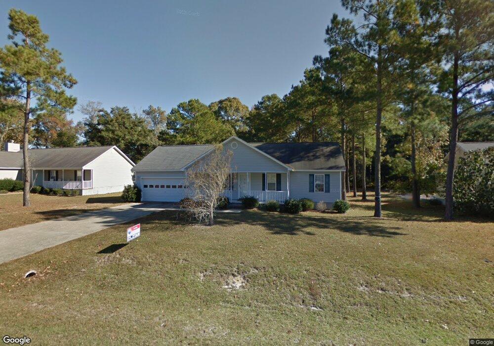
108 Knotts Ct Sneads Ferry, NC 28460
Estimated Value: $274,000 - $276,000
3
Beds
2
Baths
1,125
Sq Ft
$244/Sq Ft
Est. Value
About This Home
This home is located at 108 Knotts Ct, Sneads Ferry, NC 28460 and is currently estimated at $274,947, approximately $244 per square foot. 108 Knotts Ct is a home located in Onslow County with nearby schools including Dixon Elementary School and Dixon High School.
Ownership History
Date
Name
Owned For
Owner Type
Purchase Details
Closed on
Apr 23, 2013
Sold by
Gregson Raymond T
Bought by
Secretary Of Veterans Affairs
Current Estimated Value
Purchase Details
Closed on
Jan 8, 2013
Sold by
The Secretary Of Veterans Affairs
Bought by
Zelensky Stanley John and Zelensky Peggy Lee
Home Financials for this Owner
Home Financials are based on the most recent Mortgage that was taken out on this home.
Original Mortgage
$101,492
Interest Rate
4.56%
Mortgage Type
VA
Purchase Details
Closed on
Jan 23, 2006
Sold by
Atlantic Construction Inc
Bought by
Gregson Raymond T
Home Financials for this Owner
Home Financials are based on the most recent Mortgage that was taken out on this home.
Original Mortgage
$131,671
Interest Rate
6.14%
Mortgage Type
VA
Create a Home Valuation Report for This Property
The Home Valuation Report is an in-depth analysis detailing your home's value as well as a comparison with similar homes in the area
Home Values in the Area
Average Home Value in this Area
Purchase History
| Date | Buyer | Sale Price | Title Company |
|---|---|---|---|
| Secretary Of Veterans Affairs | $123,382 | None Available | |
| Zelensky Stanley John | $98,250 | None Available | |
| Gregson Raymond T | $129,000 | None Available |
Source: Public Records
Mortgage History
| Date | Status | Borrower | Loan Amount |
|---|---|---|---|
| Previous Owner | Zelensky Stanley John | $101,492 | |
| Previous Owner | Gregson Raymond T | $131,671 |
Source: Public Records
Tax History Compared to Growth
Tax History
| Year | Tax Paid | Tax Assessment Tax Assessment Total Assessment is a certain percentage of the fair market value that is determined by local assessors to be the total taxable value of land and additions on the property. | Land | Improvement |
|---|---|---|---|---|
| 2025 | $1,318 | $201,154 | $45,000 | $156,154 |
| 2024 | $1,318 | $201,154 | $45,000 | $156,154 |
| 2023 | $1,318 | $201,154 | $45,000 | $156,154 |
| 2022 | $1,318 | $201,154 | $45,000 | $156,154 |
| 2021 | $949 | $134,570 | $40,000 | $94,570 |
| 2020 | $949 | $134,570 | $40,000 | $94,570 |
| 2019 | $949 | $134,570 | $40,000 | $94,570 |
| 2018 | $949 | $134,570 | $40,000 | $94,570 |
| 2017 | $865 | $128,140 | $30,000 | $98,140 |
| 2016 | $865 | $128,140 | $0 | $0 |
| 2015 | $865 | $128,140 | $0 | $0 |
| 2014 | $865 | $128,140 | $0 | $0 |
Source: Public Records
Map
Nearby Homes
- 159 Tillett Ln
- 141 Lawndale Ln
- 153 Lawndale Ln
- 119 Lawndale Ln
- 535 Moore Landing Rd
- 104 Justice Farm Dr
- 102 Justice Farm Dr
- 208 Fulcher Landing Rd
- 116 Vernelle Ct
- 657 Canady Rd
- 179 Hall Point Rd
- 139 Hall Point
- 232 Fulcher Landing Rd
- 226 Fulcher Landing Rd
- 228 Fulcher Landing Rd
- 250 Riverside Dr
- 112 Midland Ln
- 211 Riverside Dr
- 221 Riverside Dr
- 412 Crows Nest Ln