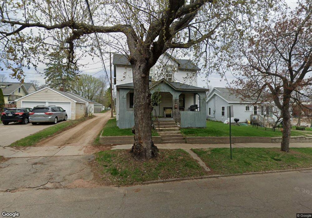
108 Maple St Wausau, WI 54401
Westies NeighborhoodEstimated Value: $104,000 - $130,525
4
Beds
2
Baths
1,448
Sq Ft
$81/Sq Ft
Est. Value
About This Home
This home is located at 108 Maple St, Wausau, WI 54401 and is currently estimated at $117,131, approximately $80 per square foot. 108 Maple St is a home located in Marathon County with nearby schools including Grant Elementary School, John Muir Middle School, and West High School.
Ownership History
Date
Name
Owned For
Owner Type
Purchase Details
Closed on
Apr 29, 2016
Sold by
Vision Real Estate Inc
Bought by
Rodman David S
Current Estimated Value
Home Financials for this Owner
Home Financials are based on the most recent Mortgage that was taken out on this home.
Original Mortgage
$25,000
Outstanding Balance
$19,665
Interest Rate
3.71%
Mortgage Type
New Conventional
Estimated Equity
$97,466
Purchase Details
Closed on
Oct 28, 2015
Sold by
Fochs Debra J
Bought by
Vision Real Estate Inc
Create a Home Valuation Report for This Property
The Home Valuation Report is an in-depth analysis detailing your home's value as well as a comparison with similar homes in the area
Home Values in the Area
Average Home Value in this Area
Purchase History
| Date | Buyer | Sale Price | Title Company |
|---|---|---|---|
| Rodman David S | $45,000 | Attorney | |
| Vision Real Estate Inc | $95,000 | Attorney |
Source: Public Records
Mortgage History
| Date | Status | Borrower | Loan Amount |
|---|---|---|---|
| Open | Rodman David S | $25,000 |
Source: Public Records
Tax History
| Year | Tax Paid | Tax Assessment Tax Assessment Total Assessment is a certain percentage of the fair market value that is determined by local assessors to be the total taxable value of land and additions on the property. | Land | Improvement |
|---|---|---|---|---|
| 2025 | $2,009 | $77,200 | $6,600 | $70,600 |
| 2024 | $1,994 | $77,200 | $6,600 | $70,600 |
| 2023 | $1,882 | $58,500 | $6,400 | $52,100 |
| 2022 | $1,848 | $58,500 | $6,400 | $52,100 |
| 2021 | $1,847 | $58,500 | $6,400 | $52,100 |
| 2020 | $1,832 | $58,500 | $6,400 | $52,100 |
| 2019 | $1,857 | $52,800 | $4,200 | $48,600 |
| 2018 | $1,326 | $52,800 | $4,200 | $48,600 |
| 2017 | $1,742 | $52,800 | $4,200 | $48,600 |
| 2016 | $1,356 | $52,800 | $4,200 | $48,600 |
| 2015 | $1,276 | $52,800 | $4,200 | $48,600 |
| 2014 | $1,284 | $55,700 | $6,400 | $49,300 |
Source: Public Records
Map
Nearby Homes
- 206 N 2nd Ave
- 309 N 2nd Ave
- 310 S 4th Ave
- 309 S 5th Ave
- 427 N 6th Ave
- 328 N 7th Ave
- 424 N 8th Ave
- 550 S 1st Ave
- 1331 N 2nd St
- 330 N 3rd St Unit 601
- 311 S 10th Ave
- 306 S 11th Ave
- 411 West St
- 640 S 6th Ave
- 613 McIndoe St
- 505 N 6th St Unit 601 McClellan
- 620 Dekalb St Unit 624 Dekalb St (Vacan
- 530 Humboldt Ave
- 618 E Bridge St
- 213 N 17th Ave
- 204 N 1st Ave
- 208 N 1st Ave
- 205 N 2nd Ave
- 207 N 2nd Ave
- 201 N 2nd Ave
- 210 N 1st Ave
- 132 N 1st Ave
- 209 N 2nd Ave
- 130 N 1st Ave Unit 131 River Drive
- 129 N 2nd Ave
- 211 N 2nd Ave
- 216 N 1st Ave
- 126 N 1st Ave
- 215 N 2nd Ave
- 125 N 2nd Ave
- 220 N 1st Ave
- 121 N 2nd Ave
- 219 N 2nd Ave
- 132 N 2nd Ave
- 130 N 2nd Ave
Your Personal Tour Guide
Ask me questions while you tour the home.