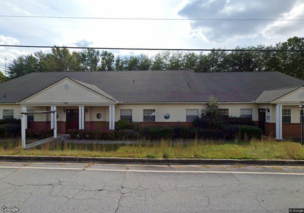
108 Mountain Dr Dahlonega, GA 30533
Estimated Value: $970,112
--
Bed
--
Bath
9,132
Sq Ft
$106/Sq Ft
Est. Value
About This Home
This home is located at 108 Mountain Dr, Dahlonega, GA 30533 and is currently estimated at $970,112, approximately $106 per square foot. 108 Mountain Dr is a home located in Lumpkin County with nearby schools including Lumpkin County High School.
Ownership History
Date
Name
Owned For
Owner Type
Purchase Details
Closed on
Oct 21, 2021
Sold by
Mountain Real Estate Partnership
Bought by
Soo & Min Grp Llc
Current Estimated Value
Home Financials for this Owner
Home Financials are based on the most recent Mortgage that was taken out on this home.
Original Mortgage
$546,000
Interest Rate
2.88%
Mortgage Type
Commercial
Purchase Details
Closed on
Feb 22, 1991
Sold by
St Joseph'S Hospital
Bought by
Mountainside Real Es
Purchase Details
Closed on
Jan 1, 1987
Sold by
St Joseph'S Hospital
Bought by
St Joseph'S Hospital
Purchase Details
Closed on
Oct 1, 1985
Bought by
St Joseph'S Hospital
Create a Home Valuation Report for This Property
The Home Valuation Report is an in-depth analysis detailing your home's value as well as a comparison with similar homes in the area
Home Values in the Area
Average Home Value in this Area
Purchase History
| Date | Buyer | Sale Price | Title Company |
|---|---|---|---|
| Soo & Min Grp Llc | $780,000 | -- | |
| Mountainside Real Es | $60,000 | -- | |
| St Joseph'S Hospital | -- | -- | |
| St Joseph'S Hospital | -- | -- |
Source: Public Records
Mortgage History
| Date | Status | Borrower | Loan Amount |
|---|---|---|---|
| Closed | Soo & Min Grp Llc | $546,000 |
Source: Public Records
Tax History Compared to Growth
Tax History
| Year | Tax Paid | Tax Assessment Tax Assessment Total Assessment is a certain percentage of the fair market value that is determined by local assessors to be the total taxable value of land and additions on the property. | Land | Improvement |
|---|---|---|---|---|
| 2024 | $11,303 | $420,005 | $57,000 | $363,005 |
| 2023 | $12,107 | $420,005 | $57,000 | $363,005 |
| 2022 | $9,487 | $310,546 | $111,000 | $199,546 |
| 2021 | $8,978 | $275,194 | $111,000 | $164,194 |
| 2020 | $9,327 | $275,194 | $111,000 | $164,194 |
| 2017 | $10,185 | $275,194 | $111,000 | $164,194 |
| 2016 | $10,411 | $275,194 | $111,000 | $164,194 |
Source: Public Records
Map
Nearby Homes
- 0 Alicia Ln
- 0 Highway 9 S Unit 7548614
- 0 Highway 9 S Unit 10487179
- 0 Highway 60 Unit 7241582
- 19 Stoneybrook Dr
- 0 Calhoun Rd Unit 10598012
- 0 Calhoun Rd Unit 7643314
- 00 Calhoun Rd
- 0 Deer Run Unit 10437845
- SUDBURY 24' TOWNHOME Plan at Mountain Park
- 332 Stoneybrook Dr
- 98 Riley Rd
- 388 Stoneybrook Dr
- 396 Stoneybrook Dr
- 329 Morrison Moore Pkwy E
- 1392 S Chestatee St
- 6480A Highway 52
- 0 Crown Mountain Unit 10572497
- 0 Placer Mining Rd Unit 7499268
- 0 Crown Mountain Way Unit 7666031
- 70 Ansley Dr
- 70 Mountain Dr
- 52 Mountain Dr
- 81 Crown Mountain Place Unit A
- 81 Crown Mountain Place Unit A300
- 81 Crown Mountain Place Unit E100
- 81 Crown Mountain Place Unit 100 E
- 81 Crown Mountain Place Unit A100
- 81 Crown Mountain Place Unit B400
- 81 Crown Mountain Place Unit C300
- 0 Ansley Dr Unit 8791141
- 0 Ansley Dr
- 0 Tipton Dr
- 59 Tipton Dr
- 20 Mountain Dr
- 20 Mountain Dr
- 134 Ansley Dr
- 111 Tipton Dr
- 0 Crown Mountain Place Unit 10352209
- 0 Crown Mountain Place Unit 7352561