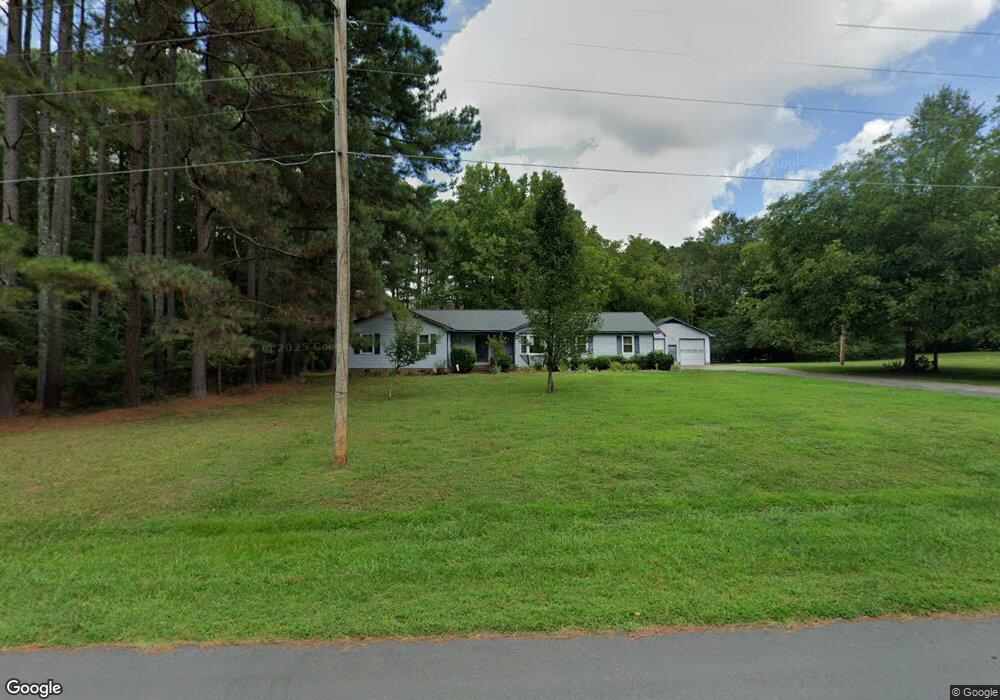
108 Munford Dr Louisburg, NC 27549
Estimated Value: $287,000 - $315,457
3
Beds
2
Baths
1,990
Sq Ft
$152/Sq Ft
Est. Value
About This Home
This home is located at 108 Munford Dr, Louisburg, NC 27549 and is currently estimated at $302,114, approximately $151 per square foot. 108 Munford Dr is a home located in Franklin County with nearby schools including Louisburg Elementary School, Terrell Lane Middle School, and Louisburg High School.
Ownership History
Date
Name
Owned For
Owner Type
Purchase Details
Closed on
Jun 6, 2006
Sold by
Wynee Tony Clifton
Bought by
Wynne Tony C and Wynne Terri D
Current Estimated Value
Home Financials for this Owner
Home Financials are based on the most recent Mortgage that was taken out on this home.
Original Mortgage
$132,000
Interest Rate
6.55%
Mortgage Type
New Conventional
Create a Home Valuation Report for This Property
The Home Valuation Report is an in-depth analysis detailing your home's value as well as a comparison with similar homes in the area
Home Values in the Area
Average Home Value in this Area
Purchase History
| Date | Buyer | Sale Price | Title Company |
|---|---|---|---|
| Wynne Tony C | -- | None Available |
Source: Public Records
Mortgage History
| Date | Status | Borrower | Loan Amount |
|---|---|---|---|
| Closed | Wynne Tony C | $132,000 |
Source: Public Records
Tax History Compared to Growth
Tax History
| Year | Tax Paid | Tax Assessment Tax Assessment Total Assessment is a certain percentage of the fair market value that is determined by local assessors to be the total taxable value of land and additions on the property. | Land | Improvement |
|---|---|---|---|---|
| 2025 | $1,657 | $256,840 | $59,670 | $197,170 |
| 2024 | $1,657 | $256,840 | $59,670 | $197,170 |
| 2023 | $1,669 | $176,710 | $28,160 | $148,550 |
| 2022 | $1,659 | $176,710 | $28,160 | $148,550 |
| 2021 | $1,677 | $176,710 | $28,160 | $148,550 |
| 2020 | $1,669 | $176,710 | $28,160 | $148,550 |
| 2019 | $1,655 | $176,710 | $28,160 | $148,550 |
| 2018 | $1,654 | $176,710 | $28,160 | $148,550 |
| 2017 | $1,900 | $186,170 | $25,600 | $160,570 |
| 2016 | $1,622 | $152,320 | $25,600 | $126,720 |
| 2015 | $1,615 | $152,320 | $25,600 | $126,720 |
| 2014 | $1,513 | $152,320 | $25,600 | $126,720 |
Source: Public Records
Map
Nearby Homes
- 101 Briarwood Ct
- 615 Woodland Trail
- 126 Person St
- 0-0 Halifax Rd
- 612 N Main St
- 7.69 Acres N Carolina 561
- 23.20 Acre N Carolina 561
- 10.26 Acre N Carolina 561
- 604 N Main St
- 125 Davis St
- 301 W College St
- 109 Drew St
- 313 W Noble St
- 414 W Noble St
- 321 W Noble St
- 401 N Main St
- 305 N Elm St
- 205 Williamson St
- 101 S Elm St
- 105 S Elm St
- 108 Munford Dr
- Lot Munford Dr
- Lot #20 Munford Dr
- Lot 17 Munford Dr
- 110 Munford Dr
- 953 N Main St
- 111 Munford Dr
- 109 Munford Dr
- 109 Munford Dr Unit 20
- 955 N Main St
- 949 N Main St
- 115 Munford Dr
- 114 Munford Dr
- 1671 Nc 39 Hwy N
- 947 N Main St
- 945 N Main St
- 943 N Main St
- 116 Munford Dr
- 941 N Main St
- 948 N Main St