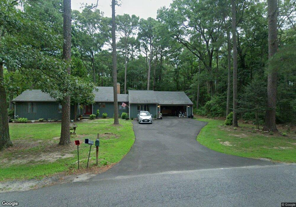
108 Queens Colony High Rd Stevensville, MD 21666
Estimated Value: $511,568 - $594,000
--
Bed
2
Baths
1,760
Sq Ft
$324/Sq Ft
Est. Value
About This Home
This home is located at 108 Queens Colony High Rd, Stevensville, MD 21666 and is currently estimated at $570,392, approximately $324 per square foot. 108 Queens Colony High Rd is a home located in Queen Anne's County with nearby schools including Matapeake Elementary School, Matapeake Middle School, and Kent Island High School.
Ownership History
Date
Name
Owned For
Owner Type
Purchase Details
Closed on
Jan 15, 2002
Sold by
Weinstock Michael S and Weinstock Janis A
Bought by
Riggs William and Kulesza Joann M
Current Estimated Value
Purchase Details
Closed on
Apr 9, 1992
Sold by
Buckingham Rita D
Bought by
Weinstock Michael S and Weinstock Janis A
Create a Home Valuation Report for This Property
The Home Valuation Report is an in-depth analysis detailing your home's value as well as a comparison with similar homes in the area
Home Values in the Area
Average Home Value in this Area
Purchase History
| Date | Buyer | Sale Price | Title Company |
|---|---|---|---|
| Riggs William | $205,000 | -- | |
| Weinstock Michael S | $128,900 | -- |
Source: Public Records
Mortgage History
| Date | Status | Borrower | Loan Amount |
|---|---|---|---|
| Closed | Riggs William | -- |
Source: Public Records
Tax History Compared to Growth
Tax History
| Year | Tax Paid | Tax Assessment Tax Assessment Total Assessment is a certain percentage of the fair market value that is determined by local assessors to be the total taxable value of land and additions on the property. | Land | Improvement |
|---|---|---|---|---|
| 2025 | $3,656 | $393,700 | $0 | $0 |
| 2024 | $3,539 | $372,500 | $0 | $0 |
| 2023 | $3,369 | $351,300 | $191,700 | $159,600 |
| 2022 | $3,369 | $351,300 | $191,700 | $159,600 |
| 2021 | $3,461 | $351,300 | $191,700 | $159,600 |
| 2020 | $3,461 | $354,600 | $191,700 | $162,900 |
| 2019 | $3,320 | $339,933 | $0 | $0 |
| 2018 | $3,180 | $325,267 | $0 | $0 |
| 2017 | $3,039 | $310,600 | $0 | $0 |
| 2016 | -- | $310,600 | $0 | $0 |
| 2015 | $1,326 | $310,600 | $0 | $0 |
| 2014 | $1,326 | $313,200 | $0 | $0 |
Source: Public Records
Map
Nearby Homes
- 114 Queens Colony High Rd
- 303 Queens Colony High Rd
- 0 Reynolds Ave
- 312 Queens Colony High Rd
- 0 Allen Ave
- 511 Chesapeake Ave
- 206 Columbia Ln
- 410 5 Farms Dr
- 227 Queen Anne Club Dr
- 303 Queen Anne Club Dr
- 412 Five Farms Dr
- 312 Columbia Ln
- 116 Mallard Dr
- 122 Mallard Dr
- Lot 7 Maple Rd
- 103 Chesapeake Estates Dr
- 0 Chesapeake Estates Dr
- 101 Oak St
- 321 Oregon Rd
- 122 S Carolina Rd
- 110 Queens Colony High Rd
- 106 Queens Colony High Rd
- 113 Queens Colony High Rd
- 104 Queens Colony High Rd
- 112 Queens Colony High Rd
- 117 Queens Colony High Rd
- 102 Queens Colony High Rd
- 105 Queens Colony High Rd
- 119 Queens Colony High Rd
- 116 Queens Colony High Rd
- 100 Queens Colony High Rd
- 121 Queens Colony High Rd
- 300 Chesapeake Ave
- 123 Queens Colony High Rd
- 120 Queens Colony High Rd
- 302 Chesapeake Ave
- 200 Queens Colony High Rd
- 125 Holly Thicket
- 311 Annette Ave
- 2702 Romancoke Rd