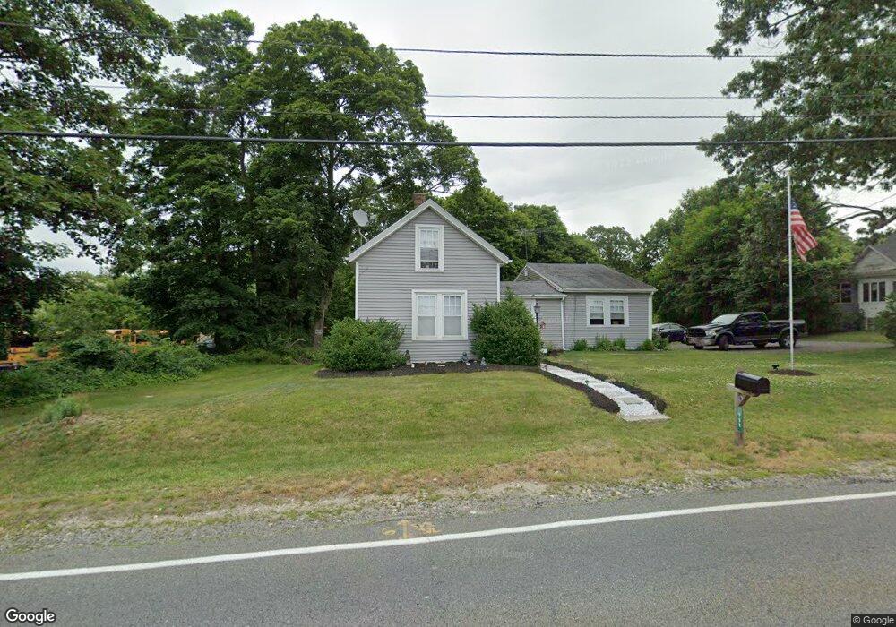
108 Sanford Rd Westport, MA 02790
North Westport NeighborhoodEstimated Value: $431,000 - $542,000
3
Beds
2
Baths
1,763
Sq Ft
$272/Sq Ft
Est. Value
About This Home
This home is located at 108 Sanford Rd, Westport, MA 02790 and is currently estimated at $479,815, approximately $272 per square foot. 108 Sanford Rd is a home located in Bristol County with nearby schools including Alice A. Macomber Primary School, Westport Elementary School, and Westport Middle-High School.
Ownership History
Date
Name
Owned For
Owner Type
Purchase Details
Closed on
Aug 13, 2010
Sold by
Levesque Sandra A Est
Bought by
Levesque Benjamin A and Levesque Alicia M
Current Estimated Value
Home Financials for this Owner
Home Financials are based on the most recent Mortgage that was taken out on this home.
Original Mortgage
$115,445
Outstanding Balance
$76,667
Interest Rate
4.63%
Mortgage Type
Purchase Money Mortgage
Estimated Equity
$403,148
Create a Home Valuation Report for This Property
The Home Valuation Report is an in-depth analysis detailing your home's value as well as a comparison with similar homes in the area
Home Values in the Area
Average Home Value in this Area
Purchase History
| Date | Buyer | Sale Price | Title Company |
|---|---|---|---|
| Levesque Benjamin A | $117,000 | -- |
Source: Public Records
Mortgage History
| Date | Status | Borrower | Loan Amount |
|---|---|---|---|
| Open | Levesque Benjamin A | $50,000 | |
| Open | Levesque Benjamin A | $115,445 | |
| Previous Owner | Levesque Benjamin A | $55,000 |
Source: Public Records
Tax History Compared to Growth
Tax History
| Year | Tax Paid | Tax Assessment Tax Assessment Total Assessment is a certain percentage of the fair market value that is determined by local assessors to be the total taxable value of land and additions on the property. | Land | Improvement |
|---|---|---|---|---|
| 2025 | $2,628 | $352,700 | $173,200 | $179,500 |
| 2024 | $2,307 | $298,500 | $153,800 | $144,700 |
| 2023 | $2,250 | $275,700 | $140,100 | $135,600 |
| 2022 | $2,212 | $260,900 | $140,100 | $120,800 |
| 2021 | $2,039 | $236,600 | $115,800 | $120,800 |
| 2020 | $1,955 | $231,900 | $111,100 | $120,800 |
| 2019 | $1,878 | $227,100 | $111,100 | $116,000 |
| 2018 | $4,914 | $219,700 | $112,200 | $107,500 |
| 2017 | $1,705 | $213,900 | $108,600 | $105,300 |
| 2016 | $1,664 | $210,400 | $105,100 | $105,300 |
| 2015 | $1,461 | $184,300 | $107,400 | $76,900 |
Source: Public Records
Map
Nearby Homes
- 33 William St
- 6 Beaulieu St
- 25 Beaulieu St
- 128 Old Bedford Rd
- 9 Register Ave
- 34 Alsop St
- 92 Benoit St
- 125 Angell St
- 3 Diane Way
- 37 Eaton St
- 219 Earle St Unit 3
- 217 Earle St Unit 2
- 215 Earle St Unit 1
- 1792 Pleasant St Unit 1808
- 85 Reney St
- 172 Earle St
- 100 D Dr
- 89 Lafayette St
- 951 Dickinson St
- 4 Lake Ave
- 112 Sanford Rd
- 109 Sanford Rd
- 103 Sanford Rd
- 82 Sanford Rd
- 115 Sanford Rd
- 97 Sanford Rd
- 11 Christopher Dr
- 124 Sanford Rd
- 175 State Rd
- 8 Christopher Dr
- 14 Christopher Dr
- 123 Sanford Rd
- 128 Sanford Rd
- 17 Christopher Dr
- 129 Sanford Rd
- 16 Christopher Dr
- 15 Christopher Dr
- 136 Sanford Rd
- 994 State
- 227 State Rd