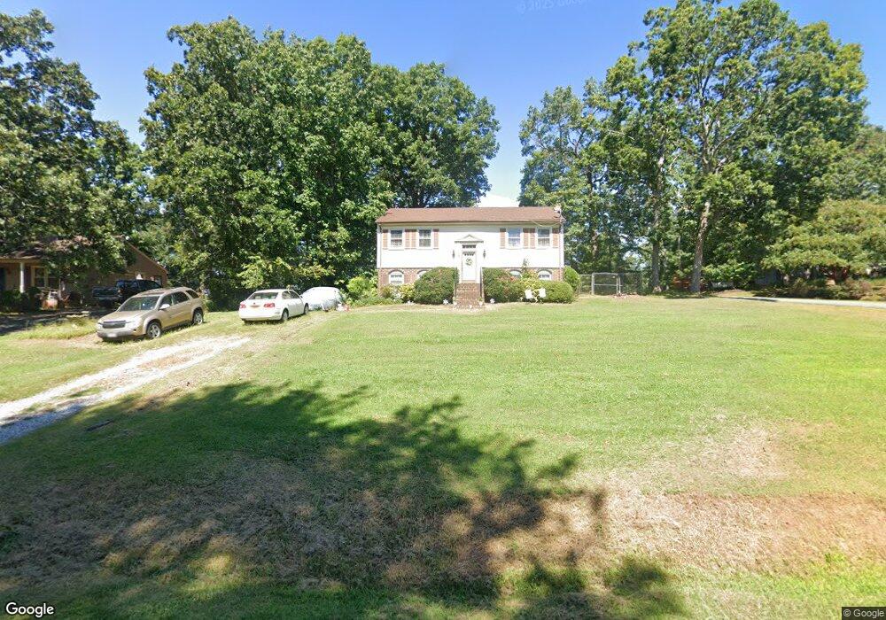
108 Shady Oak Dr Madison Heights, VA 24572
Estimated Value: $237,000 - $326,000
3
Beds
2
Baths
1,872
Sq Ft
$147/Sq Ft
Est. Value
About This Home
This home is located at 108 Shady Oak Dr, Madison Heights, VA 24572 and is currently estimated at $275,613, approximately $147 per square foot. 108 Shady Oak Dr is a home located in Amherst County with nearby schools including Amelon Elementary School, Monelison Middle School, and Amherst County High School.
Ownership History
Date
Name
Owned For
Owner Type
Purchase Details
Closed on
Jan 20, 2017
Sold by
Batman John W and Batman Melissa A
Bought by
Stinnett Tammy R
Current Estimated Value
Home Financials for this Owner
Home Financials are based on the most recent Mortgage that was taken out on this home.
Original Mortgage
$109,600
Outstanding Balance
$90,423
Interest Rate
4.16%
Mortgage Type
New Conventional
Estimated Equity
$185,190
Purchase Details
Closed on
Mar 2, 2006
Sold by
The Oceanus Group Corp
Bought by
Batman John W and Batman Melissa A
Home Financials for this Owner
Home Financials are based on the most recent Mortgage that was taken out on this home.
Original Mortgage
$100,000
Interest Rate
6%
Mortgage Type
New Conventional
Create a Home Valuation Report for This Property
The Home Valuation Report is an in-depth analysis detailing your home's value as well as a comparison with similar homes in the area
Home Values in the Area
Average Home Value in this Area
Purchase History
| Date | Buyer | Sale Price | Title Company |
|---|---|---|---|
| Stinnett Tammy R | $137,000 | Covenant Real Estate Svcs | |
| Batman John W | -- | None Available |
Source: Public Records
Mortgage History
| Date | Status | Borrower | Loan Amount |
|---|---|---|---|
| Open | Stinnett Tammy R | $109,600 | |
| Previous Owner | Batman John W | $100,000 |
Source: Public Records
Tax History Compared to Growth
Tax History
| Year | Tax Paid | Tax Assessment Tax Assessment Total Assessment is a certain percentage of the fair market value that is determined by local assessors to be the total taxable value of land and additions on the property. | Land | Improvement |
|---|---|---|---|---|
| 2025 | $772 | $126,500 | $20,000 | $106,500 |
| 2024 | $772 | $126,500 | $20,000 | $106,500 |
| 2023 | $772 | $126,500 | $20,000 | $106,500 |
| 2022 | $772 | $126,500 | $20,000 | $106,500 |
| 2021 | $772 | $126,500 | $20,000 | $106,500 |
| 2020 | $772 | $126,500 | $20,000 | $106,500 |
| 2019 | $724 | $118,700 | $26,000 | $92,700 |
| 2018 | $724 | $118,700 | $26,000 | $92,700 |
| 2017 | $724 | $118,700 | $26,000 | $92,700 |
| 2016 | $724 | $118,700 | $26,000 | $92,700 |
| 2015 | $619 | $110,600 | $26,000 | $84,600 |
| 2014 | $619 | $110,600 | $26,000 | $84,600 |
Source: Public Records
Map
Nearby Homes
- 151 Stratford Place
- TBD Stratford Place Unit 39
- 289 Todd Ln
- 193 Fernridge Ct
- 156 Bryant Rd
- 0 Monticello Ln
- 0 Lot 10 & 11 Stoney Creek Dr Unit 345183
- 193 Daniels Dr
- 149 Peaceful Ln
- 107 Tyree Ct
- 193 Wright Shop Rd
- 571 Dixie Airport Rd
- 164 Glade Rd
- 4123 S Amherst Hwy
- 140 Garford Rd
- 0 Commonwealth Dr Unit 361760
- 0 Cherry Ln
- 4512 S Amherst Hwy
- 137 Cherry Ln
- 327 Dixie Airport Rd
- 112 Shady Oak Dr
- 254 Woodland Dr
- 120 Shady Oak Dr
- 282 Woodland Dr
- 273 Woodland Dr
- 237 Woodland Dr
- 119 Stratford Place
- 119 Shady Oak Dr
- 128 Shady Oak Dr
- 239 Woodland Dr
- 285 Woodland Dr
- 127 Stratford Place
- 294 Woodland Dr
- 224 Oakland Dr
- 110 Stratford Place
- 136 Shady Oak Dr
- 289 Woodland Dr
- 114 Stratford Place
- 123 Erin Dr
- 143 Shady Oak Dr