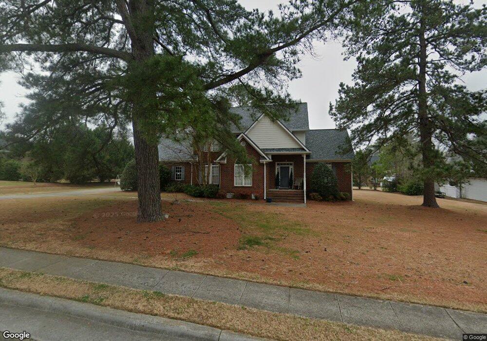
108 Spring Branch Dr Four Oaks, NC 27524
Ingrams NeighborhoodEstimated Value: $481,000 - $517,545
3
Beds
3
Baths
3,263
Sq Ft
$153/Sq Ft
Est. Value
About This Home
This home is located at 108 Spring Branch Dr, Four Oaks, NC 27524 and is currently estimated at $497,886, approximately $152 per square foot. 108 Spring Branch Dr is a home located in Johnston County with nearby schools including Four Oaks Elementary School, Four Oaks Middle School, and South Johnston High School.
Ownership History
Date
Name
Owned For
Owner Type
Purchase Details
Closed on
Nov 6, 2002
Sold by
Holmes Garry R
Bought by
Heritage Homes Of Clayton Inc
Current Estimated Value
Purchase Details
Closed on
Jun 12, 2002
Sold by
Heritage Homes Of Clayton Inc
Bought by
Jelp Development Co Llc
Purchase Details
Closed on
Sep 5, 2001
Sold by
Jelp Development Co Llc
Bought by
B & C Financial Services Inc
Create a Home Valuation Report for This Property
The Home Valuation Report is an in-depth analysis detailing your home's value as well as a comparison with similar homes in the area
Home Values in the Area
Average Home Value in this Area
Purchase History
| Date | Buyer | Sale Price | Title Company |
|---|---|---|---|
| Heritage Homes Of Clayton Inc | $245,000 | -- | |
| Jelp Development Co Llc | -- | -- | |
| B & C Financial Services Inc | -- | -- |
Source: Public Records
Tax History Compared to Growth
Tax History
| Year | Tax Paid | Tax Assessment Tax Assessment Total Assessment is a certain percentage of the fair market value that is determined by local assessors to be the total taxable value of land and additions on the property. | Land | Improvement |
|---|---|---|---|---|
| 2025 | $4,505 | $492,380 | $96,730 | $395,650 |
| 2024 | $3,243 | $273,690 | $60,360 | $213,330 |
| 2023 | $3,188 | $273,690 | $60,360 | $213,330 |
| 2022 | $3,230 | $273,690 | $60,360 | $213,330 |
| 2021 | $3,230 | $273,690 | $60,360 | $213,330 |
| 2020 | $3,315 | $273,690 | $60,360 | $213,330 |
| 2019 | $3,312 | $273,690 | $60,360 | $213,330 |
| 2018 | $3,537 | $287,540 | $60,360 | $227,180 |
| 2017 | $3,450 | $287,540 | $60,360 | $227,180 |
| 2016 | $3,450 | $287,540 | $60,360 | $227,180 |
| 2015 | $3,335 | $287,540 | $60,360 | $227,180 |
| 2014 | $3,335 | $287,540 | $60,360 | $227,180 |
Source: Public Records
Map
Nearby Homes
- 0 Country Club Rd
- Retreat Plan at The View at Holt Lake
- Prelude Plan at The View at Holt Lake
- Wayfare Plan at The View at Holt Lake
- Escape Plan at The View at Holt Lake
- 90 Muscovy Dr
- 4516 Us 301 Hwy
- 2310 Devils Racetrack Rd
- 0 N Brightleaf & Galilee Blvd Unit 10136028
- 207 Heath Rd
- 000 Wildberry Rd
- 5495 U S Highway 301 S
- 5121 U S 701 Hwy
- 5111 U S 701 Hwy
- 178 Ruskin Dr
- 102 Pine Tree Ln
- 233 Meadow Hills Dr
- 106 W Caroline Ave
- 35 Kevior Ave
- 346 New Twin Branch Ct
- 104 Spring Branch Dr
- 118 Spring Branch Dr
- 113 Carroll Dr
- 117 Carroll Dr
- 107 Spring Branch Dr
- 111 Spring Branch Dr
- 109 Carroll Dr
- 103 Spring Branch Dr
- 100 Spring Branch Dr
- --- Carroll Dr
- 123 Carroll Dr
- 115 Spring Branch
- 126 Spring Branch Dr
- 131 Carroll Dr
- 131 Carroll Dr Unit 46
- 101 Spring Branch Dr
- 99 Carroll Dr
- 99 Carroll Dr Unit 44
- 119 Spring Branch Dr
- 0 Spring Branch Dr