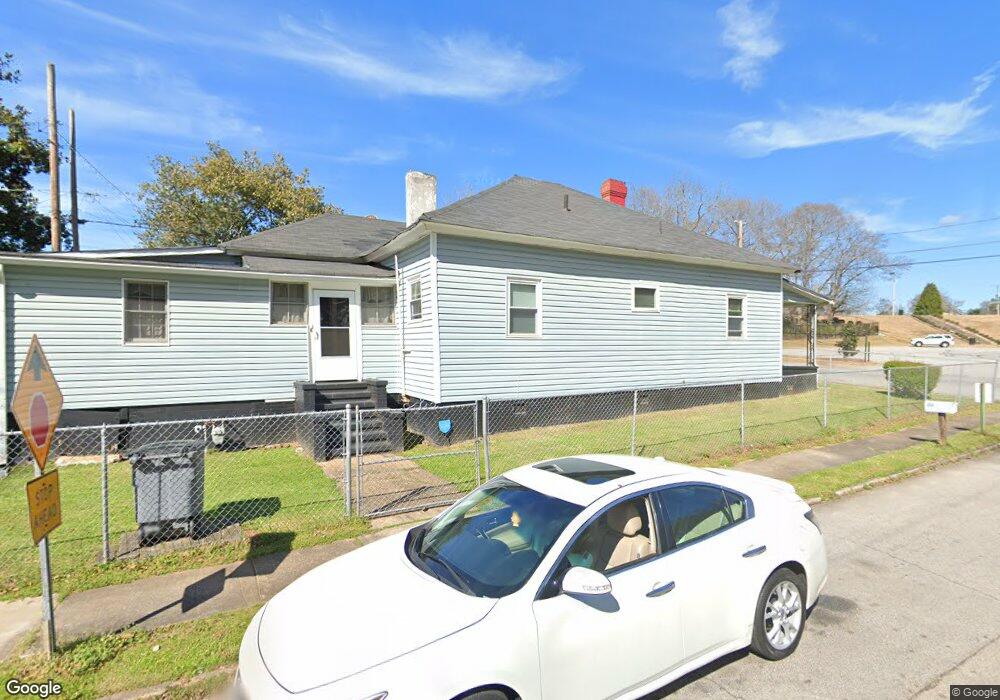
108 Union St Lagrange, GA 30241
Estimated Value: $88,000 - $109,931
3
Beds
1
Bath
1,768
Sq Ft
$57/Sq Ft
Est. Value
About This Home
This home is located at 108 Union St, Lagrange, GA 30241 and is currently estimated at $100,983, approximately $57 per square foot. 108 Union St is a home with nearby schools including Hollis Hand Elementary School, Franklin Forest Elementary School, and Ethel W. Kight Elementary School.
Ownership History
Date
Name
Owned For
Owner Type
Purchase Details
Closed on
Oct 1, 1988
Sold by
Sheri Lynn Knopp
Bought by
Gates Steve E
Current Estimated Value
Purchase Details
Closed on
Jan 1, 1988
Sold by
Hewlett Hawthorne Cooper
Bought by
Sheri Lynn Knopp
Purchase Details
Closed on
Jun 1, 1985
Bought by
Hewlett Hawthorne Cooper
Purchase Details
Closed on
Oct 24, 1974
Sold by
Cooper Joyce Lee
Purchase Details
Closed on
Jan 1, 1967
Sold by
Cooper Ella Mae
Bought by
Cooper Joyce Lee
Create a Home Valuation Report for This Property
The Home Valuation Report is an in-depth analysis detailing your home's value as well as a comparison with similar homes in the area
Purchase History
| Date | Buyer | Sale Price | Title Company |
|---|---|---|---|
| Gates Steve E | $33,500 | -- | |
| Sheri Lynn Knopp | -- | -- | |
| Hewlett Hawthorne Cooper | -- | -- | |
| -- | -- | -- | |
| Cooper Joyce Lee | -- | -- |
Source: Public Records
Tax History
| Year | Tax Paid | Tax Assessment Tax Assessment Total Assessment is a certain percentage of the fair market value that is determined by local assessors to be the total taxable value of land and additions on the property. | Land | Improvement |
|---|---|---|---|---|
| 2025 | $828 | $39,720 | $3,360 | $36,360 |
| 2024 | $752 | $35,400 | $3,360 | $32,040 |
| 2023 | $706 | $25,880 | $3,360 | $22,520 |
| 2022 | $683 | $24,480 | $3,360 | $21,120 |
| 2021 | $712 | $23,600 | $1,720 | $21,880 |
| 2020 | $712 | $23,600 | $1,720 | $21,880 |
| 2019 | $637 | $21,120 | $1,720 | $19,400 |
| 2018 | $637 | $21,120 | $1,720 | $19,400 |
| 2017 | $637 | $21,120 | $1,720 | $19,400 |
| 2016 | $618 | $20,484 | $1,720 | $18,764 |
| 2015 | $619 | $20,484 | $1,720 | $18,764 |
| 2014 | $647 | $21,384 | $1,720 | $19,664 |
| 2013 | -- | $22,947 | $1,720 | $21,227 |
Source: Public Records
Map
Nearby Homes
Your Personal Tour Guide
Ask me questions while you tour the home.