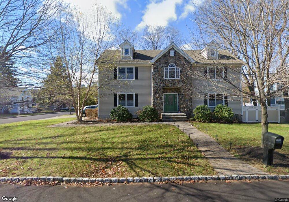
108 William St Morris Plains, NJ 07950
Estimated Value: $897,000 - $1,042,000
4
Beds
4
Baths
2,930
Sq Ft
$338/Sq Ft
Est. Value
About This Home
This home is located at 108 William St, Morris Plains, NJ 07950 and is currently estimated at $989,142, approximately $337 per square foot. 108 William St is a home located in Morris County with nearby schools including Mount Tabor School, Brooklawn Middle School, and Parsippany Hills High School.
Ownership History
Date
Name
Owned For
Owner Type
Purchase Details
Closed on
May 10, 2019
Sold by
Bibin George and Bibin George Asha
Bought by
Chidella Srinivasa Kumar and Chidella Venkata Suneeta Kumari
Current Estimated Value
Home Financials for this Owner
Home Financials are based on the most recent Mortgage that was taken out on this home.
Original Mortgage
$595,199
Outstanding Balance
$522,238
Interest Rate
4.1%
Mortgage Type
New Conventional
Estimated Equity
$466,905
Purchase Details
Closed on
Apr 28, 2010
Sold by
Andican Celal and George Delvin
Bought by
George Bibin and George Asha
Home Financials for this Owner
Home Financials are based on the most recent Mortgage that was taken out on this home.
Original Mortgage
$635,937
Interest Rate
5.5%
Mortgage Type
FHA
Purchase Details
Closed on
Oct 24, 2007
Sold by
Santoro Arlene C and Tarascio Louise D
Bought by
M & P Rescue Realty Llc
Create a Home Valuation Report for This Property
The Home Valuation Report is an in-depth analysis detailing your home's value as well as a comparison with similar homes in the area
Home Values in the Area
Average Home Value in this Area
Purchase History
| Date | Buyer | Sale Price | Title Company |
|---|---|---|---|
| Chidella Srinivasa Kumar | $743,999 | Democracy Title Agency | |
| George Bibin | $675,000 | Fidelity Natl Title Ins Co | |
| M & P Rescue Realty Llc | $290,000 | Commonwealth Land Title Insu |
Source: Public Records
Mortgage History
| Date | Status | Borrower | Loan Amount |
|---|---|---|---|
| Open | Chidella Srinivasa Kumar | $595,199 | |
| Previous Owner | George Bibin | $635,937 |
Source: Public Records
Tax History Compared to Growth
Tax History
| Year | Tax Paid | Tax Assessment Tax Assessment Total Assessment is a certain percentage of the fair market value that is determined by local assessors to be the total taxable value of land and additions on the property. | Land | Improvement |
|---|---|---|---|---|
| 2025 | $17,492 | $503,500 | $166,000 | $337,500 |
| 2024 | $17,159 | $503,500 | $166,000 | $337,500 |
| 2023 | $17,159 | $503,500 | $166,000 | $337,500 |
| 2022 | $15,966 | $503,500 | $166,000 | $337,500 |
| 2021 | $15,966 | $503,500 | $166,000 | $337,500 |
| 2020 | $15,528 | $503,500 | $166,000 | $337,500 |
| 2019 | $15,110 | $503,500 | $166,000 | $337,500 |
| 2018 | $14,682 | $503,500 | $166,000 | $337,500 |
| 2017 | $14,350 | $503,500 | $166,000 | $337,500 |
| 2016 | $14,103 | $503,500 | $166,000 | $337,500 |
| 2015 | $13,746 | $503,500 | $166,000 | $337,500 |
| 2014 | $13,544 | $503,500 | $166,000 | $337,500 |
Source: Public Records
Map
Nearby Homes
- 21 Holly Dr
- 711 Park Rd
- 1 Ironwood Dr
- 20 Whitewood Dr
- 62 Brookstone Cir
- 34 Moraine Rd
- 2350 State Route 10 Unit D11
- 78 North Place
- 35 Ferncliff Rd
- 2 Castaby Way
- 9 Craydon St
- 32 Fletcher Place
- 29 Whitfield Place
- 26 Wesley Place
- 15 Force Place
- 1466 Tabor Rd
- 62 Fernview Rd
- 42 Flintlock Rd
- 2467 Route 10 Unit 20
- 35 Oakdale Rd