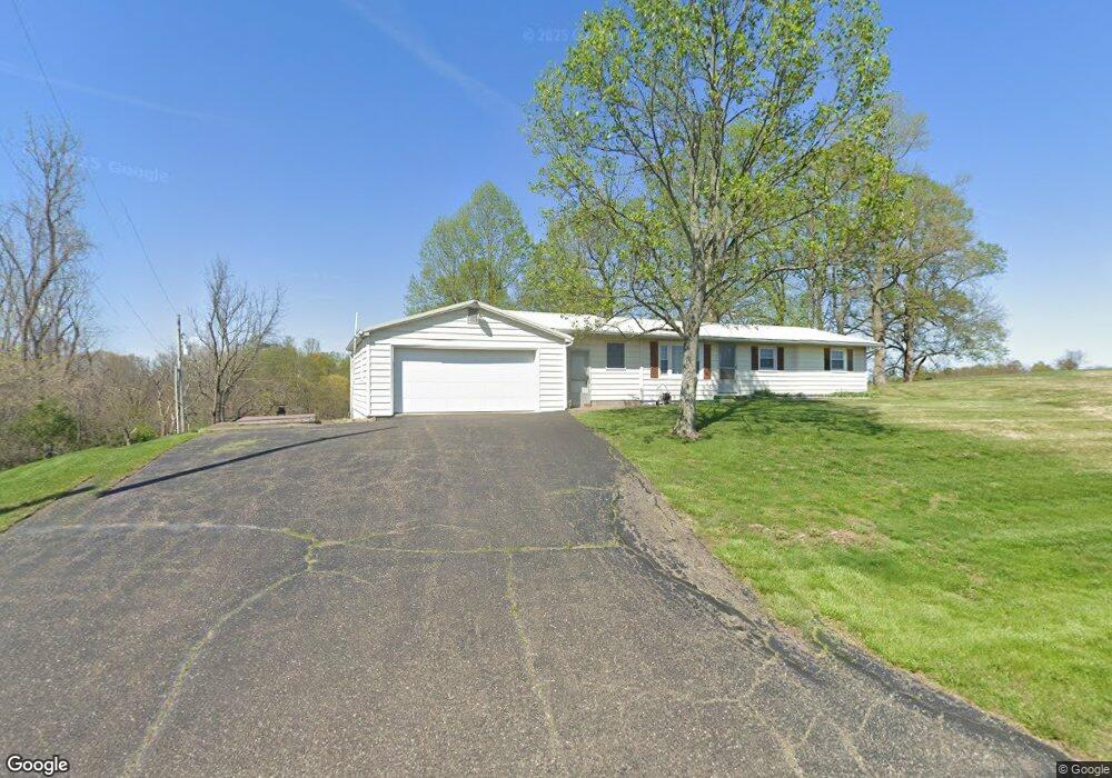
1080 E Airport Rd NE McConnelsville, OH 43756
Estimated Value: $172,000 - $253,754
2
Beds
1
Bath
1,200
Sq Ft
$172/Sq Ft
Est. Value
About This Home
This home is located at 1080 E Airport Rd NE, McConnelsville, OH 43756 and is currently estimated at $206,189, approximately $171 per square foot. 1080 E Airport Rd NE is a home located in Morgan County with nearby schools including Morgan High School.
Ownership History
Date
Name
Owned For
Owner Type
Purchase Details
Closed on
Aug 25, 1999
Sold by
Bailey Bettie P
Bought by
Bailey David L and Bailey Patricia A
Current Estimated Value
Purchase Details
Closed on
Aug 24, 1999
Sold by
Bailey Don L and Bailey Bettie P
Bought by
Bailey Bettie P
Create a Home Valuation Report for This Property
The Home Valuation Report is an in-depth analysis detailing your home's value as well as a comparison with similar homes in the area
Home Values in the Area
Average Home Value in this Area
Purchase History
| Date | Buyer | Sale Price | Title Company |
|---|---|---|---|
| Bailey David L | -- | -- | |
| Bailey Bettie P | -- | -- |
Source: Public Records
Tax History Compared to Growth
Tax History
| Year | Tax Paid | Tax Assessment Tax Assessment Total Assessment is a certain percentage of the fair market value that is determined by local assessors to be the total taxable value of land and additions on the property. | Land | Improvement |
|---|---|---|---|---|
| 2024 | $1,865 | $57,780 | $22,340 | $35,440 |
| 2023 | $1,353 | $42,420 | $19,030 | $23,390 |
| 2022 | $1,356 | $42,420 | $19,030 | $23,390 |
| 2021 | $1,377 | $42,640 | $19,030 | $23,610 |
| 2019 | $1,253 | $37,100 | $16,550 | $20,550 |
| 2018 | $907 | $37,100 | $16,550 | $20,550 |
| 2017 | $734 | $31,206 | $9,660 | $21,546 |
| 2016 | $737 | $31,206 | $9,660 | $21,546 |
| 2015 | $737 | $31,206 | $9,660 | $21,546 |
| 2014 | $759 | $31,206 | $9,660 | $21,546 |
| 2013 | $752 | $31,206 | $9,660 | $21,546 |
Source: Public Records
Map
Nearby Homes
- 112 S 16th St
- 3470 N Terrace Dr NW
- 545 E Mcconnel Ave
- 346 E Union Ave
- 274 N 8th St
- 2700 Fred Mummy Rd
- 3810 N Dugan Rd NW
- 422 N Kennebec Ave
- 284 N Kennebec Ave
- 3955 Wedgewood Dr
- 262 N 5th St
- 41 W Bell Ave
- 142 N 5th St
- 774 N Kennebec Ave
- 361 W Jefferson Ave
- 2680 Mummey Rd
- 1096 N Kennebec Ave
- 20 2nd St
- 95 Sunset Dr
- 4000 Henderson Ln
- 910 E Airport Rd NE
- 1212 E Airport Rd NE
- 740 E Mckendree Rd NE
- 690 E Airport Rd NE
- 802 E State Route 60 NE
- 776 E State Route 60 NE
- 755 E State Route 60 NE
- 610 E State Route 60 NE
- 588 E State Route 60 NE
- 1495 E Airport Rd NE
- 905 E State Route 60 NE
- 3445 Doc Taylor Rd
- 935 E State Route 60 NE
- 1515 E Airport Rd NE
- 939 E State Route 60 NE
- 341 E State Route 60 NE
- 952 E State Route 60 NE
- 941 E State Route 60 NE
- 1723 E Airport Rd NE