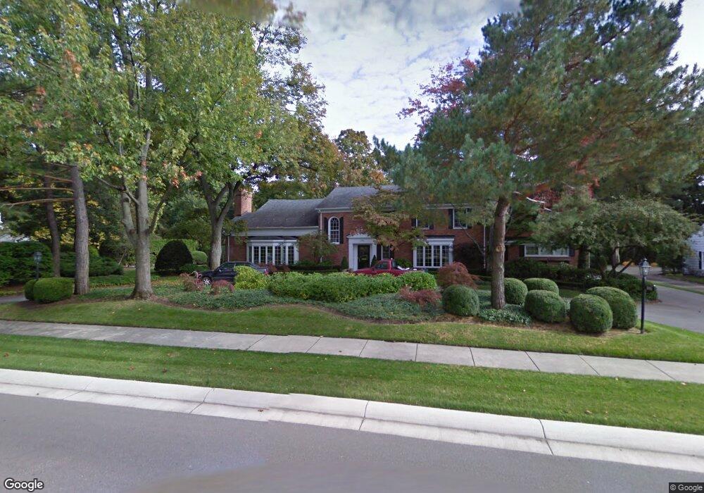
1080 N Cranbrook Rd Bloomfield Hills, MI 48301
Estimated Value: $2,303,000 - $3,492,000
6
Beds
8
Baths
6,901
Sq Ft
$385/Sq Ft
Est. Value
About This Home
This home is located at 1080 N Cranbrook Rd, Bloomfield Hills, MI 48301 and is currently estimated at $2,655,823, approximately $384 per square foot. 1080 N Cranbrook Rd is a home located in Oakland County with nearby schools including Quarton Elementary, Derby Middle School, and Ernest W. Seaholm High School.
Ownership History
Date
Name
Owned For
Owner Type
Purchase Details
Closed on
Jan 29, 2001
Sold by
Jones L
Bought by
Eisenberg Stephen
Current Estimated Value
Home Financials for this Owner
Home Financials are based on the most recent Mortgage that was taken out on this home.
Original Mortgage
$1,040,000
Outstanding Balance
$370,883
Interest Rate
6.91%
Estimated Equity
$2,284,940
Create a Home Valuation Report for This Property
The Home Valuation Report is an in-depth analysis detailing your home's value as well as a comparison with similar homes in the area
Home Values in the Area
Average Home Value in this Area
Purchase History
| Date | Buyer | Sale Price | Title Company |
|---|---|---|---|
| Eisenberg Stephen | -- | -- |
Source: Public Records
Mortgage History
| Date | Status | Borrower | Loan Amount |
|---|---|---|---|
| Open | Eisenberg Stephen | $1,040,000 |
Source: Public Records
Tax History Compared to Growth
Tax History
| Year | Tax Paid | Tax Assessment Tax Assessment Total Assessment is a certain percentage of the fair market value that is determined by local assessors to be the total taxable value of land and additions on the property. | Land | Improvement |
|---|---|---|---|---|
| 2024 | $15,976 | $1,143,730 | $0 | $0 |
| 2023 | $15,332 | $1,000,810 | $0 | $0 |
| 2022 | $27,032 | $950,170 | $0 | $0 |
| 2021 | $27,256 | $885,230 | $0 | $0 |
| 2020 | $14,727 | $835,740 | $0 | $0 |
| 2019 | $27,172 | $937,790 | $0 | $0 |
| 2018 | $26,882 | $824,290 | $0 | $0 |
| 2017 | $26,882 | $797,690 | $0 | $0 |
| 2016 | $27,035 | $834,240 | $0 | $0 |
| 2015 | -- | $795,730 | $0 | $0 |
| 2014 | -- | $755,110 | $0 | $0 |
| 2011 | -- | $568,430 | $0 | $0 |
Source: Public Records
Map
Nearby Homes
- 1019 N Cranbrook Rd
- 956 Westwood Dr
- 2579 Amberly Rd
- 1120 Lyonhurst St
- 1260 Lyonhurst St
- 1882 Melbourne St
- 345 Kimberly St
- 1834 Fairview St
- 586 Fairfax St
- 375 Dunston Rd
- 1056 Pilgrim Ave
- 120 Westchester Way
- 270 Martell Dr
- 1537 Ashford Ln
- 397 S Cranbrook Rd
- 394 S Glenhurst Dr
- 100 Overhill Rd
- 1348 Charrington Rd
- 3320 Morningview Terrace
- 1287 Charrington Rd
- 1048 N Cranbrook Rd
- 1099 N Cranbrook Rd
- 1039 N Cranbrook Rd
- 1085 Waddington St
- 1144 N Cranbrook Rd
- 1020 N Cranbrook Rd
- 1053 Waddington St
- 1028 Yarmouth Rd
- 1133 N Cranbrook Rd
- 2224 Yarmouth Rd
- 1015 Waddington St
- 965 N Cranbrook Rd
- 976 N Cranbrook Rd
- 1055 Yarmouth Rd
- 968 Yarmouth Rd
- 1216 N Cranbrook Rd
- 1187 N Cranbrook Rd
- 2192 Yarmouth Rd
- 971 Waddington St
- 1084 Waddington St