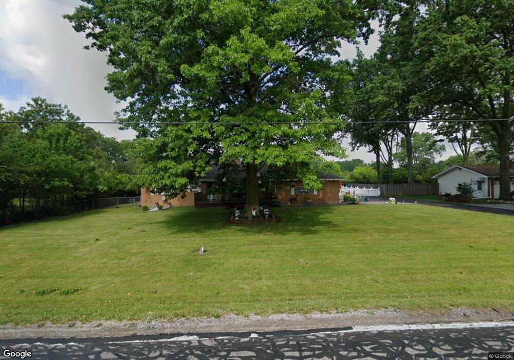
10800 Durkee Rd Grafton, OH 44044
Estimated Value: $250,000 - $355,000
3
Beds
1
Bath
1,344
Sq Ft
$216/Sq Ft
Est. Value
About This Home
This home is located at 10800 Durkee Rd, Grafton, OH 44044 and is currently estimated at $289,672, approximately $215 per square foot. 10800 Durkee Rd is a home located in Lorain County with nearby schools including Midview West Elementary School, Midview North Elementary School, and Midview East Intermediate School.
Ownership History
Date
Name
Owned For
Owner Type
Purchase Details
Closed on
Nov 2, 2022
Sold by
Swiger Beth Ann
Bought by
Swiger Scott E and Swiger Beth Ann
Current Estimated Value
Purchase Details
Closed on
Feb 8, 2003
Sold by
Roger Swiger and Ann Beth
Bought by
Swiger Roger and Swiger Beth Ann
Purchase Details
Closed on
Mar 28, 1997
Sold by
Est Effie E Krespach
Bought by
Swiger Roger and Swiger Beth A
Home Financials for this Owner
Home Financials are based on the most recent Mortgage that was taken out on this home.
Original Mortgage
$35,500
Interest Rate
7.73%
Mortgage Type
New Conventional
Create a Home Valuation Report for This Property
The Home Valuation Report is an in-depth analysis detailing your home's value as well as a comparison with similar homes in the area
Home Values in the Area
Average Home Value in this Area
Purchase History
| Date | Buyer | Sale Price | Title Company |
|---|---|---|---|
| Swiger Scott E | -- | -- | |
| Swiger Roger | -- | -- | |
| Swiger Roger | $100,000 | -- |
Source: Public Records
Mortgage History
| Date | Status | Borrower | Loan Amount |
|---|---|---|---|
| Previous Owner | Swiger Roger | $35,500 |
Source: Public Records
Tax History Compared to Growth
Tax History
| Year | Tax Paid | Tax Assessment Tax Assessment Total Assessment is a certain percentage of the fair market value that is determined by local assessors to be the total taxable value of land and additions on the property. | Land | Improvement |
|---|---|---|---|---|
| 2024 | $3,752 | $94,798 | $14,788 | $80,010 |
| 2023 | $2,057 | $51,209 | $12,436 | $38,773 |
| 2022 | $2,035 | $51,209 | $12,436 | $38,773 |
| 2021 | $2,040 | $51,209 | $12,436 | $38,773 |
| 2020 | $1,912 | $45,600 | $11,070 | $34,530 |
| 2019 | $1,905 | $45,600 | $11,070 | $34,530 |
| 2018 | $1,926 | $45,600 | $11,070 | $34,530 |
| 2017 | $2,237 | $48,430 | $11,300 | $37,130 |
| 2016 | $2,268 | $48,430 | $11,300 | $37,130 |
| 2015 | $2,279 | $48,430 | $11,300 | $37,130 |
| 2014 | $2,251 | $47,470 | $11,070 | $36,400 |
| 2013 | $2,254 | $47,470 | $11,070 | $36,400 |
Source: Public Records
Map
Nearby Homes
- 37520 Eagle Nest Dr
- 156 Arrow Ct
- 327 Breckenridge Oval Unit 9
- 110 Carrington Ct
- 136 Arrow Ct
- 601 Cedar Crest Dr
- 38484 E River Rd
- Iris Plan at Fieldstone Lakes - Fieldstone West
- Lily Plan at Fieldstone Lakes - Fieldstone West
- Marigold Plan at Fieldstone Lakes - Fieldstone West
- 360 Lily Ln
- 11110 Arrowhead Dr
- 102 Stonecrest Trail
- 106 Stonecrest Trail
- 118 Stonecrest Trail
- 133 Stonecrest Trail
- 167 Prestwyck Ln
- 157 Stonecrest Trail
- 202 Queensbury Run
- 758 Song Bird St
- 10760 Durkee Rd
- 10765 Durkee Rd
- 10700 Durkee Rd
- 10841 Durkee Rd
- 10753 Durkee Rd
- 10607 Durkee Rd
- 10600 Durkee Rd
- 10843 Durkee Rd
- 10660 Durkee Rd
- 10550 Durkee Rd
- 10585 Durkee Rd
- 10860 Durkee Rd
- 10861 Durkee Rd
- 10549 Durkee Rd
- 10900 Durkee Rd
- 10970 Durkee Rd
- 10967 Durkee Rd
- 10471 Durkee Rd
- 11000 Durkee Rd
- 10540 Durkee Rd