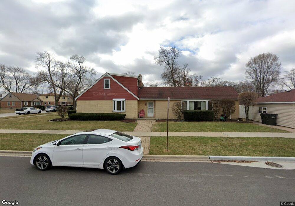
10800 Mcvicker Ave Chicago Ridge, IL 60415
Estimated Value: $301,000 - $336,000
4
Beds
2
Baths
1,649
Sq Ft
$194/Sq Ft
Est. Value
About This Home
This home is located at 10800 Mcvicker Ave, Chicago Ridge, IL 60415 and is currently estimated at $319,282, approximately $193 per square foot. 10800 Mcvicker Ave is a home located in Cook County with nearby schools including Ridge Central Elementary School, Elden D Finley Jr High School, and Harold L. Richards High School.
Ownership History
Date
Name
Owned For
Owner Type
Purchase Details
Closed on
Aug 31, 2001
Sold by
White Dennis G
Bought by
White Dennis G and White Diane M
Current Estimated Value
Home Financials for this Owner
Home Financials are based on the most recent Mortgage that was taken out on this home.
Original Mortgage
$170,824
Interest Rate
6.88%
Mortgage Type
FHA
Purchase Details
Closed on
Aug 21, 2001
Sold by
Ryniak George A and Ryniak Cheryl E
Bought by
White Dennis G
Home Financials for this Owner
Home Financials are based on the most recent Mortgage that was taken out on this home.
Original Mortgage
$170,824
Interest Rate
6.88%
Mortgage Type
FHA
Purchase Details
Closed on
Aug 22, 2000
Sold by
Lasalle Bank National Assn
Bought by
Ryniak George A and Ryniak Cheryl E
Create a Home Valuation Report for This Property
The Home Valuation Report is an in-depth analysis detailing your home's value as well as a comparison with similar homes in the area
Home Values in the Area
Average Home Value in this Area
Purchase History
| Date | Buyer | Sale Price | Title Company |
|---|---|---|---|
| White Dennis G | -- | -- | |
| White Dennis G | $198,000 | Chicago Title Insurance Co | |
| Ryniak George A | -- | -- |
Source: Public Records
Mortgage History
| Date | Status | Borrower | Loan Amount |
|---|---|---|---|
| Previous Owner | White Dennis G | $170,824 |
Source: Public Records
Tax History Compared to Growth
Tax History
| Year | Tax Paid | Tax Assessment Tax Assessment Total Assessment is a certain percentage of the fair market value that is determined by local assessors to be the total taxable value of land and additions on the property. | Land | Improvement |
|---|---|---|---|---|
| 2024 | $3,409 | $24,000 | $4,792 | $19,208 |
| 2023 | $3,981 | $24,000 | $4,792 | $19,208 |
| 2022 | $3,981 | $17,001 | $4,193 | $12,808 |
| 2021 | $3,877 | $17,001 | $4,193 | $12,808 |
| 2020 | $5,147 | $17,001 | $4,193 | $12,808 |
| 2019 | $5,778 | $18,227 | $3,793 | $14,434 |
| 2018 | $5,492 | $18,227 | $3,793 | $14,434 |
| 2017 | $5,524 | $18,227 | $3,793 | $14,434 |
| 2016 | $4,780 | $14,479 | $3,194 | $11,285 |
| 2015 | $4,640 | $14,479 | $3,194 | $11,285 |
| 2014 | $4,565 | $14,479 | $3,194 | $11,285 |
| 2013 | $5,050 | $17,118 | $3,194 | $13,924 |
Source: Public Records
Map
Nearby Homes
- 10854 Lyman Ave
- 10925 Lyman Ave
- 10925 Mcvicker Ave
- 10755 Mason Ave
- 10807 Oak Ave
- 10937 Moody Ave
- 5924 W 109th St
- 10821 Princess Ave
- 10706 Oak Ave
- 5825 109th St
- 10825 Oxford Ave
- 10912 Princess Ave
- 6040 111th St
- 10529 Lyman Ave
- 5810 107th Court Way
- 10832 Massasoit Ave
- 10840 S Ridgeland Ave
- 11013 Menard Ave
- 10429 Austin Ave Unit A
- 5730 110th St
- 10806 Mcvicker Ave
- 10812 Mcvicker Ave
- 10754 Mcvicker Ave
- 10801 Lyman Ave
- 10807 Lyman Ave
- 10813 Lyman Ave
- 10818 Mcvicker Ave
- 10755 Lyman Ave
- 10748 Mcvicker Ave
- 10801 Mcvicker Ave
- 10819 Lyman Ave
- 10813 Mcvicker Ave
- 10755 Mcvicker Ave
- 10749 Lyman Ave
- 10824 Mcvicker Ave
- 10742 Mcvicker Ave
- 10819 Mcvicker Ave
- 10825 Lyman Ave
- 10749 Mcvicker Ave
- 10743 Lyman Ave