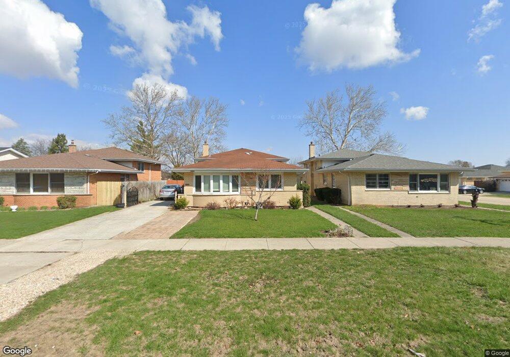
10802 31st St Westchester, IL 60154
Estimated Value: $368,000 - $439,000
3
Beds
2
Baths
1,377
Sq Ft
$286/Sq Ft
Est. Value
About This Home
This home is located at 10802 31st St, Westchester, IL 60154 and is currently estimated at $393,645, approximately $285 per square foot. 10802 31st St is a home located in Cook County with nearby schools including Westchester Primary School, Westchester Intermediate School, and Westchester Middle School.
Ownership History
Date
Name
Owned For
Owner Type
Purchase Details
Closed on
Jul 14, 2004
Sold by
Cortese Peter J
Bought by
Yaqub Ali
Current Estimated Value
Home Financials for this Owner
Home Financials are based on the most recent Mortgage that was taken out on this home.
Original Mortgage
$125,000
Interest Rate
6.34%
Mortgage Type
Unknown
Create a Home Valuation Report for This Property
The Home Valuation Report is an in-depth analysis detailing your home's value as well as a comparison with similar homes in the area
Home Values in the Area
Average Home Value in this Area
Purchase History
| Date | Buyer | Sale Price | Title Company |
|---|---|---|---|
| Yaqub Ali | -- | First American Title |
Source: Public Records
Mortgage History
| Date | Status | Borrower | Loan Amount |
|---|---|---|---|
| Closed | Yaqub Ali | $125,000 |
Source: Public Records
Tax History Compared to Growth
Tax History
| Year | Tax Paid | Tax Assessment Tax Assessment Total Assessment is a certain percentage of the fair market value that is determined by local assessors to be the total taxable value of land and additions on the property. | Land | Improvement |
|---|---|---|---|---|
| 2024 | $3,764 | $16,000 | $2,531 | $13,469 |
| 2023 | $3,968 | $16,000 | $2,531 | $13,469 |
| 2022 | $3,968 | $14,719 | $2,194 | $12,525 |
| 2021 | $3,854 | $14,717 | $2,193 | $12,524 |
| 2020 | $3,799 | $14,717 | $2,193 | $12,524 |
| 2019 | $3,178 | $12,965 | $2,025 | $10,940 |
| 2018 | $3,136 | $12,965 | $2,025 | $10,940 |
| 2017 | $3,084 | $12,965 | $2,025 | $10,940 |
| 2016 | $2,743 | $10,655 | $1,856 | $8,799 |
| 2015 | $2,690 | $10,655 | $1,856 | $8,799 |
| 2014 | $2,636 | $10,655 | $1,856 | $8,799 |
| 2013 | $2,878 | $12,764 | $1,856 | $10,908 |
Source: Public Records
Map
Nearby Homes
- 3036 Downing Ave
- 2925 Denton Ct
- 2858 Kensington Ave
- 16 Princess Ct Unit 16
- 2623 Sunnyside Ave
- 2610 Sunnyside Ave
- 10916 Kingston St
- 10511 Preston St
- 2401 Mayfair Ave
- 10610 Essex St
- 636 N Stone Ave
- 2316 Boeger Ave
- 606 N Brainard Ave
- 2230 Kensington Ave
- 4 Garden Dr Unit 4
- 2228 High Ridge Pkwy
- 2205 Mayfair Ave
- 818 N La Grange Rd
- 10630 W Cermak Rd Unit 2E
- 314 E 31st St
- 10802 31st St
- 10800 31st St
- 10808 31st St
- 10808 31st St
- 10814 31st St
- 10814 31st St
- 10756 31st St
- 10756 31st St
- 3040 Mayfair Ave
- 3040 Mayfair Ave
- 3045 Halifax Ave
- 3032 Mayfair Ave
- 3032 Mayfair Ave
- 3037 Halifax Ave
- 3039 Mayfair Ave
- 3039 Mayfair Ave
- 10752 31st St
- 3031 Halifax Ave
- 3035 Mayfair Ave
- 3028 Mayfair Ave