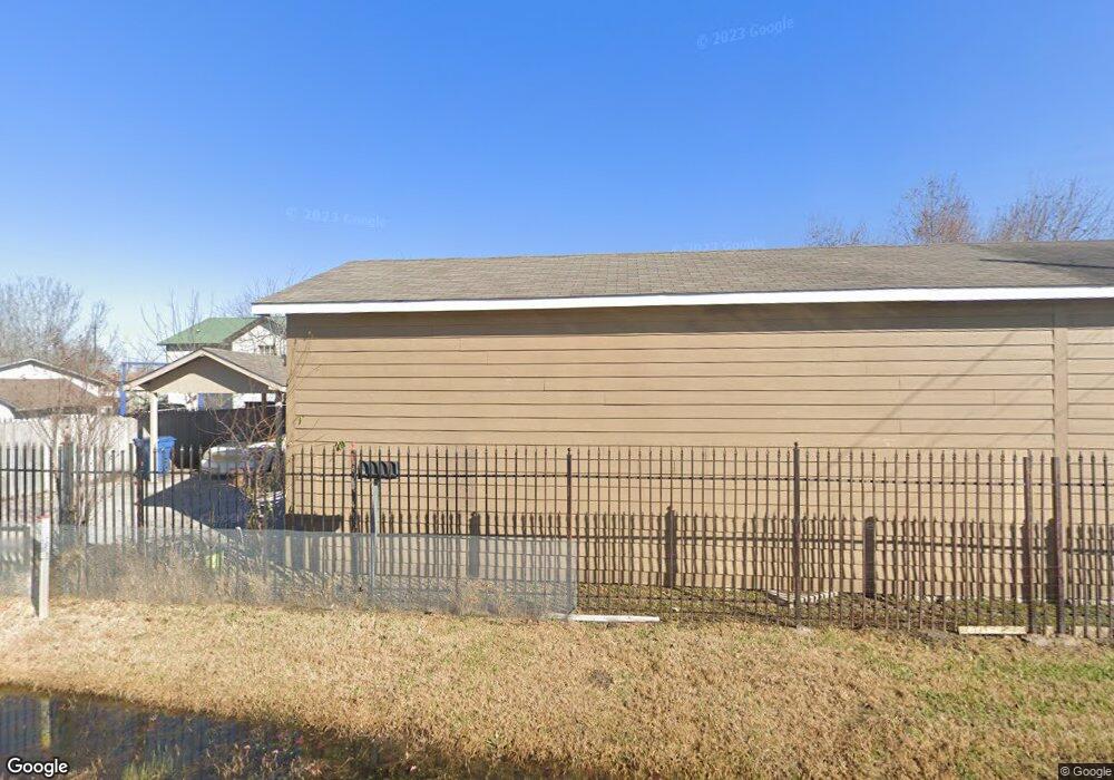
10802 Somerset Ln Houston, TX 77093
Estimated Value: $177,296 - $241,000
2
Beds
1
Bath
1,509
Sq Ft
$137/Sq Ft
Est. Value
About This Home
This home is located at 10802 Somerset Ln, Houston, TX 77093 and is currently estimated at $207,324, approximately $137 per square foot. 10802 Somerset Ln is a home located in Harris County with nearby schools including Scarborough Elementary School, Patrick Henry Middle School, and Sam Houston Math, Science & Technology Center.
Ownership History
Date
Name
Owned For
Owner Type
Purchase Details
Closed on
Sep 16, 1994
Sold by
Ward Doris F
Bought by
Perdomo Rosa
Current Estimated Value
Home Financials for this Owner
Home Financials are based on the most recent Mortgage that was taken out on this home.
Original Mortgage
$27,000
Interest Rate
8.45%
Purchase Details
Closed on
Feb 17, 1994
Sold by
Ward Larry W
Bought by
Ward Doris F
Create a Home Valuation Report for This Property
The Home Valuation Report is an in-depth analysis detailing your home's value as well as a comparison with similar homes in the area
Home Values in the Area
Average Home Value in this Area
Purchase History
| Date | Buyer | Sale Price | Title Company |
|---|---|---|---|
| Perdomo Rosa | -- | Fidelity National Title | |
| Ward Doris F | -- | -- |
Source: Public Records
Mortgage History
| Date | Status | Borrower | Loan Amount |
|---|---|---|---|
| Closed | Perdomo Rosa | $27,000 |
Source: Public Records
Tax History Compared to Growth
Tax History
| Year | Tax Paid | Tax Assessment Tax Assessment Total Assessment is a certain percentage of the fair market value that is determined by local assessors to be the total taxable value of land and additions on the property. | Land | Improvement |
|---|---|---|---|---|
| 2025 | $1,068 | $162,380 | $35,156 | $127,224 |
| 2024 | $1,068 | $162,380 | $35,156 | $127,224 |
| 2023 | $1,068 | $135,521 | $35,156 | $100,365 |
| 2022 | $2,058 | $135,521 | $32,696 | $102,825 |
| 2021 | $1,986 | $100,606 | $32,696 | $67,910 |
| 2020 | $2,066 | $100,606 | $32,696 | $67,910 |
| 2019 | $2,001 | $100,606 | $32,696 | $67,910 |
| 2018 | $1,196 | $84,900 | $23,438 | $61,462 |
| 2017 | $1,819 | $84,900 | $23,438 | $61,462 |
| 2016 | $1,819 | $84,900 | $23,438 | $61,462 |
| 2015 | $1,317 | $84,900 | $23,438 | $61,462 |
| 2014 | $1,317 | $84,900 | $23,438 | $61,462 |
Source: Public Records
Map
Nearby Homes
- 2636 Lone Oak Rd
- 2629 Kowis St
- 1728 Little York Rd
- 2315 Langley Rd
- 1904 Little York Rd
- 2817 Cromwell St
- 2152 William Tell St
- 2122 Kowis St
- 2332 Margaret St
- 2237 Cromwell St
- 2311 Warwick Rd
- 2415 Goodloe St
- 1908 Little York Rd
- 2131 Cromwell St Unit D
- 2306 Wardmont St
- 2326 Sunny Dr
- 1829 Skinner Rd
- 1930 Cromwell St
- 2131 Warwick Rd
- 2123 Warwick Rd
- 2602 Trenton Rd
- 10803 Somerset Ln
- 2526 Trenton Rd
- 2601 Trenton Rd
- 2626 Trenton Rd
- 2625 Little York Rd
- 2609 Trenton Rd
- 2529 Trenton Rd
- 10850 Somerset Ln
- 2525 Trenton Rd
- 2612 Little York Rd
- 2625 Trenton Rd
- 2604 Little York Rd
- 2617 Trenton Rd
- 2517 Trenton Rd
- 2532 Little York Rd
- 2672 Trenton Rd
- 2506 Trenton Rd
- 2534 Little York Rd
- 2600 Lone Oak Rd