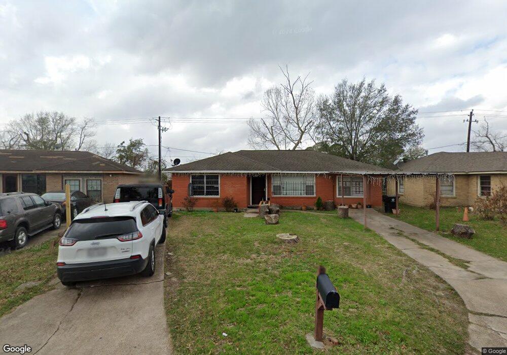
10807 Royal Pine Dr Houston, TX 77093
Eastex-Jensen NeighborhoodEstimated Value: $184,000 - $207,607
3
Beds
2
Baths
1,496
Sq Ft
$130/Sq Ft
Est. Value
About This Home
This home is located at 10807 Royal Pine Dr, Houston, TX 77093 and is currently estimated at $195,152, approximately $130 per square foot. 10807 Royal Pine Dr is a home located in Harris County with nearby schools including Scarborough Elementary School, Patrick Henry Middle School, and Sam Houston Math, Science & Technology Center.
Ownership History
Date
Name
Owned For
Owner Type
Purchase Details
Closed on
Dec 5, 2024
Sold by
Rodriguez Maria T and Cruz Maria T
Bought by
Rodriguez Maria T
Current Estimated Value
Purchase Details
Closed on
Feb 2, 2004
Sold by
Cruz Juan
Bought by
Cruz Maria Teresa
Purchase Details
Closed on
Jul 2, 1999
Sold by
Reber Daniel W and Reber Dorothy
Bought by
Cruz Juan and Cruz Maria T
Home Financials for this Owner
Home Financials are based on the most recent Mortgage that was taken out on this home.
Original Mortgage
$66,900
Interest Rate
7.21%
Create a Home Valuation Report for This Property
The Home Valuation Report is an in-depth analysis detailing your home's value as well as a comparison with similar homes in the area
Home Values in the Area
Average Home Value in this Area
Purchase History
| Date | Buyer | Sale Price | Title Company |
|---|---|---|---|
| Rodriguez Maria T | -- | None Listed On Document | |
| Cruz Maria Teresa | -- | -- | |
| Cruz Juan | -- | American Title Co |
Source: Public Records
Mortgage History
| Date | Status | Borrower | Loan Amount |
|---|---|---|---|
| Previous Owner | Cruz Juan | $66,900 |
Source: Public Records
Tax History Compared to Growth
Tax History
| Year | Tax Paid | Tax Assessment Tax Assessment Total Assessment is a certain percentage of the fair market value that is determined by local assessors to be the total taxable value of land and additions on the property. | Land | Improvement |
|---|---|---|---|---|
| 2025 | $1,715 | $193,803 | $55,086 | $138,717 |
| 2024 | $1,715 | $184,118 | $45,401 | $138,717 |
| 2023 | $1,715 | $185,162 | $45,401 | $139,761 |
| 2022 | $2,804 | $162,179 | $30,267 | $131,912 |
| 2021 | $2,698 | $133,128 | $19,674 | $113,454 |
| 2020 | $2,548 | $125,787 | $19,674 | $106,113 |
| 2019 | $2,421 | $116,831 | $16,647 | $100,184 |
| 2018 | $2,197 | $86,970 | $16,647 | $70,323 |
| 2017 | $2,197 | $86,970 | $16,647 | $70,323 |
| 2016 | $1,997 | $78,997 | $16,647 | $62,350 |
| 2015 | $1,439 | $78,997 | $16,647 | $62,350 |
| 2014 | $1,439 | $96,065 | $16,647 | $79,418 |
Source: Public Records
Map
Nearby Homes
- 1728 Little York Rd
- 1904 Little York Rd
- 2636 Lone Oak Rd
- 2629 Kowis St
- 2817 Cromwell St
- 4918 Langley Rd
- 2315 Langley Rd
- 3418 Hopper Rd
- 2332 Margaret St
- 2415 Goodloe St
- 3804 Cedar Hill Ln
- 2311 Warwick Rd
- 2237 Cromwell St
- 3214 Brea Crest St
- 2152 William Tell St
- 2915 Brea Crest St
- 2122 Kowis St
- 2326 Sunny Dr
- 3202 Parker Rd
- 2306 Wardmont St
- 10811 Royal Pine Dr
- 10803 Royal Pine Dr
- 10815 Royal Pine Dr
- 2904 Barksdale Dr
- 2907 Barksdale Dr
- 10819 Royal Pine Dr
- 2908 Trenton Rd
- 2908 Barksdale Dr
- 2911 Barksdale Dr
- 10903 Royal Pine Dr
- 2912 Barksdale Dr
- 2912 Trenton Rd
- 2915 Barksdale Dr
- 2916 Barksdale Dr
- 10907 Royal Pine Dr
- 2916 Trenton Rd
- 2907 Trenton Rd
- 2919 Barksdale Dr
- 2920 Barksdale Dr
- 10911 Royal Pine Dr