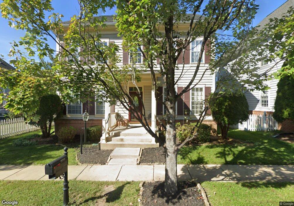
10808 Henry Abbott Rd Bristow, VA 20136
Estimated Value: $785,250 - $826,000
4
Beds
3
Baths
3,008
Sq Ft
$267/Sq Ft
Est. Value
About This Home
This home is located at 10808 Henry Abbott Rd, Bristow, VA 20136 and is currently estimated at $803,563, approximately $267 per square foot. 10808 Henry Abbott Rd is a home located in Prince William County with nearby schools including T. Clay Wood Elementary School, E.H. Marsteller Middle School, and Brentsville District High School.
Ownership History
Date
Name
Owned For
Owner Type
Purchase Details
Closed on
Oct 8, 2008
Sold by
Centex Homes
Bought by
Howard Brian
Current Estimated Value
Home Financials for this Owner
Home Financials are based on the most recent Mortgage that was taken out on this home.
Original Mortgage
$382,822
Outstanding Balance
$254,324
Interest Rate
6.41%
Mortgage Type
FHA
Estimated Equity
$549,239
Create a Home Valuation Report for This Property
The Home Valuation Report is an in-depth analysis detailing your home's value as well as a comparison with similar homes in the area
Home Values in the Area
Average Home Value in this Area
Purchase History
| Date | Buyer | Sale Price | Title Company |
|---|---|---|---|
| Howard Brian | $387,875 | -- |
Source: Public Records
Mortgage History
| Date | Status | Borrower | Loan Amount |
|---|---|---|---|
| Open | Howard Brian | $382,822 |
Source: Public Records
Tax History
| Year | Tax Paid | Tax Assessment Tax Assessment Total Assessment is a certain percentage of the fair market value that is determined by local assessors to be the total taxable value of land and additions on the property. | Land | Improvement |
|---|---|---|---|---|
| 2025 | $6,812 | $751,900 | $207,700 | $544,200 |
| 2024 | $6,812 | $685,000 | $197,700 | $487,300 |
| 2023 | $6,706 | $644,500 | $163,400 | $481,100 |
| 2022 | $6,778 | $601,700 | $163,400 | $438,300 |
| 2021 | $6,443 | $528,900 | $141,400 | $387,500 |
| 2020 | $7,677 | $495,300 | $141,400 | $353,900 |
| 2019 | $7,301 | $471,000 | $141,400 | $329,600 |
| 2018 | $5,375 | $445,100 | $141,400 | $303,700 |
| 2017 | $5,472 | $444,400 | $141,400 | $303,000 |
| 2016 | $5,309 | $435,100 | $134,900 | $300,200 |
| 2015 | $4,960 | $427,100 | $127,700 | $299,400 |
| 2014 | $4,960 | $397,300 | $118,100 | $279,200 |
Source: Public Records
Map
Nearby Homes
- 11712 Robert e Lee Dr
- 11747 Alexander Hays Rd
- 10615 Bristow Station Dr
- 10630 Bristow Station Dr
- 10582 Poagues Battery Dr
- 11912 Ricketts Battery Dr
- 11995 General Cooke Dr
- 11701 Town Green Rd
- 11650 Iron Brigade Unit Ave
- 12172 Aster Rd
- 12203 Aster Rd
- 12268 Sedge St
- 10116 Middlebrooks Terrace
- 12217 Wheat Mill Loop
- 12149 Drum Salute Place
- 12360 Corncrib Ct
- 12511 Heykens Ln
- 11821 Arcari Dr
- 10410 Kettle Run Rd
- 9813 Nugget Ct
- 10804 Henry Abbott Rd
- 11779 General Cooke Dr
- 11716 Robert e Lee Dr
- 10800 Henry Abbott Rd
- 11726 Robert e Lee Dr
- 11730 Robert e Lee Dr
- 10809 Henry Abbott Rd
- 11722 Robert e Lee Dr
- 10813 Henry Abbott Rd
- 10805 Henry Abbott Rd
- 11734 Robert e Lee Dr
- 10817 Henry Abbott Rd
- 10801 Henry Abbott Rd
- 11774 General Cooke Dr
- 11770 General Cooke Dr
- 11713 Robert e Lee Dr
- 11717 Robert e Lee Dr
- 11778 General Cooke Dr
- 11766 General Cooke Dr
- 10821 Henry Abbott Rd
Your Personal Tour Guide
Ask me questions while you tour the home.