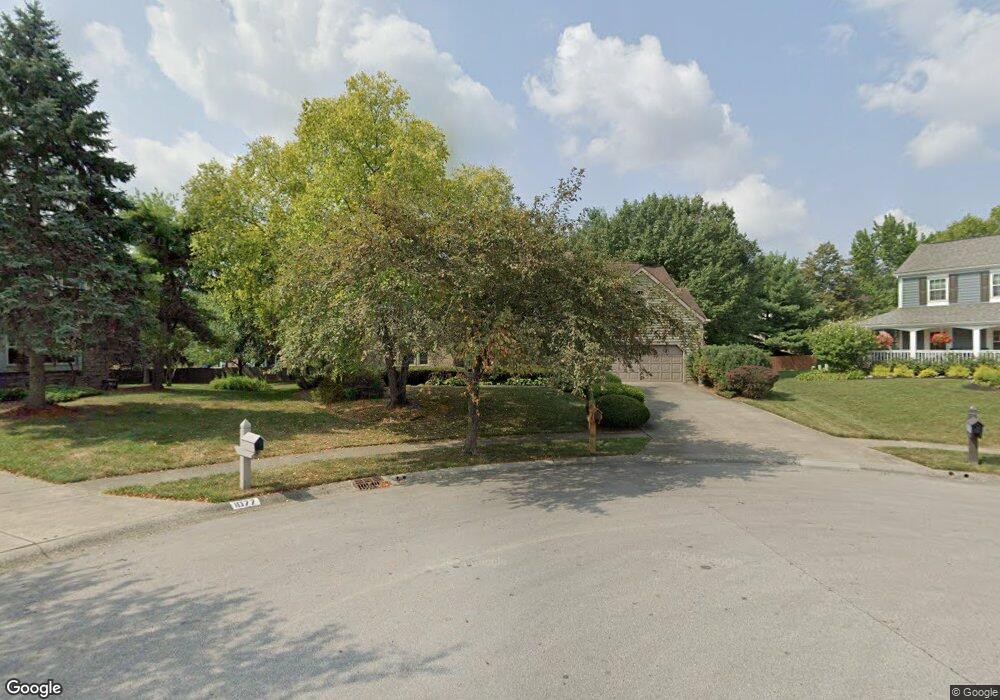
1081 Cannonade Ct Columbus, OH 43230
Estimated Value: $525,000 - $690,000
3
Beds
4
Baths
2,800
Sq Ft
$206/Sq Ft
Est. Value
About This Home
This home is located at 1081 Cannonade Ct, Columbus, OH 43230 and is currently estimated at $575,420, approximately $205 per square foot. 1081 Cannonade Ct is a home located in Franklin County with nearby schools including High Point Elementary School, Gahanna East Middle School, and Lincoln High School.
Ownership History
Date
Name
Owned For
Owner Type
Purchase Details
Closed on
May 31, 2000
Sold by
Whiting John C and Whiting Audrey J
Bought by
Whiting John C and Whiting Audrey J
Current Estimated Value
Home Financials for this Owner
Home Financials are based on the most recent Mortgage that was taken out on this home.
Original Mortgage
$192,500
Outstanding Balance
$68,299
Interest Rate
8.31%
Mortgage Type
Purchase Money Mortgage
Estimated Equity
$507,121
Purchase Details
Closed on
May 30, 1991
Bought by
Whiting John C and Whiting Audrey J
Create a Home Valuation Report for This Property
The Home Valuation Report is an in-depth analysis detailing your home's value as well as a comparison with similar homes in the area
Home Values in the Area
Average Home Value in this Area
Purchase History
| Date | Buyer | Sale Price | Title Company |
|---|---|---|---|
| Whiting John C | $242,500 | Stewart Title Agency Of Colu | |
| Whiting John C | $176,200 | -- |
Source: Public Records
Mortgage History
| Date | Status | Borrower | Loan Amount |
|---|---|---|---|
| Open | Whiting John C | $192,500 |
Source: Public Records
Tax History Compared to Growth
Tax History
| Year | Tax Paid | Tax Assessment Tax Assessment Total Assessment is a certain percentage of the fair market value that is determined by local assessors to be the total taxable value of land and additions on the property. | Land | Improvement |
|---|---|---|---|---|
| 2024 | $9,384 | $169,090 | $43,890 | $125,200 |
| 2023 | $9,303 | $169,085 | $43,890 | $125,195 |
| 2022 | $7,922 | $114,840 | $21,000 | $93,840 |
| 2021 | $7,662 | $114,840 | $21,000 | $93,840 |
| 2020 | $7,598 | $114,840 | $21,000 | $93,840 |
| 2019 | $6,245 | $95,760 | $17,500 | $78,260 |
| 2018 | $5,854 | $95,760 | $17,500 | $78,260 |
| 2017 | $5,618 | $95,760 | $17,500 | $78,260 |
| 2016 | $5,504 | $84,850 | $17,330 | $67,520 |
| 2015 | $5,509 | $84,850 | $17,330 | $67,520 |
| 2014 | $5,466 | $84,850 | $17,330 | $67,520 |
| 2013 | $2,714 | $84,840 | $17,325 | $67,515 |
Source: Public Records
Map
Nearby Homes
- 4220 E Johnstown Rd
- 0 Beecher Crossing
- 638 Churchill Dr
- 636 Grove Cir Unit 1803
- 777 Dark Star Ave
- 1199 Riva Ridge Blvd
- 4574 N Hamilton Rd
- 804 Riva Ridge Blvd
- 597 Piney Glen Dr Unit 597
- 1035 Riva Ridge Blvd
- 4651 E Johnstown Rd
- 900 Old Pine Dr
- 6019 Bentgate Ln Unit 60192
- 641 Sycamore Mill Dr
- 3753 Brightwell Ln
- 6263 Wagtail Rd Unit 13
- 6200 Downwing Ln Unit 20
- 365 Sycamore Woods Ln Unit 365
- 6169 Needletail Rd
- 211 Crossing Creek N
- 1077 Cannonade Ct
- 1080 Cannonade Ct
- 572 Dark Star Ave
- 580 Dark Star Ave
- 1075 Cannonade Ct
- 1076 Cannonade Ct
- 558 Dark Star Ave
- 1007 Arcaro Dr
- 1011 Arcaro Dr
- 1074 Cannonade Ct
- 1073 Cannonade Ct
- 590 Dark Star Ave
- 1015 Arcaro Dr
- 1010 Mccarron Ct
- 1072 Cannonade Ct
- 1019 Arcaro Dr
- 1071 Cannonade Ct
- 1015 Mccarron Ct
- 581 Dark Star Ave
- 1002 Mccarron Ct