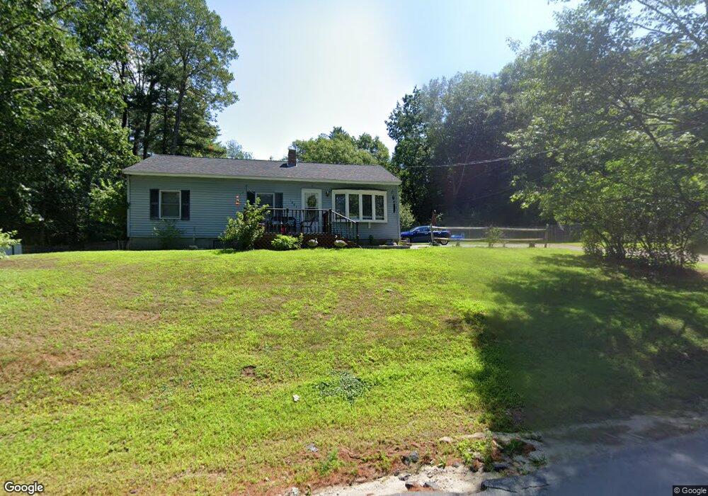
1081 Corn Hill Rd Webster, NH 03303
Estimated Value: $352,645 - $432,000
2
Beds
1
Bath
1,187
Sq Ft
$330/Sq Ft
Est. Value
About This Home
This home is located at 1081 Corn Hill Rd, Webster, NH 03303 and is currently estimated at $391,411, approximately $329 per square foot. 1081 Corn Hill Rd is a home located in Merrimack County with nearby schools including Webster Elementary School, Merrimack Valley Middle School, and Merrimack Valley High School.
Ownership History
Date
Name
Owned For
Owner Type
Purchase Details
Closed on
Jun 23, 2003
Sold by
Raymond Suzanne J
Bought by
Dyment Jonathan S and Dyment Kathleen A
Current Estimated Value
Home Financials for this Owner
Home Financials are based on the most recent Mortgage that was taken out on this home.
Original Mortgage
$126,450
Outstanding Balance
$53,206
Interest Rate
5.71%
Estimated Equity
$338,205
Create a Home Valuation Report for This Property
The Home Valuation Report is an in-depth analysis detailing your home's value as well as a comparison with similar homes in the area
Home Values in the Area
Average Home Value in this Area
Purchase History
We collect this data history from publicly available records. To have your information removed, we recommend requesting removal directly through your county’s website.
| Date | Buyer | Sale Price | Title Company |
|---|---|---|---|
| Dyment Jonathan S | $127,500 | -- |
Source: Public Records
Mortgage History
We collect this data history from publicly available records. To have your information removed, we recommend requesting removal directly through your county’s website.
| Date | Status | Borrower | Loan Amount |
|---|---|---|---|
| Open | Dyment Jonathan S | $35,259 | |
| Open | Dyment Jonathan S | $126,450 |
Source: Public Records
Tax History
| Year | Tax Paid | Tax Assessment Tax Assessment Total Assessment is a certain percentage of the fair market value that is determined by local assessors to be the total taxable value of land and additions on the property. | Land | Improvement |
|---|---|---|---|---|
| 2025 | $5,033 | $279,900 | $120,000 | $159,900 |
| 2024 | $4,719 | $277,900 | $120,000 | $157,900 |
| 2023 | $4,735 | $277,900 | $120,000 | $157,900 |
| 2022 | $4,492 | $161,700 | $65,000 | $96,700 |
| 2021 | $4,342 | $161,700 | $65,000 | $96,700 |
| 2020 | $4,269 | $161,700 | $65,000 | $96,700 |
| 2019 | $4,332 | $161,700 | $65,000 | $96,700 |
| 2018 | $3,483 | $161,700 | $65,000 | $96,700 |
| 2017 | $2,857 | $124,400 | $30,000 | $94,400 |
| 2016 | $2,818 | $122,700 | $30,000 | $92,700 |
| 2015 | $2,955 | $122,700 | $30,000 | $92,700 |
| 2014 | $2,784 | $122,700 | $30,000 | $92,700 |
| 2013 | $2,666 | $122,700 | $30,000 | $92,700 |
Source: Public Records
Map
Nearby Homes
- 122 Centennial Dr
- M10 L05 S37 Centennial Dr
- 17 Centennial Dr
- 30 Centennial Dr
- Map 10 Dr
- 84 New Hampshire Dr Unit 4
- 63 Concord Dr
- 41 Franklin Pierce Dr
- Map 6, Lot 38 Chadwick Hill Rd
- 196 Clothespin Bridge Rd
- 00 Deer Meadow Rd Unit 26
- 119 Gerrish Rd
- 298 Battle St
- 46 Water St
- 18 Stacey Dr
- 25 Merrill Corner Rd
- 5 Pamela Dr
- 20 Water St
- 15 Suffolk Dr Unit 2
- 15 Suffolk Dr Unit 6
- 139 Rumford Dr
- 99 Rumford Dr
- 1073 Corn Hill Rd
- 113 Centennial Dr
- 0 Rumford Dr Unit 4321175
- 0 Rumford Dr Unit 4184022
- 0 Rumford Dr Unit 10-05-156 4888186
- 0 Rumford Dr Unit 10-05-155 4888182
- 0 Rumford Dr Unit 4250510
- 1093 Corn Hill Rd
- 95 Rumford Dr
- 10-5-89 Rumford Dr
- 10-5-33 Rumford Dr
- 10-5-91 Rumford Dr
- 117 Centennial Dr
- 20 Christopher Robert Dr
- 00 Rumford Dr
- 114 Centennial Dr
- 87 Rumford Dr
- 12 Christopher Robert Dr
Your Personal Tour Guide
Ask me questions while you tour the home.