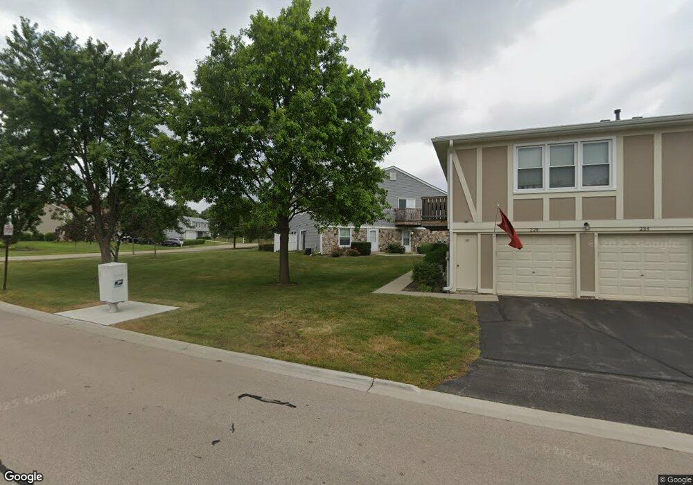
1081 Glouchester Harbor Unit 1202 Schaumburg, IL 60193
South Schaumburg NeighborhoodEstimated Value: $239,000 - $257,000
2
Beds
1
Bath
1,000
Sq Ft
$248/Sq Ft
Est. Value
About This Home
This home is located at 1081 Glouchester Harbor Unit 1202, Schaumburg, IL 60193 and is currently estimated at $247,763, approximately $247 per square foot. 1081 Glouchester Harbor Unit 1202 is a home located in Cook County with nearby schools including Michael Collins Elementary School, Robert Frost Junior High School, and J B Conant High School.
Ownership History
Date
Name
Owned For
Owner Type
Purchase Details
Closed on
Mar 3, 2004
Sold by
White Robert L
Bought by
Sittiwong Ruangwit and Sittiwong Kotchakorn
Current Estimated Value
Home Financials for this Owner
Home Financials are based on the most recent Mortgage that was taken out on this home.
Original Mortgage
$123,200
Outstanding Balance
$57,498
Interest Rate
5.65%
Mortgage Type
Purchase Money Mortgage
Estimated Equity
$190,265
Create a Home Valuation Report for This Property
The Home Valuation Report is an in-depth analysis detailing your home's value as well as a comparison with similar homes in the area
Home Values in the Area
Average Home Value in this Area
Purchase History
| Date | Buyer | Sale Price | Title Company |
|---|---|---|---|
| Sittiwong Ruangwit | $154,000 | Multiple |
Source: Public Records
Mortgage History
| Date | Status | Borrower | Loan Amount |
|---|---|---|---|
| Open | Sittiwong Ruangwit | $123,200 | |
| Closed | Sittiwong Ruangwit | $15,400 |
Source: Public Records
Tax History Compared to Growth
Tax History
| Year | Tax Paid | Tax Assessment Tax Assessment Total Assessment is a certain percentage of the fair market value that is determined by local assessors to be the total taxable value of land and additions on the property. | Land | Improvement |
|---|---|---|---|---|
| 2024 | $3,438 | $15,590 | $646 | $14,944 |
| 2023 | $3,306 | $15,590 | $646 | $14,944 |
| 2022 | $3,306 | $15,590 | $646 | $14,944 |
| 2021 | $3,196 | $13,874 | $352 | $13,522 |
| 2020 | $3,209 | $13,874 | $352 | $13,522 |
| 2019 | $3,213 | $15,416 | $352 | $15,064 |
| 2018 | $2,253 | $10,944 | $293 | $10,651 |
| 2017 | $2,236 | $10,944 | $293 | $10,651 |
| 2016 | $2,333 | $10,944 | $293 | $10,651 |
| 2015 | $2,010 | $9,341 | $264 | $9,077 |
| 2014 | $2,004 | $9,341 | $264 | $9,077 |
| 2013 | $1,935 | $9,341 | $264 | $9,077 |
Source: Public Records
Map
Nearby Homes
- 286 Nantucket Harbor Unit 601
- 1205 Laurel Ln
- 1078 Newport Harbor Unit 6101
- 1100 Boston Harbor Unit 7004
- 421 E Wise Rd
- 1323 S Roselle Rd
- 13 W Monterey Ave
- 1420 Indian Hill Dr
- 211 Steeple Bush Ln Unit 10343
- 205 Steeple Bush Ln Unit 10444
- 717 Tipperary Ct Unit 1C
- 731 Highpoint Ct
- 620 S Point Dr
- 733 Limerick Ln Unit 7333D
- 134 Lunt Ave
- 727 Killarney Ct Unit 2D
- 712 Tipperary Ct Unit 1C
- 711 Tipperary Ct Unit 2D
- 1531 Marion St
- 629 Derry Ct Unit 1A
- 1083 Glouchester Harbor Unit 1203
- 1083 Glouchester Harbor Unit 1083
- 1079 Glouchester Harbor Unit 1201
- 1072 Glouchester Harbor Unit 2501
- 1072 Glouchester Harbor Unit 1072
- 1072 Glouchester Harbor Unit END
- 228 Nantucket Harbor Unit 110
- 228 Nantucket Harbor Unit 228
- 232 Nantucket Harbor Unit 110
- 1074 Glouchester Harbor Unit 2504
- 1074 Glouchester Harbor Unit 1074
- 1074 Glouchester Harbor Unit 1
- 1070 Glouchester Harbor Unit 2502
- 1068 Glouchester Harbor
- 1077 Glouchester Harbor Unit 1204
- 230 Nantucket Harbor Unit 110
- 1076 Glouchester Harbor Unit 2603
- 1082 Glouchester Harbor Unit 2604
- 1080 Glouchester Harbor
- 1080 Glouchester Harbor Unit 1034