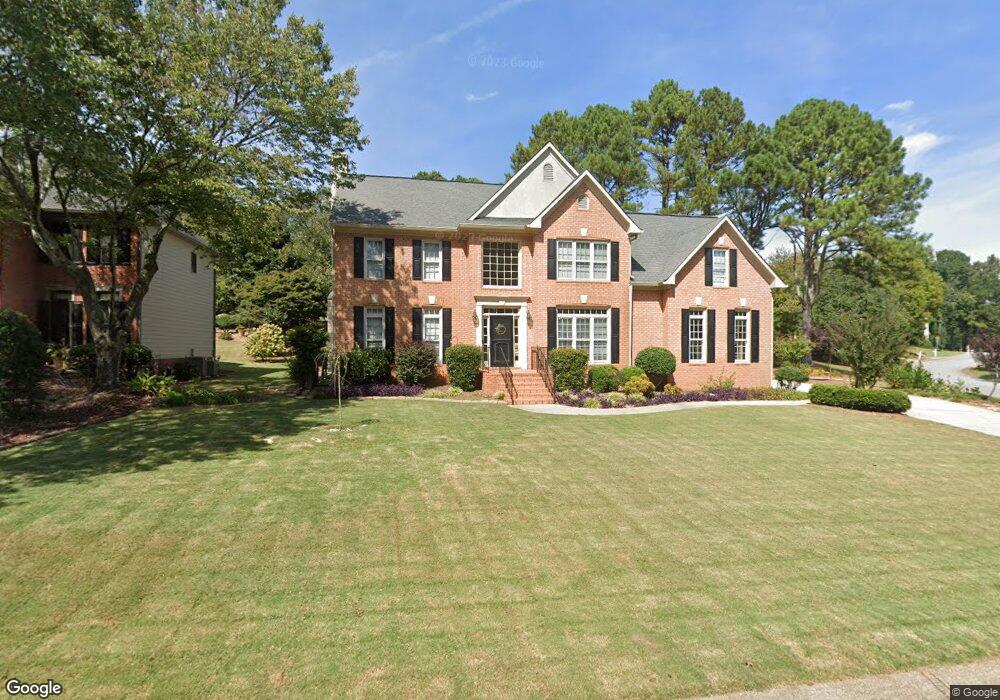
1081 Kenmore Way Snellville, GA 30078
Gwinnett Place NeighborhoodEstimated Value: $539,314 - $576,000
4
Beds
6
Baths
3,179
Sq Ft
$176/Sq Ft
Est. Value
About This Home
This home is located at 1081 Kenmore Way, Snellville, GA 30078 and is currently estimated at $558,829, approximately $175 per square foot. 1081 Kenmore Way is a home located in Gwinnett County with nearby schools including Craig Elementary School, Alton C. Crews Middle School, and Brookwood High School.
Ownership History
Date
Name
Owned For
Owner Type
Purchase Details
Closed on
Mar 18, 2025
Sold by
Ramalal Kalpna
Bought by
Mohamed Suleiman Eggeh and Ramalal Kalpna
Current Estimated Value
Home Financials for this Owner
Home Financials are based on the most recent Mortgage that was taken out on this home.
Original Mortgage
$285,000
Outstanding Balance
$283,536
Interest Rate
6.85%
Mortgage Type
New Conventional
Estimated Equity
$275,293
Purchase Details
Closed on
Aug 21, 2024
Sold by
Hornsby David J
Bought by
David & Alaina Hornsby Revocable Trust and Hornsby Alaina Trust
Purchase Details
Closed on
Jun 29, 1993
Sold by
Wieland John Homes
Bought by
Landreau Joseph R
Home Financials for this Owner
Home Financials are based on the most recent Mortgage that was taken out on this home.
Original Mortgage
$167,850
Interest Rate
7.52%
Create a Home Valuation Report for This Property
The Home Valuation Report is an in-depth analysis detailing your home's value as well as a comparison with similar homes in the area
Home Values in the Area
Average Home Value in this Area
Purchase History
| Date | Buyer | Sale Price | Title Company |
|---|---|---|---|
| Mohamed Suleiman Eggeh | -- | -- | |
| Ramalal Kalpna | $555,000 | -- | |
| David & Alaina Hornsby Revocable Trust | -- | -- | |
| Landreau Joseph R | $186,500 | -- |
Source: Public Records
Mortgage History
| Date | Status | Borrower | Loan Amount |
|---|---|---|---|
| Open | Ramalal Kalpna | $285,000 | |
| Previous Owner | Landreau Joseph R | $167,850 |
Source: Public Records
Tax History Compared to Growth
Tax History
| Year | Tax Paid | Tax Assessment Tax Assessment Total Assessment is a certain percentage of the fair market value that is determined by local assessors to be the total taxable value of land and additions on the property. | Land | Improvement |
|---|---|---|---|---|
| 2024 | $5,905 | $175,080 | $36,000 | $139,080 |
| 2023 | $5,905 | $206,280 | $37,600 | $168,680 |
| 2022 | $6,065 | $184,520 | $35,200 | $149,320 |
| 2021 | $5,217 | $140,040 | $26,000 | $114,040 |
| 2020 | $4,574 | $140,040 | $26,000 | $114,040 |
| 2019 | $4,448 | $140,040 | $26,000 | $114,040 |
| 2018 | $4,457 | $140,040 | $26,000 | $114,040 |
| 2016 | $3,663 | $102,560 | $18,400 | $84,160 |
| 2015 | $3,698 | $102,560 | $18,400 | $84,160 |
| 2014 | $3,717 | $102,560 | $18,400 | $84,160 |
Source: Public Records
Map
Nearby Homes
- 2061 Vicarage Ln
- 1870 Milfield Cir
- 1107 Hardwyck Pass
- 543 Grassmeade Way
- 1195 Haverhill Trail
- 2071 Havenview Ct
- 969 Flowers Crossing
- 971 Providence Dr Unit 3
- 1035 Bridgewater Walk
- 825 Connell Ln
- 2011 Montrose Ct
- 4105 Vicksburg Dr
- 1810 Talbot Ct
- 1336 Janmar Rd
- 840 Deer Oaks Dr
- 3217 Hidden Valley Cir
- 3218 Hidden Valley Cir
- 1887 Kennard Ct
- 1876 Kennard Ct Unit 5
- 1090 Kenmore Way
- 1958 Kentland Place
- 1110 Kenmore Way
- 1897 Kennard Ct
- 1886 Kennard Ct Unit 5
- 1071 Kenmore Way
- 1948 Kentland Place
- 1061 Kenmore Way Unit 5
- 1938 Kentland Place Unit 6
- 1907 Kennard Ct Unit 5
- 1060 Kenmore Way
- 1960 Milfield Cir Unit 4
- 1896 Kennard Ct
- 1918 Kentland Place
- 1906 Kennard Ct
- 1969 Kentland Place
- 1051 Kenmore Way Unit 5
- 0 Kenmore Way