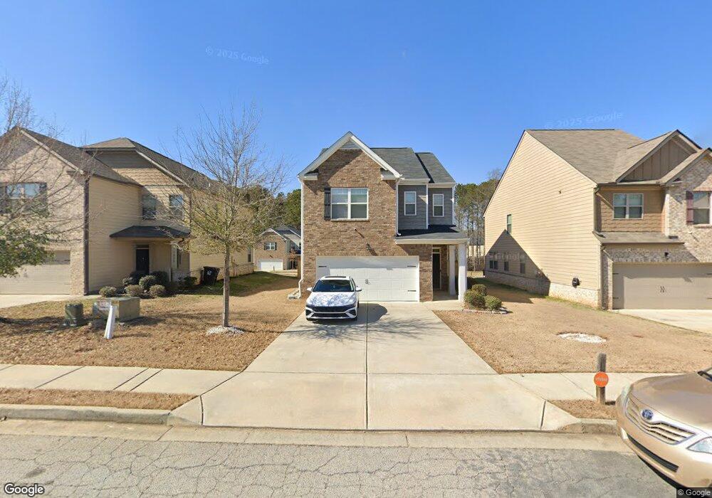
1081 Lear Dr Unit 449 Locust Grove, GA 30248
Estimated Value: $275,000 - $300,566
3
Beds
3
Baths
1,476
Sq Ft
$198/Sq Ft
Est. Value
About This Home
This home is located at 1081 Lear Dr Unit 449, Locust Grove, GA 30248 and is currently estimated at $291,642, approximately $197 per square foot. 1081 Lear Dr Unit 449 is a home located in Henry County with nearby schools including Locust Grove Elementary School, Locust Grove Middle School, and Locust Grove High School.
Ownership History
Date
Name
Owned For
Owner Type
Purchase Details
Closed on
Sep 14, 2018
Sold by
Dr Horton Crown Llc
Bought by
Malloy Farrah
Current Estimated Value
Home Financials for this Owner
Home Financials are based on the most recent Mortgage that was taken out on this home.
Original Mortgage
$185,300
Outstanding Balance
$161,260
Interest Rate
4.5%
Estimated Equity
$130,382
Purchase Details
Closed on
Aug 18, 2017
Sold by
Gdci Ga 5 Lp
Bought by
Dr Horton Inc
Purchase Details
Closed on
May 30, 2014
Sold by
Res Ga Two Llc
Bought by
Gdic Ga 5 Lp
Create a Home Valuation Report for This Property
The Home Valuation Report is an in-depth analysis detailing your home's value as well as a comparison with similar homes in the area
Home Values in the Area
Average Home Value in this Area
Purchase History
| Date | Buyer | Sale Price | Title Company |
|---|---|---|---|
| Malloy Farrah | $181,400 | -- | |
| Dr Horton Inc | $588,000 | -- | |
| Gdic Ga 5 Lp | $2,431,000 | -- |
Source: Public Records
Mortgage History
| Date | Status | Borrower | Loan Amount |
|---|---|---|---|
| Open | Malloy Farrah | $185,300 |
Source: Public Records
Tax History
| Year | Tax Paid | Tax Assessment Tax Assessment Total Assessment is a certain percentage of the fair market value that is determined by local assessors to be the total taxable value of land and additions on the property. | Land | Improvement |
|---|---|---|---|---|
| 2025 | $3,958 | $123,760 | $16,000 | $107,760 |
| 2024 | $3,958 | $129,440 | $16,000 | $113,440 |
| 2023 | $3,403 | $134,600 | $21,200 | $113,400 |
| 2022 | $3,115 | $100,480 | $21,200 | $79,280 |
| 2021 | $2,718 | $84,880 | $21,200 | $63,680 |
| 2020 | $2,538 | $75,920 | $12,000 | $63,920 |
| 2019 | $2,461 | $72,560 | $11,827 | $60,733 |
| 2018 | $0 | $10,800 | $10,800 | $0 |
| 2016 | $146 | $4,000 | $4,000 | $0 |
| 2015 | $128 | $4,000 | $4,000 | $0 |
| 2014 | $82 | $2,160 | $2,160 | $0 |
Source: Public Records
Map
Nearby Homes
- 219 Ferguson Ave
- 523 Carleton Place
- 171 Al Jennah Blvd
- 170 Al Jennah Blvd
- 143 Massey Ln
- 0 Locust Rd Unit 10495072
- 0 Locust Rd Unit 19967321
- 313 Harris Ave
- 0 Jackson St Unit 10554689
- 1537 Jackson St
- 2031 Theberton Trail
- 409 Kirkland Dr
- 340 Harris Ave
- 70 Grove Creek Dr
- 4382 Highway 42
- 269 Baumgard Way
- 188 Sophie Cir
- 830 Trillium Dr
- 825 Trillium Dr
- 52 Weymouth Dr
- 1081 Lear Dr
- 1079 Lear Dr
- 1079 Lear Dr Unit 448
- 1079 Lear Dr
- 1083 Lear Dr
- 1077 Lear Dr
- 1077 Lear Dr Unit 358
- 0 Big Poplar Way Unit 94 8825328
- 1075 Lear Dr
- 1075 Lear Dr Unit 446
- 1078 Lear Dr
- 1415 Brickfield Way
- 1417 Brickfield Way
- 1417 Brickfield Way Unit 438
- 1076 Lear Dr Unit 411
- 1076 Lear Dr
- 1082 Lear Dr Unit 408
- 1082 Lear Dr
- 1419 Brickfield Way
- 1419 Brickfield Way Unit 439
Your Personal Tour Guide
Ask me questions while you tour the home.